Category:Maps of civil parishes in the East Riding of Yorkshire
Jump to navigation
Jump to search
Ceremonial counties of England: Bedfordshire · Berkshire · Buckinghamshire · Cambridgeshire · Cheshire · Cornwall · Cumbria · Derbyshire · Devon · Dorset · Durham · East Riding of Yorkshire · East Sussex · Essex · Gloucestershire · Greater London · Greater Manchester · Hampshire · Herefordshire · Hertfordshire · Isle of Wight · Kent · Lancashire · Leicestershire · Lincolnshire · Merseyside · Norfolk · North Yorkshire · Northamptonshire · Northumberland · Nottinghamshire · Oxfordshire · Rutland · Shropshire · Somerset · South Yorkshire · Staffordshire · Suffolk · Surrey · Tyne and Wear · Warwickshire · West Midlands · West Sussex · West Yorkshire · Wiltshire · Worcestershire
City-counties:
Former historic counties: Sussex ·
Other former counties: Avon · East Suffolk · Humberside · West Suffolk
City-counties:
Former historic counties: Sussex ·
Other former counties: Avon · East Suffolk · Humberside · West Suffolk
| NO WIKIDATA ID FOUND! Search for Maps of civil parishes in the East Riding of Yorkshire on Wikidata | |
| Upload media |

Media in category "Maps of civil parishes in the East Riding of Yorkshire"
The following 171 files are in this category, out of 171 total.
-
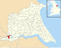 Airmyn UK parish locator map.svg 1,425 × 1,107; 1.68 MB
-
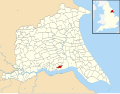
 Aldbrough, East Riding of Yorkshire UK parish locator map.svg 1,425 × 1,107; 1.68 MB
-
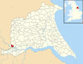
 Allerthorpe UK parish locator map.svg 1,425 × 1,107; 1.68 MB
-
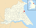
 Anlaby with Anlaby Common UK parish locator map.svg 1,425 × 1,107; 1.68 MB
-
 Asselby UK parish locator map.svg 1,425 × 1,107; 1.68 MB
-
 Atwick UK parish locator map.svg 1,425 × 1,107; 1.68 MB
-
 Bainton, East Riding of Yorkshire UK parish locator map.svg 1,425 × 1,107; 1.68 MB
-
 Barmby Moor UK parish locator map.svg 1,425 × 1,107; 1.68 MB
-
 Barmby on the Marsh UK parish locator map.svg 1,425 × 1,107; 1.68 MB
-
 Barmston and Fraisthorpe UK parish locator map.svg 1,425 × 1,107; 1.68 MB
-
 Beeford UK parish locator map.svg 1,425 × 1,107; 1.68 MB
-
 Bempton UK parish locator map.svg 1,425 × 1,107; 1.68 MB
-
 Beswick, East Riding of Yorkshire UK parish locator map.svg 1,425 × 1,107; 1.68 MB
-
 Beverley UK parish locator map.svg 1,425 × 1,107; 1.68 MB
-
 Bewholme UK parish locator map.svg 1,425 × 1,107; 1.68 MB
-
 Bielby UK parish locator map.svg 1,425 × 1,107; 1.68 MB
-
 Bilton, East Riding of Yorkshire UK parish locator map.svg 1,425 × 1,107; 1.68 MB
-
 Bishop Burton UK parish locator map.svg 1,425 × 1,107; 1.68 MB
-
 Bishop Wilton UK parish locator map.svg 1,425 × 1,107; 1.68 MB
-
 Blacktoft UK parish locator map.svg 1,425 × 1,107; 1.68 MB
-
 Boynton, East Riding of Yorkshire UK parish locator map.svg 1,425 × 1,107; 1.68 MB
-
 Brandesburton UK parish locator map.svg 1,425 × 1,107; 1.68 MB
-
 Brantingham UK parish locator map.svg 1,425 × 1,107; 1.68 MB
-
 Bridlington UK parish locator map.svg 1,425 × 1,107; 1.68 MB
-
 Broomfleet UK parish locator map.svg 1,425 × 1,107; 1.68 MB
-
 Bubwith UK parish locator map.svg 1,425 × 1,107; 1.68 MB
-
 Bugthorpe UK parish locator map.svg 1,425 × 1,107; 1.68 MB
-
 Burstwick UK parish locator map.svg 1,425 × 1,107; 1.68 MB
-
 Burton Agnes UK parish locator map.svg 1,425 × 1,107; 1.68 MB
-
 Burton Constable UK parish locator map.svg 1,425 × 1,107; 1.68 MB
-
 Burton Fleming UK parish locator map.svg 1,425 × 1,107; 1.68 MB
-
 Burton Pidsea UK parish locator map.svg 1,425 × 1,107; 1.68 MB
-
 Carnaby UK parish locator map.svg 1,425 × 1,107; 1.68 MB
-
 Catton, East Riding of Yorkshire UK parish locator map.svg 1,425 × 1,107; 1.68 MB
-
 Catwick UK parish locator map.svg 1,425 × 1,107; 1.68 MB
-
 Cherry Burton UK parish locator map.svg 1,425 × 1,107; 1.68 MB
-
 Coniston, East Riding of Yorkshire UK parish locator map.svg 1,425 × 1,107; 1.68 MB
-
 Cottam, East Riding of Yorkshire UK parish locator map.svg 1,425 × 1,107; 1.68 MB
-
 Cottingham, East Riding of Yorkshire UK parish locator map.svg 1,425 × 1,107; 1.68 MB
-
 Cottingwith UK parish locator map.svg 1,425 × 1,107; 1.68 MB
-
 Dalton Holme UK parish locator map.svg 1,425 × 1,107; 1.68 MB
-
 Driffield UK parish locator map.svg 1,425 × 1,107; 1.68 MB
-
 Easington, East Riding of Yorkshire UK parish locator map.svg 1,425 × 1,107; 1.68 MB
-
 East Garton UK parish locator map.svg 1,425 × 1,107; 1.68 MB
-
 East Riding of Yorkshire UK parish map (blank).svg 1,425 × 1,107; 1.68 MB
-
 Eastrington UK parish locator map.svg 1,425 × 1,107; 1.68 MB
-
 Ellerker UK parish locator map.svg 1,425 × 1,107; 1.68 MB
-
 Ellerton and Aughton UK parish locator map.svg 1,425 × 1,107; 1.68 MB
-
 Elloughton-cum-Brough UK parish locator map.svg 1,425 × 1,107; 1.68 MB
-
 Elstronwick UK parish locator map.svg 1,425 × 1,107; 1.68 MB
-
 Etton, East Riding of Yorkshire UK parish locator map.svg 1,425 × 1,107; 1.68 MB
-
 Everingham UK parish locator map.svg 1,425 × 1,107; 1.68 MB
-
 Fangfoss with Bolton UK parish locator map.svg 1,425 × 1,107; 1.68 MB
-
 Fimber UK parish locator map.svg 1,425 × 1,107; 1.68 MB
-
 Flamborough UK parish locator map.svg 1,425 × 1,107; 1.68 MB
-
 Foggathorpe UK parish locator map.svg 1,425 × 1,107; 1.68 MB
-
 Foston on the Wolds UK parish locator map.svg 1,425 × 1,107; 1.68 MB
-
 Fridaythorpe UK parish locator map.svg 1,425 × 1,107; 1.68 MB
-
 Full Sutton UK parish locator map.svg 1,425 × 1,107; 1.68 MB
-
 Garton on the Wolds UK parish locator map.svg 1,425 × 1,107; 1.68 MB
-
 Gilberdyke UK parish locator map.svg 1,425 × 1,107; 1.68 MB
-
 Goodmanham UK parish locator map.svg 1,425 × 1,107; 1.68 MB
-
 Goole Fields UK parish locator map.svg 1,425 × 1,107; 1.68 MB
-
 Goole UK parish locator map.svg 1,425 × 1,107; 1.68 MB
-
 Gowdall UK parish locator map.svg 1,425 × 1,107; 1.68 MB
-
 Grindale UK parish locator map.svg 1,425 × 1,107; 1.68 MB
-
 Halsham UK parish locator map.svg 1,425 × 1,107; 1.68 MB
-
 Harpham UK parish locator map.svg 1,425 × 1,107; 1.68 MB
-
 Hatfield, East Riding of Yorkshire UK parish locator map.svg 1,425 × 1,107; 1.68 MB
-
 Hayton and Burnby UK parish locator map.svg 1,425 × 1,107; 1.68 MB
-
 Hedon UK parish locator map.svg 1,425 × 1,107; 1.68 MB
-
 Hessle UK parish locator map.svg 1,425 × 1,107; 1.68 MB
-
 Hollym, East Riding of Yorkshire UK parish locator map.svg 1,425 × 1,107; 1.68 MB
-
 Holme-on-Spalding-Moor UK parish locator map.svg 1,425 × 1,107; 1.68 MB
-
 Holmpton UK parish locator map.svg 1,425 × 1,107; 1.68 MB
-
 Hook, East Riding of Yorkshire UK parish locator map.svg 1,425 × 1,107; 1.68 MB
-
 Hornsea UK parish locator map.svg 1,425 × 1,107; 1.68 MB
-
 Hotham, East Riding of Yorkshire UK parish locator map.svg 1,425 × 1,107; 1.68 MB
-
 Howden UK parish locator map.svg 1,425 × 1,107; 1.68 MB
-
 Huggate UK parish locator map.svg 1,425 × 1,107; 1.68 MB
-
 Humbleton UK parish locator map.svg 1,425 × 1,107; 1.68 MB
-
 Hutton Cranswick UK parish locator map.svg 1,425 × 1,107; 1.68 MB
-
 Kelk, East Riding of Yorkshire UK parish locator map.svg 1,425 × 1,107; 1.68 MB
-
 Keyingham UK parish locator map.svg 1,425 × 1,107; 1.68 MB
-
 Kilham, East Riding of Yorkshire UK parish locator map.svg 1,425 × 1,107; 1.68 MB
-
 Kilpin UK parish locator map.svg 1,425 × 1,107; 1.68 MB
-
 Kirby Underdale UK parish locator map.svg 1,425 × 1,107; 1.68 MB
-
 Kirk Ella and West Ella UK parish locator map.svg 1,425 × 1,107; 1.68 MB
-
 Kirkburn UK parish locator map.svg 1,425 × 1,107; 1.68 MB
-
 Langtoft, East Riding of Yorkshire UK parish locator map.svg 1,425 × 1,107; 1.68 MB
-
 Laxton, East Riding of Yorkshire UK parish locator map.svg 1,425 × 1,107; 1.68 MB
-
 Leconfield UK parish locator map.svg 1,425 × 1,107; 1.68 MB
-
 Leven, East Riding of Yorkshire UK parish locator map.svg 1,425 × 1,107; 1.68 MB
-
 Lissett and Ulrome UK parish locator map.svg 1,425 × 1,107; 1.68 MB
-
 Lockington, East Riding of Yorkshire UK parish locator map.svg 1,425 × 1,107; 1.68 MB
-
 Londesborough UK parish locator map.svg 1,425 × 1,107; 1.68 MB
-
 Lund, East Riding of Yorkshire UK parish locator map.svg 1,425 × 1,107; 1.68 MB
-
 Mappleton UK parish locator map.svg 1,425 × 1,107; 1.68 MB
-
 Market Weighton UK parish locator map.svg 1,425 × 1,107; 1.68 MB
-
 Melbourne, East Riding of Yorkshire UK parish locator map.svg 1,425 × 1,107; 1.68 MB
-
 Middleton on the Wolds UK parish locator map.svg 1,425 × 1,107; 1.68 MB
-
 Millington, East Riding of Yorkshire UK parish locator map.svg 1,425 × 1,107; 1.68 MB
-
 Molescroft UK parish locator map.svg 1,425 × 1,107; 1.68 MB
-
 Nafferton UK parish locator map.svg 1,425 × 1,107; 1.68 MB
-
 Newbald UK parish locator map.svg 1,425 × 1,107; 1.68 MB
-
 Newport, East Riding of Yorkshire UK parish locator map.svg 1,425 × 1,107; 1.68 MB
-
 Newton upon Derwent UK parish locator map.svg 1,425 × 1,107; 1.68 MB
-
 North and South Cliffe UK parish locator map.svg 1,425 × 1,107; 1.68 MB
-
 North Cave UK parish locator map.svg 1,425 × 1,107; 1.68 MB
-
 North Dalton UK parish locator map.svg 1,425 × 1,107; 1.68 MB
-
 North Ferriby UK parish locator map.svg 1,425 × 1,107; 1.68 MB
-
 North Frodingham UK parish locator map.svg 1,425 × 1,107; 1.68 MB
-
 Nunburnholme UK parish locator map.svg 1,425 × 1,107; 1.68 MB
-
 Ottringham UK parish locator map.svg 1,425 × 1,107; 1.68 MB
-
 Patrington UK parish locator map.svg 1,425 × 1,107; 1.68 MB
-
 Paull UK parish locator map.svg 1,425 × 1,107; 1.68 MB
-
 Pocklington UK parish locator map.svg 1,425 × 1,107; 1.68 MB
-
 Pollington UK parish locator map.svg 1,425 × 1,107; 1.68 MB
-
 Preston, East Riding of Yorkshire UK parish locator map.svg 1,425 × 1,107; 1.68 MB
-
 Rawcliffe, East Riding of Yorkshire UK parish locator map.svg 1,425 × 1,107; 1.68 MB
-
 Reedness UK parish locator map.svg 1,425 × 1,107; 1.68 MB
-
 Rimswell UK parish locator map.svg 1,425 × 1,107; 1.68 MB
-
 Rise, East Riding of Yorkshire UK parish locator map.svg 1,425 × 1,107; 1.68 MB
-
 Riston UK parish locator map.svg 1,425 × 1,107; 1.68 MB
-
 Roos UK parish locator map.svg 1,425 × 1,107; 1.68 MB
-
 Routh, East Riding of Yorkshire UK parish locator map.svg 1,425 × 1,107; 1.68 MB
-
 Rowley, East Riding of Yorkshire UK parish locator map.svg 1,425 × 1,107; 1.68 MB
-
 Rudston UK parish locator map.svg 1,425 × 1,107; 1.68 MB
-
 Sancton UK parish locator map.svg 1,425 × 1,107; 1.68 MB
-
 Seaton Ross UK parish locator map.svg 1,425 × 1,107; 1.68 MB
-
 Seaton, East Riding of Yorkshire UK parish locator map.svg 1,425 × 1,107; 1.68 MB
-
 Shiptonthorpe UK parish locator map.svg 1,425 × 1,107; 1.68 MB
-
 Sigglesthorne UK parish locator map.svg 1,425 × 1,107; 1.68 MB
-
 Skeffling UK parish locator map.svg 1,425 × 1,107; 1.68 MB
-
 Skerne and Wansford UK parish locator map.svg 1,425 × 1,107; 1.68 MB
-
 Skidby UK parish locator map.svg 1,425 × 1,107; 1.68 MB
-
 Skipsea UK parish locator map.svg 1,425 × 1,107; 1.68 MB
-
 Skirlaugh UK parish locator map.svg 1,425 × 1,107; 1.68 MB
-
 Skirpenbeck UK parish locator map.svg 1,425 × 1,107; 1.68 MB
-
 Sledmere UK parish locator map.svg 1,425 × 1,107; 1.68 MB
-
 Snaith and Cowick UK parish locator map.svg 1,425 × 1,107; 1.68 MB
-
 South Cave UK parish locator map.svg 1,425 × 1,107; 1.68 MB
-
 Spaldington UK parish locator map.svg 1,425 × 1,107; 1.68 MB
-
 Sproatley UK parish locator map.svg 1,425 × 1,107; 1.68 MB
-
 Stamford Bridge, East Riding of Yorkshire UK parish locator map.svg 1,425 × 1,107; 1.68 MB
-
 Sunk Island UK parish locator map.svg 1,425 × 1,107; 1.68 MB
-
 Sutton upon Derwent UK parish locator map.svg 1,425 × 1,107; 1.68 MB
-
 Swanland UK parish locator map.svg 1,425 × 1,107; 1.68 MB
-
 Swine, East Riding of Yorkshire UK parish locator map.svg 1,425 × 1,107; 1.68 MB
-
 Swinefleet UK parish locator map.svg 1,425 × 1,107; 1.68 MB
-
 Thorngumbald UK parish locator map.svg 1,425 × 1,107; 1.68 MB
-
 Thornton, East Riding of Yorkshire UK parish locator map.svg 1,425 × 1,107; 1.68 MB
-
 Thwing and Octon UK parish locator map.svg 1,425 × 1,107; 1.68 MB
-
 Tibthorpe UK parish locator map.svg 1,425 × 1,107; 1.68 MB
-
 Tickton UK parish locator map.svg 1,425 × 1,107; 1.68 MB
-
 Twin Rivers, East Riding of Yorkshire UK parish locator map.svg 1,425 × 1,107; 1.68 MB
-
 Walkington UK parish locator map.svg 1,425 × 1,107; 1.68 MB
-
 Warter UK parish locator map.svg 1,425 × 1,107; 1.68 MB
-
 Watton, East Riding of Yorkshire UK parish locator map.svg 1,425 × 1,107; 1.68 MB
-
 Wawne UK parish locator map.svg 1,425 × 1,107; 1.68 MB
-
 Welton, East Riding of Yorkshire UK parish locator map.svg 1,425 × 1,107; 1.68 MB
-
 Welwick UK parish locator map.svg 1,425 × 1,107; 1.68 MB
-
 Wetwang UK parish locator map.svg 1,425 × 1,107; 1.68 MB
-
 Wilberfoss UK parish locator map.svg 1,425 × 1,107; 1.68 MB
-
 Willerby, East Riding of Yorkshire UK parish locator map.svg 1,425 × 1,107; 1.68 MB
-
 Withernsea UK parish locator map.svg 1,425 × 1,107; 1.68 MB
-
 Withernwick UK parish locator map.svg 1,425 × 1,107; 1.68 MB
-
 Wold Newton, East Riding of Yorkshire UK parish locator map.svg 1,425 × 1,107; 1.68 MB
-
 Woodmansey UK parish locator map.svg 1,425 × 1,107; 1.68 MB
-
 Wressle UK parish locator map.svg 1,425 × 1,107; 1.68 MB
-
 Yapham cum Meltonby UK parish locator map.svg 1,425 × 1,107; 1.68 MB


.svg)