Category:Maps of the history of Kentucky
Jump to navigation
Jump to search
States of the United States: Alabama · Alaska · Arizona · Arkansas · California · Colorado · Connecticut · Delaware · Florida · Georgia · Hawaii · Idaho · Illinois · Indiana · Iowa · Kansas · Kentucky · Louisiana · Maine · Maryland · Massachusetts · Michigan · Minnesota · Mississippi · Missouri · Montana · Nebraska · Nevada · New Hampshire · New Jersey · New Mexico · New York · North Carolina · North Dakota · Ohio · Oklahoma · Oregon · Pennsylvania · Rhode Island · South Carolina · South Dakota · Tennessee · Texas · Utah · Vermont · Virginia · Washington · West Virginia · Wisconsin · Wyoming – Washington, D.C.
Puerto Rico
Puerto Rico
Subcategories
This category has the following 4 subcategories, out of 4 total.
Media in category "Maps of the history of Kentucky"
The following 11 files are in this category, out of 11 total.
-
 Caborn Welborn Map HRoe 2010 01.jpg 800 × 548; 318 KB
-
 Fort Ancient Monongahela cultures HRoe 2010.jpg 700 × 496; 312 KB
-
 Kentucky Congressional Districts (1935-2021).gif 837 × 387; 30.63 MB
-
 Kentucky County, Virginia 1780.png 638 × 300; 222 KB
-

-
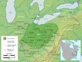 Ohio Country en.png 1,217 × 920; 1.41 MB
-
 TENNESSEE map - Indian land cessions in the United States.jpg 820 × 535; 122 KB
-
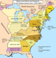 United States land claims and cessions 1782-1802.png 747 × 782; 145 KB
-
 Flag map of the Colony of Virginia (English Flag).png 3,388 × 1,292; 38 KB
-
 Flag map of the Colony of Virginia (Union Jack).png 3,388 × 1,292; 69 KB
-
 Wilderness road en.png 1,254 × 796; 1.74 MB


.gif)


.png)
.png)