Category:Maps of the history of Wyoming
Jump to navigation
Jump to search
States of the United States: Alabama · Alaska · Arizona · Arkansas · California · Colorado · Connecticut · Delaware · Florida · Georgia · Hawaii · Idaho · Illinois · Indiana · Iowa · Kansas · Kentucky · Louisiana · Maine · Maryland · Massachusetts · Michigan · Minnesota · Mississippi · Missouri · Montana · Nebraska · Nevada · New Hampshire · New Jersey · New Mexico · New York · North Carolina · North Dakota · Ohio · Oklahoma · Oregon · Pennsylvania · Rhode Island · South Carolina · South Dakota · Tennessee · Texas · Utah · Vermont · Virginia · Washington · West Virginia · Wisconsin · Wyoming – Washington, D.C.
Puerto Rico
Puerto Rico
Subcategories
This category has only the following subcategory.
Media in category "Maps of the history of Wyoming"
The following 8 files are in this category, out of 8 total.
-

-
 Battlefields (approx.) - U.S. Army and Lakotas, 1854-1890.png 500 × 371; 298 KB
-
 Bozeman Trail, the forts and the Indian territories.jpg 1,720 × 2,052; 458 KB
-
 Cooperative economic insect report (1957) (20698078925).jpg 3,442 × 2,206; 2.07 MB
-
 Flight of the Nez Perce-1877-map.jpg 2,800 × 1,833; 1.35 MB
-
 Map from Indian land cessions in the United States by Charles C. Royce 63.jpg 4,256 × 3,297; 4.43 MB
-
 Map from Indian land cessions in the United States by Charles C. Royce 65.jpg 4,256 × 3,297; 5.52 MB
-
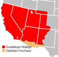 Treaty of Guadalupe Hidalgo.png 320 × 315; 9 KB
_-_U.S._Army_and_Lakotas,_1854-1868_(blue_x)_and_1869-1890_(red_x).png)
_-_U.S._Army_and_Lakotas,_1854-1890.png)

_(20698078925).jpg)


