Category:Nanos
Appearance
Slovenščina: Nanos, kraška planota v jugozahodni Sloveniji, del Dinarskega gorstva.
mountain range | |||||
| Upload media | |||||
| Instance of | |||||
|---|---|---|---|---|---|
| Location | Inner Carniola, Slovenia | ||||
| Mountain range | |||||
| Highest point |
| ||||
| Elevation above sea level |
| ||||
![]() | |||||
| |||||
Subcategories
This category has the following 10 subcategories, out of 10 total.
A
- Agriculture on Nanos (15 F)
B
F
- Flora of Nanos (45 F)
H
M
- Mali vipavski ledenik (7 F)
P
- Pleša (23 F)
V
- Veliki vipavski ledenik (5 F)
Media in category "Nanos"
The following 126 files are in this category, out of 126 total.
-
2018-8-Piran in Nanos.jpg 4,608 × 2,460; 1.46 MB
-
Blažon - panoramio.jpg 3,648 × 2,736; 2.77 MB
-
Coffee challenge on the mountains - Hike to Nanos.webm 1 h 10 min 11 s, 2,560 × 1,440; 3.66 GB
-
Cows & Mt. Nanos - panoramio.jpg 1,600 × 1,200; 437 KB
-
Komen village.jpg 4,000 × 3,000; 3.14 MB
-
Map-Peartreeforest-Hrušica.png 839 × 639; 256 KB
-
Mappa della Selva di Tarnova e di Piro.png 1,348 × 820; 382 KB
-
Mejni kamen 1000mnv.jpg 8,160 × 6,120; 17.24 MB
-
Mejni kamen 1100mnv.jpg 8,160 × 6,120; 17.53 MB
-
Mejni kamen 900mnv.jpg 8,160 × 6,120; 18.41 MB
-
Memorial for Janko Premrl Vojko near the Vojko Lodge on the Nanos Plateau.jpg 1,500 × 1,125; 348 KB
-
Menji kamen 800mnv.jpg 8,160 × 6,120; 17.19 MB
-
Mount Nanos Military Road 1.jpg 2,454 × 3,383; 3.96 MB
-
Mount Nanos Military Road 2.jpg 2,889 × 2,172; 3.42 MB
-
Nanos (Slovenia).webm 3 min 34 s, 1,920 × 1,080; 360.32 MB
-
Nanos - panoramio.jpg 3,872 × 2,592; 3.83 MB
-
Nanos - St. Hieronim - panoramio.jpg 3,872 × 2,592; 3.95 MB
-
Nanos 01 (42273103281).jpg 4,608 × 3,456; 2.83 MB
-
Nanos 02 (41552050984).jpg 4,608 × 2,670; 1.74 MB
-
Nanos along the flat trail 01.jpg 3,280 × 2,464; 3.48 MB
-
Nanos along the flat trail 02.jpg 3,280 × 2,464; 3.37 MB
-
Nanos in spring.jpg 5,472 × 3,648; 16.59 MB
-
Nanos iz avtoceste - panoramio.jpg 1,600 × 1,200; 270 KB
-
Nanos mountain in winter during a Bora's storm.webm 2 min 48 s, 1,280 × 720; 62.63 MB
-
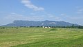
Nanos Plateau, western edge 01.jpg 4,640 × 3,472; 7.18 MB
-
Nanos Plateau, western edge 02.jpg 4,640 × 3,472; 7.66 MB
-
Nanos Plateau, western edge 03.jpg 4,640 × 3,472; 7.44 MB
-
Nanos Plateau, western edge 04.jpg 4,640 × 3,472; 6.18 MB
-
Nanos Plateau, western edge 05.jpg 4,640 × 3,472; 8.62 MB
-
Nanos Plateau, western edge 06.jpg 3,280 × 2,464; 3.36 MB
-
Nanos Plateau, western edge 07.jpg 4,640 × 3,472; 9.52 MB
-
Nanos Plateau, western edge 08.jpg 4,498 × 3,274; 6.65 MB
-
Nanos Plateau, western edge 09.jpg 4,414 × 3,148; 6.55 MB
-
Nanos, flat trail from Razdrto 01.jpg 3,280 × 2,464; 3.29 MB
-
Nanos, flat trail from Razdrto 02.jpg 4,640 × 3,472; 7 MB
-
Nanos, flat trail from Razdrto 03.jpg 3,472 × 4,640; 9.67 MB
-
Nanos, flat trail from Razdrto 04.jpg 3,472 × 4,640; 10.3 MB
-
Nanos, path from Strane 01.jpg 3,472 × 4,640; 7.73 MB
-
Nanos, path from Strane 02.jpg 3,472 × 4,640; 7.65 MB
-
Nanos, path from Strane 03.jpg 3,472 × 4,640; 11.36 MB
-
Nanos, rock formation along the steep trail 01.jpg 3,472 × 4,640; 7.51 MB
-
Nanos, rock formation along the steep trail 02.jpg 4,640 × 3,472; 7.36 MB
-
Nanos, rock formation along the steep trail 03.jpg 3,472 × 4,640; 8.1 MB
-
Nanos, scree along the steep trail.jpg 3,200 × 1,800; 2.74 MB
-
Nanos, steep trail from Razdrto 01.jpg 3,472 × 4,640; 9.7 MB
-
Nanos, steep trail from Razdrto 02.jpg 3,472 × 4,640; 9.1 MB
-
Nanos, steep trail from Razdrto 03.jpg 3,280 × 2,464; 3.18 MB
-
Nanos, steep trail from Razdrto 04.jpg 3,472 × 4,640; 9.77 MB
-
Nanos, steep trail from Razdrto 05.jpg 3,280 × 2,464; 4.73 MB
-
Nanos, steep trail from Razdrto 06.jpg 4,640 × 3,472; 9.17 MB
-
Nanos, steep trail from Razdrto 07.jpg 2,464 × 3,280; 4.66 MB
-
Nanos, steep trail from Razdrto 08.jpg 3,472 × 4,640; 8.93 MB
-
Nanos, steep trail from Razdrto 09.jpg 3,472 × 4,640; 8.83 MB
-
Nanos, steep trail from Razdrto 10.jpg 4,640 × 3,472; 10.03 MB
-
Nanos, steep trail from Razdrto 11.jpg 2,464 × 3,280; 3.87 MB
-
Nanos, steep trail from Razdrto 12.jpg 3,280 × 2,464; 2.78 MB
-
Nanos, steep trail from Razdrto 13.jpg 3,280 × 2,464; 3.36 MB
-
Nanos, steep trail from Razdrto 14.jpg 4,640 × 3,472; 6.32 MB
-
Nanos, via ferrata section of the steep trail 01.jpg 3,472 × 4,640; 9.46 MB
-
Nanos, via ferrata section of the steep trail 02.jpg 3,472 × 4,640; 7.13 MB
-
Nanos, via ferrata section of the steep trail 03.jpg 3,280 × 2,464; 3.29 MB
-
Nanos, via ferrata section of the steep trail 04.jpg 2,464 × 3,280; 3.28 MB
-
Nanos, via ferrata section of the steep trail 05.jpg 3,280 × 2,464; 3.02 MB
-
Nanos, via ferrata section of the steep trail 06.jpg 3,472 × 4,640; 8.25 MB
-
Nanos, via ferrata section of the steep trail 07.jpg 2,464 × 3,280; 3.29 MB
-
Nanos, via ferrata section of the steep trail 08.jpg 3,280 × 2,464; 2.64 MB
-
Nanos, vie of western parts, St. Jerome church and Trnovski gozd 01.jpg 4,640 × 3,472; 4.74 MB
-
Nanos, vie of western parts, St. Jerome church and Trnovski gozd 02.jpg 4,640 × 3,472; 4.58 MB
-
Nanos, view from the Grmada peak 01.jpg 4,640 × 3,472; 6.09 MB
-
Nanos, view from the Grmada peak 02.jpg 4,640 × 3,472; 5.94 MB
-
Nanos, view of southern slopes from the steep trail 01.jpg 4,640 × 3,472; 10.41 MB
-
Nanos, view of southern slopes from the steep trail 02.jpg 4,640 × 3,472; 8.32 MB
-
Nanos, view of southern slopes from the steep trail 03.jpg 4,640 × 3,472; 7.96 MB
-
Nanos, view of southern slopes from the steep trail 04.jpg 4,640 × 3,472; 7.36 MB
-
Nanos, view of southern slopes from the steep trail 05.jpg 3,280 × 2,026; 2.65 MB
-
Nanos, view of southern slopes from the steep trail 06.jpg 3,280 × 2,184; 3.24 MB
-
Nanos, view of southern slopes from the steep trail 07.jpg 3,280 × 2,464; 3.55 MB
-
Nanos, view of southern slopes from the steep trail 08.jpg 3,280 × 2,464; 2.86 MB
-
Nanos, view of southern slopes from the steep trail 09.jpg 3,280 × 2,464; 2.7 MB
-
Nanos, view of southern slopes from the steep trail 10.jpg 4,640 × 3,472; 8.2 MB
-
Nanos, view of southern slopes from the steep trail 11.jpg 4,640 × 3,472; 8.6 MB
-
Nanos, view of southern slopes from the steep trail 12.jpg 4,640 × 3,472; 7 MB
-
Nanos, view of southern tip from Razdrto 01.jpg 4,000 × 2,729; 3.5 MB
-
Nanos, view of southern tip from Razdrto 02.jpg 4,000 × 3,000; 3.2 MB
-
Nanos, view of southern tip from Razdrto 03.jpg 4,640 × 3,472; 6.36 MB
-
Nanos, view of southern tip from Razdrto 04.jpg 4,640 × 3,472; 5.44 MB
-
Nanos, view of southern tip from Razdrto 05.jpg 4,640 × 3,472; 7.7 MB
-
Nanos, view of southern tip from Razdrto 06.jpg 4,640 × 3,472; 8.3 MB
-
Nanos, Votle stene 01.jpg 4,640 × 3,472; 5.33 MB
-
Nanos, Votle stene 02.jpg 4,640 × 3,472; 8.53 MB
-
Nanos, Votle stene 03.jpg 3,280 × 2,464; 2.58 MB
-
Nanos-hegység Postojna felől 2018-07-24.JPG 4,320 × 2,432; 4.53 MB
-
Nanos2011 dirka1.webm 10 min 28 s, 960 × 720; 510.07 MB
-
Nanos2011 dirka2.webm 10 min 20 s, 960 × 720; 567.92 MB
-
Nanos2011 dirka3.webm 8 min 20 s, 960 × 720; 429.44 MB
-
Nanos2011 dirka4.webm 6 min 20 s, 960 × 720; 294.34 MB
-
Nanos2011 zaprta voznja.webm 4 min 35 s, 960 × 720; 206.74 MB
-
Napis na poti na Nanos 1.jpg 8,160 × 6,120; 17.94 MB
-
Napis na poti na Nanos 2.jpg 8,160 × 6,120; 15.13 MB
-
Napis na poti na Nanos 3.jpg 8,160 × 6,120; 17.31 MB
-
Pogled na Nanos nad izvirom Ločnika 1.jpg 6,048 × 4,024; 16.19 MB
-
Pogled na Nanos nad izvirom Ločnika 2.jpg 6,048 × 4,024; 14.99 MB
-
Pogled z Nanosa proti Razdrtemu.jpg 8,160 × 6,120; 13.69 MB
-
Povir pogled z Tabora EŠD 15991.jpg 1,384 × 517; 170 KB
-
Razdrto - panoramio.jpg 3,264 × 2,448; 3.79 MB
-
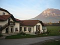
Razdrto Farm by Mt. Nanos - panoramio.jpg 1,600 × 1,200; 398 KB
-
RK 0707 1683 Nanos auf Razdrto.jpg 1,800 × 1,200; 960 KB
-
RK 0707 1702 Nanos Planote.jpg 1,800 × 1,200; 572 KB
-
Rubije-Komen-Karst-Slovenia 02.jpg 4,608 × 2,592; 4.72 MB
-
Slovenia, Nanos 2010.webm 34 s, 640 × 480; 5.19 MB
-
Spomenik na Nanosu radijskemu in tv oddajniku.jpg 8,160 × 6,120; 17.68 MB
-
Spominska plošča Banovac Branko.jpg 8,160 × 6,120; 14.93 MB
-
Spominska plošča na Nanosu za radijski in tv oddajnik.jpg 8,160 × 6,120; 24.43 MB
-
Veliki dol za Kalcem.jpg 4,032 × 3,024; 3.4 MB
-
View of Razdrto from the steep trail to Nanos 01.jpg 3,200 × 1,800; 2.53 MB
-
View of Razdrto from the steep trail to Nanos 02.jpg 4,640 × 3,472; 6.91 MB
-
View of Razdrto from the steep trail to Nanos 03.jpg 3,280 × 2,464; 3.52 MB
-
View of the Vipava Valley from Plesa.jpg 4,640 × 3,472; 6.02 MB
-
View of Vipava Valley from Nanos.jpg 4,640 × 3,472; 7.19 MB
-
View of Vipava Valley from the flat trail to Nanos.jpg 4,640 × 3,472; 7.58 MB
-
View west from the Pleša Peak on the Nanos Plateau.jpg 1,500 × 1,074; 375 KB
-
Vipava valley from Nanos.jpg 2,048 × 1,536; 609 KB
-
Vipavski partizani se marca 1943 odpravljajo z Nanosa na Dolenjsko.jpg 1,600 × 1,034; 660 KB
-
Votle stene (Nanos), detail at the St. Brice's church 01.jpg 4,640 × 3,472; 3.21 MB
-
Votle stene (Nanos), detail at the St. Brice's church 02.jpg 4,640 × 3,472; 6.17 MB
-
Votle stene (Nanos), stone altar in front of the St. Brice's church.jpg 4,640 × 3,472; 6.42 MB
