Category:Newark and Sherwood District
Zur Navigation springen
Zur Suche springen
local government district in Nottinghamshire, England   | |||||
| Medium hochladen | |||||
| Ist ein(e) | |||||
|---|---|---|---|---|---|
| Ort | Nottinghamshire, East Midlands, England | ||||
| Hauptstadt | |||||
| Gesetzgebende Körperschaft |
| ||||
| Datum der Gründung, Erstellung, Entstehung, Erbauung |
| ||||
| Einwohnerzahl |
| ||||
| Fläche |
| ||||
| offizielle Website | |||||
 | |||||
Unterkategorien
Es werden 85 von insgesamt 85 Unterkategorien in dieser Kategorie angezeigt:
In Klammern die Anzahl der enthaltenen Kategorien (K), Seiten (S), Dateien (D)
B
- Bathley (83 D)
C
E
F
- Fernwood, Nottinghamshire (83 D)
G
H
K
- Kersall (40 D)
L
- Lindhurst (56 D)
N
O
- Ompton (46 D)
P
R
S
T
U
W
Medien in der Kategorie „Newark and Sherwood District“
Folgende 44 Dateien sind in dieser Kategorie, von 44 insgesamt.
-
 All Saints' church.jpg 4.032 × 3.024; 3,51 MB
-
 British Sugar Factory, Newark on Trent - geograph.org.uk - 3561834.jpg 1.024 × 680; 140 KB
-
 Car Park, Newark on Trent - geograph.org.uk - 3561826.jpg 1.024 × 680; 141 KB
-
 Eye eye - geograph.org.uk - 1109874.jpg 640 × 487; 155 KB
-
 Gardens and bandstand, Newark Castle - geograph.org.uk - 3566843.jpg 640 × 480; 105 KB
-
 Kelham Hall, Newark - panoramio.jpg 2.448 × 3.264; 2,69 MB
-
 Lock on the River Trent, Newark - geograph.org.uk - 3566826.jpg 640 × 480; 58 KB
-
 Middle Holme Lane, Sutton-on-Trent.jpg 3.024 × 4.032; 4,73 MB
-
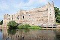 Newark Castle - geograph.org.uk - 3561601.jpg 1.024 × 680; 185 KB
-
 Newark Castle - geograph.org.uk - 3561604.jpg 1.024 × 680; 191 KB
-
 Newark Castle - geograph.org.uk - 3566834.jpg 480 × 640; 68 KB
-
 Newark Castle - geograph.org.uk - 3566845.jpg 480 × 640; 78 KB
-
 Newark on Trent Montage.jpg 3.264 × 3.264; 8,31 MB
-
 Otfc1.jpg 3.120 × 4.160; 4,91 MB
-
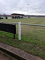 Otfc2.jpg 3.120 × 4.160; 5 MB
-
 River Trent and Trent Bridge, Newark - geograph.org.uk - 3566811.jpg 640 × 480; 70 KB
-
 River Trent, Newark on Trent - geograph.org.uk - 3561817.jpg 1.024 × 680; 156 KB
-
 Sharida And Attached Wall, Worksop Road, Budby (now called Carr Holm).jpg 4.038 × 2.916; 2,43 MB
-
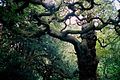
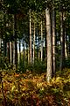 Sherwood Forest - panoramio (1).jpg 733 × 1.100; 610 KB
-
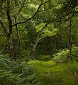
 Sherwood Forest - panoramio (2).jpg 1.100 × 563; 487 KB
-
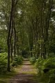
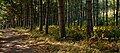 Sherwood Forest - panoramio (3).jpg 1.100 × 488; 319 KB
-
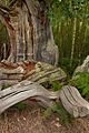
 Sherwood Forest - panoramio (4).jpg 597 × 400; 277 KB
-
 Sherwood Forest IMG 6763 - panoramio.jpg 1.600 × 1.066; 773 KB
-
 Sherwood Forest IMG 6765 - panoramio.jpg 1.468 × 1.600; 1,08 MB
-
 Sherwood Forest IMG 6800 - panoramio.jpg 1.066 × 1.600; 903 KB
-
 Sherwood Forest IMG 6808 - panoramio.jpg 1.600 × 1.066; 842 KB
-
 Sherwood Forest IMG 6822 - panoramio.jpg 1.066 × 1.600; 850 KB
-
 Sherwood Forest IMG 7259 - panoramio.jpg 733 × 1.100; 490 KB
-
 Sutton-on-Trent field, taken on Main Street.jpg 4.032 × 3.024; 4,25 MB
-
 Sutton-on-Trent scenery taken on Mulberry Path.jpg 4.608 × 3.456; 3,84 MB
-
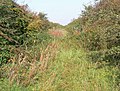 The former Newark to Bottesford Railway - geograph.org.uk - 1020944.jpg 640 × 485; 143 KB
-
 The Great North Road, through Sutton-on-Trent.jpg 3.072 × 3.761; 4,93 MB
-
 The Moorings, Newark - geograph.org.uk - 3566830.jpg 640 × 480; 91 KB
-
 The River Trent at Newark - geograph.org.uk - 3566814.jpg 640 × 480; 84 KB
-
 The River Trent at Newark - geograph.org.uk - 3566823.jpg 640 × 480; 69 KB
-
 The Royal Oak pub, Newark - geograph.org.uk - 3566836.jpg 640 × 480; 67 KB
-
 Toby Short and the Mandem.jpg 1.024 × 768; 190 KB
-
 Train passing through Sutton-on-Trent.jpg 4.032 × 3.024; 3,99 MB
-
 Trees in Newark Castle - geograph.org.uk - 3561823.jpg 1.024 × 680; 248 KB
-
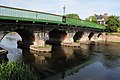 Trent Bridge, Newark on Trent - geograph.org.uk - 3561820.jpg 1.024 × 680; 186 KB
-
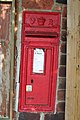 Victorian Postbox - geograph.org.uk - 195672.jpg 427 × 640; 67 KB
-
 Volmer VJ-24W G-MBBZ (14420475670).jpg 5.184 × 3.456; 5,43 MB
-
 Ye Olde Market, Newark - geograph.org.uk - 3566838.jpg 640 × 480; 69 KB
-
 Zizzi, Newark on Trent - geograph.org.uk - 3561613.jpg 1.024 × 680; 210 KB


.jpg)
.jpg)
.jpg)
.jpg)
.jpg)


.jpg)

