Category:Old maps of the Bahamas
Jump to navigation
Jump to search
Countries of North America: Antigua and Barbuda · The Bahamas · Barbados · Belize · Canada · Costa Rica · Cuba · Dominica · Dominican Republic · El Salvador · Grenada · Guatemala · Haiti · Honduras · Jamaica · Mexico · Nicaragua · Panama · Saint Kitts and Nevis · Saint Lucia · Saint Vincent and the Grenadines · Trinidad and Tobago‡ · United States of America‡
Other territories: Bermuda · Florida Keys · Greenland · Guadeloupe · Martinique · Montserrat · Puerto Rico · Saint Barthélemy · Saint-Martin · Saint Pierre and Miquelon
‡: partly located in North America
Other territories: Bermuda · Florida Keys · Greenland · Guadeloupe · Martinique · Montserrat · Puerto Rico · Saint Barthélemy · Saint-Martin · Saint Pierre and Miquelon
‡: partly located in North America
Subcategories
This category has the following 7 subcategories, out of 7 total.
C
- Old maps of Cay Sal Bank (10 F)
Media in category "Old maps of the Bahamas"
The following 9 files are in this category, out of 9 total.
-

-
 Admiralty Chart No 1469 Crooked Island anchorage, Published 1843.jpg 3,789 × 4,725; 1.5 MB
-

-
 Admiralty Chart No 3042 Harbours and Anchorages in the Bahamas, Published 1899, New Edition 1929.jpg 16,586 × 11,384; 17.83 MB
-
 Admiralty Chart No 399 Man of War Cay anchorage, Published 1830.jpg 3,849 × 3,776; 2.47 MB
-
 Admiralty Chart No 400 Pelican and Little Harbours, Published 1830.jpg 3,505 × 4,733; 1.59 MB
-

-
 Annals of the Carnegie Museum (1910-1911) (18227422019).jpg 3,082 × 2,280; 955 KB
-
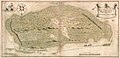 New Providence 1751 map.jpg 4,252 × 2,056; 1.36 MB
.jpg)


_(18227422019).jpg)
