Category:Rhubodach
Jump to navigation
Jump to search
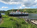
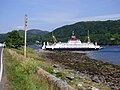
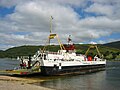
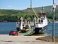
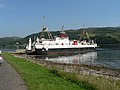
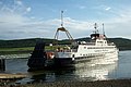
English: Rhubodach is a village on the Isle of Bute, off the coast of south-western Scotland.

human settlement in Argyll and Bute, Scotland, UK  | |||||
| Upload media | |||||
| Instance of | |||||
|---|---|---|---|---|---|
| Location |
| ||||
 | |||||
Subcategories
This category has only the following subcategory.
C
- Colintraive to Rhubodach Ferry (89 F)
Media in category "Rhubodach"
The following 76 files are in this category, out of 76 total.
-
 'Loch Dunvegan' at Rubha a' Bhodaich - geograph.org.uk - 5426349.jpg 3,264 × 2,448; 3.17 MB
-
 Approaching the Isle of Bute - geograph.org.uk - 4596988.jpg 2,000 × 1,333; 1.35 MB
-
 Beach, East Kyle - geograph.org.uk - 3681459.jpg 640 × 480; 291 KB
-
 Boat passing Altgaltraig Point - geograph.org.uk - 5868882.jpg 1,024 × 768; 379 KB
-
 Boat passing Colintraive - geograph.org.uk - 5868861.jpg 1,024 × 542; 297 KB
-
 Bus stop at the ferry at Rhubodach - geograph.org.uk - 3523655.jpg 640 × 475; 43 KB
-
 CalMac ferry at Rhubodach - geograph.org.uk - 4166041.jpg 3,072 × 1,728; 1.67 MB
-
 CalMac's Loch Dunvegan at Rhubodach - geograph.org.uk - 6151370.jpg 1,024 × 768; 352 KB
-
 Church of Scotland, Colintraive - geograph.org.uk - 5868622.jpg 1,024 × 768; 464 KB
-
 Colintraive Ferry (1329623075).jpg 1,024 × 768; 297 KB
-
 Colintraive Ferry (1329624599).jpg 1,024 × 768; 303 KB
-
 Colintraive Ferry - geograph.org.uk - 229513.jpg 640 × 480; 74 KB
-

-
 Colintraive, as seen from Rhubodach - geograph.org.uk - 4175228.jpg 640 × 480; 81 KB
-

-
 East Kyle - geograph.org.uk - 3681452.jpg 640 × 480; 324 KB
-
 Edge of Rhubodach plantation - geograph.org.uk - 1520055.jpg 640 × 480; 103 KB
-
 Ferry and yacht at Colintraive - geograph.org.uk - 5868855.jpg 1,024 × 474; 213 KB
-
 Ferry approaching Rhubodach - geograph.org.uk - 5869022.jpg 1,024 × 768; 242 KB
-
 Ferry approaching Rhubodach - geograph.org.uk - 5869028.jpg 1,024 × 768; 340 KB
-
 Ferry at Colintraive - geograph.org.uk - 5868626.jpg 1,024 × 762; 420 KB
-
 Ferry at Colintraive - geograph.org.uk - 5868880.jpg 1,024 × 768; 380 KB
-
 Ferry at Rhubocach - geograph.org.uk - 5868952.jpg 768 × 1,024; 290 KB
-
 Ferry at Rhubodach - geograph.org.uk - 5868931.jpg 1,024 × 768; 347 KB
-
 Ferry at Rhubodach - geograph.org.uk - 5868934.jpg 1,024 × 768; 359 KB
-
 Ferry at Rhubodach - geograph.org.uk - 5869035.jpg 1,024 × 768; 338 KB
-
 Ferry at Rhubodach - geograph.org.uk - 5869681.jpg 1,024 × 568; 205 KB
-
 Ferry at Rhubodach slipway, Bute - geograph.org.uk - 1520027.jpg 640 × 480; 64 KB
-
 Ferry MV Loch Dunvegan at Rhubodach - geograph.org.uk - 5868954.jpg 1,024 × 768; 287 KB
-
 Ferry MV Loch Dunvegan at Rhubodach - geograph.org.uk - 5868959.jpg 1,024 × 768; 252 KB
-
 Ferry slip at Rhubodach - geograph.org.uk - 5868859.jpg 1,024 × 629; 318 KB
-
 Gate by the A886 Rhubodach Road - geograph.org.uk - 5868888.jpg 1,024 × 768; 399 KB
-
 Highland Cow near Rhubodach - geograph.org.uk - 5868630.jpg 1,024 × 768; 328 KB
-
 Highland Cow near Rhubodach - geograph.org.uk - 5868631.jpg 1,024 × 768; 349 KB
-
 Highland Cow near Rhubodach - geograph.org.uk - 5868632.jpg 1,024 × 768; 266 KB
-
 Highland Cow near Rhubodach - geograph.org.uk - 5868633.jpg 1,024 × 725; 499 KB
-
 Houses at Altgaltraig Point - geograph.org.uk - 5868618.jpg 1,024 × 768; 411 KB
-
 Houses at Colintraive - geograph.org.uk - 5868625.jpg 1,024 × 768; 429 KB
-
 Houses near Altgaltraig Point - geograph.org.uk - 5868619.jpg 1,024 × 621; 365 KB
-
 Houses near Altgaltraig Point - geograph.org.uk - 5868621.jpg 1,024 × 768; 411 KB
-
 MV Loch Dunvegan 2016.jpg 3,558 × 2,359; 5 MB
-
 MV Loch Dunvegan 2019.jpg 6,000 × 4,000; 4.69 MB
-
 MV Loch Dunvegan.jpg 600 × 450; 53 KB
-
 Rhubodach ferry terminal - geograph.org.uk - 5868941.jpg 1,024 × 639; 195 KB
-
 Rhubodach ferry terminal - geograph.org.uk - 5868948.jpg 1,024 × 768; 296 KB
-
 Rhubodach ferry terminal - geograph.org.uk - 5868950.jpg 1,024 × 768; 275 KB
-
 Rhubodach ferry terminal - geograph.org.uk - 5868951.jpg 1,024 × 768; 345 KB
-
 Rhubodach Information Post - geograph.org.uk - 2361397.jpg 640 × 480; 64 KB
-
 Rhubodach, bus shelter - geograph.org.uk - 922102.jpg 640 × 480; 96 KB
-
 Rhubodach, measuring up - geograph.org.uk - 922095.jpg 640 × 480; 117 KB
-
 Rhubodach, the ferry - geograph.org.uk - 922097.jpg 640 × 480; 106 KB
-
 Rothesay - Rhubodach, Road - geograph.org.uk - 167000.jpg 640 × 480; 59 KB
-
 Rothesay - Rhubodach, Road - geograph.org.uk - 167001.jpg 640 × 480; 62 KB
-
 Shoreline at Rhubodach - geograph.org.uk - 2417351.jpg 640 × 480; 76 KB
-

-
 The A886 near Dougal's Rock - geograph.org.uk - 3622627.jpg 1,024 × 768; 192 KB
-
 The Bute ferry - geograph.org.uk - 625933.jpg 640 × 464; 74 KB
-
 The Colintraive Ferry. - geograph.org.uk - 414734.jpg 640 × 427; 96 KB
-
 The ferry 'Loch Alainn' at the Isle of Bute terminal - geograph.org.uk - 5660597.jpg 1,500 × 996; 1.11 MB
-
 The Loch Dunvegan at Rhudodach - geograph.org.uk - 3622579.jpg 1,024 × 768; 202 KB
-
 Vehicles Boarding the Ferry at Rhubodach - geograph.org.uk - 2609483.jpg 640 × 377; 305 KB
-
 Waiting for the ferry at Rubha a' Bhodaich - geograph.org.uk - 5423148.jpg 3,264 × 2,448; 2.68 MB
-
 Wold flower colour by the East kyle - geograph.org.uk - 3121480.jpg 640 × 481; 113 KB
-
 Yacht at Rhubodach - geograph.org.uk - 2609468.jpg 640 × 414; 384 KB
-
 Yacht in the Kyles of Bute - geograph.org.uk - 5868635.jpg 1,024 × 701; 368 KB
-
 Yacht in the Kyles of Bute - geograph.org.uk - 5868887.jpg 1,024 × 768; 440 KB
-
 Yacht passing Colintraive - geograph.org.uk - 5868877.jpg 1,024 × 768; 348 KB
-
 Across To Rhubodach Jetty - geograph.org.uk - 765480.jpg 640 × 480; 63 KB
-
 Rhubodach Cottage - geograph.org.uk - 167005.jpg 640 × 480; 86 KB
-
 Rhubodach Farm - geograph.org.uk - 167002.jpg 640 × 480; 73 KB
-
 Road to Rhubodach at Ardmaliesh Point - geograph.org.uk - 31030.jpg 640 × 480; 83 KB
-
 Rothesay - Rhubodach, Lay-By - geograph.org.uk - 166756.jpg 640 × 480; 132 KB
-
 Rothesay - Rhubodach, Lay-By - geograph.org.uk - 166999.jpg 640 × 480; 90 KB
-
 Rothesay - Rhubodach, Old Quarry - geograph.org.uk - 166997.jpg 640 × 480; 140 KB
-
 Rothesay - Rhubodach, Shalunt Farm - geograph.org.uk - 166998.jpg 640 × 480; 105 KB
-
 Rothesay - Rhubodach, Stuck Farm - geograph.org.uk - 166745.jpg 640 × 480; 65 KB


.jpg)
.jpg)


