Category:Rijnsaterwoude
Jump to navigation
Jump to search
town and former municipality in South Holland, Netherlands    | |||||
| Upload media | |||||
| Spoken text audio | |||||
|---|---|---|---|---|---|
| Instance of | |||||
| Location |
| ||||
| Population |
| ||||
 | |||||
Subcategories
This category has the following 9 subcategories, out of 9 total.
D
- Dekkermolen, Hoogmade (12 F)
H
- Herenweg 4, Rijnsaterwoude (10 F)
- Herenweg 40, Rijnsaterwoude (15 F)
M
- Maps of Rijnsaterwoude (2 F)
R
W
Media in category "Rijnsaterwoude"
The following 23 files are in this category, out of 23 total.
-
 Rijnsaterwoude wapen.svg 304 × 354; 54 KB
-
 2465 Rijnsaterwoude, Netherlands - panoramio (1).jpg 4,128 × 3,096; 7.01 MB
-
 2465 Rijnsaterwoude, Netherlands - panoramio (2).jpg 4,128 × 3,096; 4.88 MB
-
 2465 Rijnsaterwoude, Netherlands - panoramio (3).jpg 4,128 × 3,096; 4.62 MB
-
 2465 Rijnsaterwoude, Netherlands - panoramio (4).jpg 4,128 × 3,096; 3.32 MB
-
 2465 Rijnsaterwoude, Netherlands - panoramio (5).jpg 4,128 × 3,096; 3.67 MB
-
 2465 Rijnsaterwoude, Netherlands - panoramio (6).jpg 4,128 × 3,096; 5.48 MB
-
 2465 Rijnsaterwoude, Netherlands - panoramio.jpg 4,128 × 3,096; 4.03 MB
-
 Aanzicht - Rijnsaterwoude - 20186919 - RCE.jpg 1,200 × 1,193; 267 KB
-
 Aanzicht - Rijnsaterwoude - 20186920 - RCE.jpg 1,199 × 1,200; 266 KB
-

-
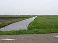
 Netherlands, Kaag en Braassem, Rijnsaterwoude, Vierambachtspolder.JPG 2,144 × 1,424; 801 KB
-
Nl-Rijnsaterwoude-article.ogg 1 min 40 s; 998 KB
-
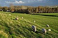
 Peacecar (3266695184).jpg 1,024 × 682; 321 KB
-
 Plaatsing houtzaagmolen - Rijnsaterwoude - 20186948 - RCE.jpg 1,200 × 1,175; 245 KB
-
 Plaquette Priester Hendrik RSW.jpg 2,896 × 1,936; 3.22 MB
-
 Priest Hendrik (2001) (3265867071).jpg 680 × 1,024; 360 KB
-
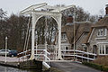 Rijnsaterwoude - Brug Leidsevaartlaan.JPG 1,920 × 1,280; 1.73 MB
-
 Rijnsaterwoude - Priester Hendrik.JPG 960 × 1,280; 601 KB
-
 Voor- en rechter zijgevel - Rijnsaterwoude - 20186937 - RCE.jpg 1,200 × 798; 240 KB
-
 Voorgevel - Rijnsaterwoude - 20186938 - RCE.jpg 787 × 1,200; 239 KB
-
 Woning HF 8 negatief bij RDMZ - Rijnsaterwoude - 20483313 - RCE.jpg 1,200 × 900; 113 KB
-
 Woning HK 2 negatief bij RDMZ - Rijnsaterwoude - 20483314 - RCE.jpg 1,200 × 900; 174 KB
.jpg)
.jpg)
.jpg)
.jpg)
.jpg)
.jpg)


.jpg)

.jpg)


_(3265867071).jpg)


