Category:Ripple, Worcestershire
Jump to navigation
Jump to search
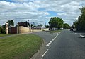
English: Ripple is a village and civil parish in the Malvern Hills District in the county of Worcestershire, England. Ripple is one of the most southerly parishes in the county and is situated on the A38 road with the River Severn as its eastern boundary. Together with the villages and hamlets of Ryall, Holly Green, The Grove, Naunton, and Uckinghall, the parish has a combined population of 1,799.
Français : Ripple est un village et une paroisse civile du Worcestershire, en Angleterre. Il est situé dans la vallée de la Severn, à environ huit kilomètres au nord de la ville de Tewkesbury. Administrativement, il relève du district de Malvern Hills. Au moment du recensement de 2011, il comptait .
Nederlands: Ripple is een plaats en civil parish in het bestuurlijke gebied Malvern Hills, in het Engelse graafschap Worcestershire met 1.500 inwoners.
Polski: Ripple – wieś w Anglii, w hrabstwie Worcestershire, w dystrykcie Malvern Hills. Leży 18 km na południe od miasta Worcester i 154 km na północny zachód od Londynu. Miejscowość liczy 1500 mieszkańców.

village and civil parish in Malvern Hills, Worcestershire, England  | |||||
| Upload media | |||||
| Instance of | |||||
|---|---|---|---|---|---|
| Location | Malvern Hills, Worcestershire, West Midlands, England | ||||
 | |||||
Subcategories
This category has the following 11 subcategories, out of 11 total.
H
- Holly Green (18 F)
N
- Naunton, Worcestershire (65 F)
Q
- Queenhill Bridge (9 F)
R
- Ripple railway station (4 F)
- Ripple village cross (3 F)
- Ryall, Worcestershire (81 F)
S
- Saxons Lode Gauging Station (8 F)
U
- Uckinghall (23 F)
Media in category "Ripple, Worcestershire"
The following 200 files are in this category, out of 529 total.
(previous page) (next page)-
 A cuckoo and wood pigeon - geograph.org.uk - 6177958.jpg 1,024 × 768; 186 KB
-
 A cuckoo in a tree - geograph.org.uk - 6177955.jpg 1,024 × 768; 155 KB
-
 A desert of lapwings - geograph.org.uk - 5603061.jpg 1,024 × 576; 212 KB
-
 A field of potatoes - geograph.org.uk - 5019999.jpg 800 × 600; 183 KB
-
 A JCB filling a dumper truck - geograph.org.uk - 5983719.jpg 1,024 × 768; 277 KB
-
 A lay-by on the A38 near Naunton - geograph.org.uk - 5637197.jpg 1,024 × 683; 219 KB
-
 A sunset and a vapour trail - geograph.org.uk - 5286249.jpg 1,024 × 768; 97 KB
-
 A useless cattle grid - geograph.org.uk - 5097335.jpg 800 × 600; 122 KB
-
 A wet and muddy track - geograph.org.uk - 5690278.jpg 1,024 × 680; 255 KB
-
 A38 approaches the Council Houses - geograph.org.uk - 3460064.jpg 3,353 × 2,543; 1.02 MB
-

-
 A38 at the county boundary - geograph.org.uk - 2319278.jpg 640 × 480; 53 KB
-
 A38 at the water works entrance - geograph.org.uk - 2319260.jpg 640 × 480; 54 KB
-
 A38 crossing Stratford Bridge - geograph.org.uk - 3511572.jpg 1,024 × 768; 180 KB
-
 A38 enters Worcestershire at Stratford Bridge - geograph.org.uk - 3460060.jpg 3,648 × 2,736; 2.05 MB
-
 A38 junction - geograph.org.uk - 2204475.jpg 1,024 × 681; 155 KB
-
 A38 junction with A4104 - geograph.org.uk - 3460074.jpg 3,648 × 2,736; 1.43 MB
-
 A38 road junction - geograph.org.uk - 1770223.jpg 640 × 419; 241 KB
-
 A4104 approaching the A38 - geograph.org.uk - 2204450.jpg 1,024 × 681; 144 KB
-
 A4104 at Holly Green with distant Malvern Hills - geograph.org.uk - 5197919.jpg 1,600 × 1,200; 285 KB
-
 A4104 Junction For Earl's Croome - geograph.org.uk - 3123256.jpg 640 × 370; 53 KB
-
 Access road to water works and gravel quarry - geograph.org.uk - 4948529.jpg 1,600 × 1,000; 598 KB
-
 Aggregate barge Elver - geograph.org.uk - 1830724.jpg 4,125 × 2,541; 5.51 MB
-
 Approaching Ryall's Court Farm - geograph.org.uk - 5983735.jpg 1,024 × 768; 303 KB
-
 Approaching Ryall's Court Farm - geograph.org.uk - 5983741.jpg 1,024 × 768; 274 KB
-
 Approaching Saxon's Lode - geograph.org.uk - 2319235.jpg 640 × 480; 42 KB
-
 Arable field at Ryall - geograph.org.uk - 4841340.jpg 800 × 600; 167 KB
-
 Arable field near Ripple - geograph.org.uk - 1856149.jpg 640 × 480; 110 KB
-
 Arable field south of Levant Lodge - geograph.org.uk - 4841984.jpg 800 × 600; 210 KB
-
 Autumn at Earl's Croome - geograph.org.uk - 5178072.jpg 1,024 × 768; 385 KB
-
 Badger footprint - geograph.org.uk - 5051736.jpg 1,024 × 576; 274 KB
-
 Badger footprints in concrete - geograph.org.uk - 5051735.jpg 576 × 1,024; 220 KB
-
 Bare winter oak tree - geograph.org.uk - 4841319.jpg 600 × 800; 215 KB
-
 Bare winter trees - geograph.org.uk - 3385784.jpg 1,024 × 680; 189 KB
-
 Bare winter trees - geograph.org.uk - 4771485.jpg 1,024 × 768; 260 KB
-
 Barge by Ryall Quarry - geograph.org.uk - 6178554.jpg 1,024 × 768; 220 KB
-
 Barges on the River Severn - geograph.org.uk - 6178560.jpg 1,024 × 768; 145 KB
-
 Barges on the Severn - geograph.org.uk - 4628072.jpg 800 × 531; 129 KB
-
 Barn conversion on Bow Lane - geograph.org.uk - 3902117.jpg 800 × 531; 156 KB
-
 Below Queenhill Bridge - geograph.org.uk - 3903254.jpg 1,024 × 680; 184 KB
-

-
 Bluebell Farm - geograph.org.uk - 4950089.jpg 1,600 × 1,067; 607 KB
-
 Bluebell Farm - geograph.org.uk - 6033286.jpg 2,880 × 2,160; 2.12 MB
-
 Boat on the Severn - geograph.org.uk - 2117572.jpg 4,084 × 2,678; 6.56 MB
-
 Bow Farm - geograph.org.uk - 1879105.jpg 640 × 480; 86 KB
-
 Bow Farm - geograph.org.uk - 4230012.jpg 800 × 531; 122 KB
-
 Bow Lane - geograph.org.uk - 5323743.jpg 1,024 × 768; 200 KB
-
 Bow Lane - geograph.org.uk - 5324721.jpg 1,024 × 768; 296 KB
-
 Bow lane and bridleway - geograph.org.uk - 3089522.jpg 1,200 × 1,600; 688 KB
-
 Bow Lane, Ripple - geograph.org.uk - 1856161.jpg 640 × 480; 89 KB
-
 Bow Lane, Ripple - geograph.org.uk - 2793829.jpg 1,024 × 680; 189 KB
-
 Bow Lane, Ripple - geograph.org.uk - 3902099.jpg 1,024 × 680; 294 KB
-
 Bow Lane, Ripple - geograph.org.uk - 896173.jpg 640 × 480; 92 KB
-
 Bridge closure - geograph.org.uk - 3015708.jpg 1,024 × 768; 167 KB
-
 Bridleway and track - geograph.org.uk - 5983731.jpg 1,024 × 768; 256 KB
-
 Bridleway north from the A4104 - geograph.org.uk - 3579429.jpg 800 × 451; 180 KB
-
 Bridleway to Severn Stoke - geograph.org.uk - 5811398.jpg 6,000 × 4,000; 7.31 MB
-
 Brockeridge Common - geograph.org.uk - 635164.jpg 640 × 426; 89 KB
-
 Building an access road - geograph.org.uk - 5171793.jpg 1,024 × 768; 156 KB
-
 Building an access road - geograph.org.uk - 5171796.jpg 1,024 × 768; 176 KB
-
 Building land for sale - geograph.org.uk - 4587086.jpg 800 × 531; 122 KB
-
 Building site at Holly Green - geograph.org.uk - 5064883.jpg 1,024 × 768; 240 KB
-
 Campers at the Sunshine Festival - geograph.org.uk - 5097366.jpg 800 × 600; 115 KB
-
 Campers at the Upton Blues Festival - geograph.org.uk - 4587082.jpg 800 × 531; 108 KB
-
 Candles in Ripple church - geograph.org.uk - 5233898.jpg 768 × 1,024; 177 KB
-
 Caravan Park entrance at Stratford Bridge - geograph.org.uk - 3511578.jpg 1,024 × 715; 123 KB
-
 Caravaners at Upton Blues Festival - geograph.org.uk - 5051767.jpg 1,024 × 576; 156 KB
-
 Celtic cross gravestone - geograph.org.uk - 5233842.jpg 768 × 1,024; 333 KB
-
 Cemex gravel extraction quarry, Ryall Court Farm - geograph.org.uk - 5690130.jpg 1,024 × 680; 208 KB
-
 Churchyard cross, Ripple - geograph.org.uk - 5562311.jpg 2,270 × 3,234; 2.67 MB
-
 Construction work begins - geograph.org.uk - 4907477.jpg 800 × 600; 91 KB
-
 Converted pub in Ryall - geograph.org.uk - 5142289.jpg 1,024 × 768; 152 KB
-
 Cottage and rising floodwaters - geograph.org.uk - 3844866.jpg 1,024 × 680; 245 KB
-
 Cottage on the corner - geograph.org.uk - 3222614.jpg 1,200 × 676; 471 KB
-
 Cottages at The Bow - geograph.org.uk - 3193746.jpg 1,200 × 676; 410 KB
-
 Court Lea, Holly Green - geograph.org.uk - 4775162.jpg 800 × 600; 94 KB
-
 Coventry Waterworks intake - geograph.org.uk - 6178573.jpg 1,024 × 768; 260 KB
-
 Crossing the winning line - geograph.org.uk - 4414434.jpg 1,024 × 680; 287 KB
-
 Crossroads north of Ripple - geograph.org.uk - 2333964.jpg 640 × 480; 51 KB
-
 Curves ahead on the A38 - geograph.org.uk - 2319265.jpg 640 × 480; 39 KB
-
 Denbow earthmovers - geograph.org.uk - 5983753.jpg 1,024 × 683; 157 KB
-
 Dismantled railway bridge - geograph.org.uk - 2975718.jpg 768 × 1,024; 225 KB
-
 Disused railway bridge, Saxon's Lode - geograph.org.uk - 2319246.jpg 640 × 480; 57 KB
-
 Drainage ditch near Ryall Court Farm - geograph.org.uk - 5171802.jpg 1,024 × 768; 306 KB
-
 Drainage pipes on the A4104 - geograph.org.uk - 6077338.jpg 1,024 × 768; 216 KB
-
 Earthmover and tractor - geograph.org.uk - 5690124.jpg 1,024 × 680; 239 KB
-
 Earthmover at gravel extraction site - geograph.org.uk - 5719863.jpg 1,024 × 576; 213 KB
-
 Earthmover at gravel extraction site - geograph.org.uk - 5983800.jpg 1,024 × 768; 261 KB
-
 Electricity poles - geograph.org.uk - 6244852.jpg 1,024 × 683; 199 KB
-
 Emerging crop above Ryall's Court - geograph.org.uk - 5808440.jpg 6,000 × 4,000; 7.66 MB
-
 Entrance to a construction site at Holly Green - geograph.org.uk - 5064887.jpg 1,024 × 768; 238 KB
-

-
 Entrance to works site beside the A4104 - geograph.org.uk - 5983727.jpg 1,024 × 768; 277 KB
-
 Evening light and the Malvern Hills - geograph.org.uk - 4920833.jpg 800 × 600; 41 KB
-
 Excavator at Cemex quarry, Ryall Court Farm - geograph.org.uk - 5690357.jpg 680 × 1,024; 248 KB
-
 Farm drive to Ryall's Court Farm - geograph.org.uk - 4841331.jpg 800 × 600; 140 KB
-
 Farm road, Ryall's Court - geograph.org.uk - 4633904.jpg 800 × 531; 117 KB
-
 Farm track near Sudeley Farm - geograph.org.uk - 5148746.jpg 1,024 × 768; 325 KB
-
 Farm track to Ryall's Court Farm - geograph.org.uk - 5001329.jpg 800 × 600; 135 KB
-
 Farmland above Ryall's Court Farm - geograph.org.uk - 4772362.jpg 1,024 × 768; 361 KB
-
 Farmland above Ryall's Court Farm - geograph.org.uk - 4840550.jpg 800 × 600; 149 KB
-
 Farmland and Bredon Hill - geograph.org.uk - 5603054.jpg 1,024 × 576; 163 KB
-
 Farmland at Ripple - geograph.org.uk - 5628657.jpg 1,024 × 768; 330 KB
-
 Farmland at Stratford Bridge - geograph.org.uk - 2268531.jpg 1,024 × 680; 257 KB
-
 Farmland by Ley Coppice - geograph.org.uk - 4291886.jpg 800 × 531; 108 KB
-
 Farmland footpath - geograph.org.uk - 4772365.jpg 800 × 600; 156 KB
-
 Farmland near Ryall - geograph.org.uk - 4841327.jpg 800 × 600; 164 KB
-
 Farmland near Ryall's Court Farm - geograph.org.uk - 4840558.jpg 800 × 600; 135 KB
-
 Farmland near Ryall's Court Farm - geograph.org.uk - 4841324.jpg 1,024 × 768; 224 KB
-
 Farmland near Stratford Bridge - geograph.org.uk - 2268528.jpg 1,024 × 680; 226 KB
-
 Farmland track - geograph.org.uk - 5001325.jpg 1,024 × 768; 280 KB
-
 Farmland track - geograph.org.uk - 5720701.jpg 1,024 × 576; 196 KB
-
 Fence on a flood bank - geograph.org.uk - 3902595.jpg 1,024 × 680; 279 KB
-
 Field beside Bow Lane, Ripple - geograph.org.uk - 3902122.jpg 800 × 531; 124 KB
-
 Field by the A38 - geograph.org.uk - 2335071.jpg 640 × 480; 62 KB
-
 Field edge path above Turks End Farm - geograph.org.uk - 5808449.jpg 6,000 × 4,000; 4.26 MB
-
 Field entrance near Stratford - geograph.org.uk - 4947352.jpg 1,600 × 1,067; 624 KB
-
 Field gateway - geograph.org.uk - 5148784.jpg 1,024 × 768; 276 KB
-
 Field growing oilseed rape - geograph.org.uk - 4771494.jpg 800 × 600; 188 KB
-
 Field of oil seed rape beside the A4104 and A38 - geograph.org.uk - 4948605.jpg 1,600 × 1,200; 717 KB
-
 Field of potatoes - geograph.org.uk - 5020004.jpg 800 × 600; 163 KB
-
 Field to the north of Ryall's Court Farm - geograph.org.uk - 4775157.jpg 800 × 600; 155 KB
-
 Field-edge path near Earl's Croome - geograph.org.uk - 5810285.jpg 6,000 × 4,000; 4.64 MB
-
 Fields leading down to Ripple Lake and the River Severn - geograph.org.uk - 3834890.jpg 2,505 × 1,847; 965 KB
-
 Figures on a former railway bridge - geograph.org.uk - 6171778.jpg 1,024 × 768; 218 KB
-
 Flood water beyond the defences - geograph.org.uk - 3240915.jpg 1,024 × 768; 184 KB
-
 Footbridge near Ryall Court Farm - geograph.org.uk - 5883538.jpg 1,024 × 768; 318 KB
-
 Footpath at Ryall - geograph.org.uk - 4841972.jpg 1,024 × 768; 396 KB
-
 Footpath beside the River Severn - geograph.org.uk - 5218003.jpg 800 × 600; 183 KB
-
 Footpath by Upton Marina - geograph.org.uk - 4408429.jpg 800 × 600; 198 KB
-
 Footpath crossing a field - geograph.org.uk - 4959767.jpg 1,024 × 768; 313 KB
-
 Footpath in an oilseed rape field - geograph.org.uk - 4939022.jpg 800 × 600; 194 KB
-
 Footpath near Earl's Croome - geograph.org.uk - 5808431.jpg 6,000 × 4,000; 6.62 MB
-
 Footpath near Levant Lodge - geograph.org.uk - 5182964.jpg 1,024 × 768; 223 KB
-
 Footpath near Levent Lodge - geograph.org.uk - 5808382.jpg 6,000 × 4,000; 4.6 MB
-
 Footpath over Ripple tip - geograph.org.uk - 1755621.jpg 640 × 427; 285 KB
-
 Footpath over Ripple tip. - geograph.org.uk - 1755601.jpg 640 × 427; 267 KB
-
 Footpath passing under a tree - geograph.org.uk - 4959770.jpg 800 × 600; 190 KB
-
 Footpath south - geograph.org.uk - 3222632.jpg 1,200 × 676; 505 KB
-
 Footpath start - geograph.org.uk - 1755595.jpg 640 × 427; 299 KB
-
 Footpath through snow - geograph.org.uk - 2209325.jpg 1,024 × 681; 197 KB
-
 Footpath to Earl's Croome - geograph.org.uk - 2209261.jpg 1,024 × 681; 209 KB
-
 Footpath to Ryall - geograph.org.uk - 2357790.jpg 640 × 480; 66 KB
-
 Footpath to the A38 and Earl's Croome - geograph.org.uk - 4841347.jpg 1,024 × 768; 340 KB
-
 Footpath to the River Severn - geograph.org.uk - 2794199.jpg 1,024 × 680; 224 KB
-
 For sale, development site - geograph.org.uk - 5811402.jpg 6,000 × 4,000; 4.29 MB
-
 Former fuel storage depot at Ripple near Worcester - geograph.org.uk - 2350139.jpg 3,008 × 2,000; 1.43 MB
-
 Former oil depot at Saxon's Lode - geograph.org.uk - 6171770.jpg 1,024 × 768; 206 KB
-
 Former railway bridge over the M50 - geograph.org.uk - 2793814.jpg 1,024 × 680; 222 KB
-
 Former railway bridge over the M50 - geograph.org.uk - 2793817.jpg 1,024 × 680; 228 KB
-
 Former railway bridge over the M50 - geograph.org.uk - 2793822.jpg 1,024 × 680; 247 KB
-
 Former railway bridge over the M50 - geograph.org.uk - 2793824.jpg 1,024 × 680; 207 KB
-
 Former railway bridge over the M50 - geograph.org.uk - 2793825.jpg 1,024 × 680; 159 KB
-
 Former railway trackbed - geograph.org.uk - 3902109.jpg 800 × 531; 149 KB
-
 Former railway trackbed - geograph.org.uk - 5323734.jpg 1,024 × 768; 484 KB
-
 Former railway trackbed - geograph.org.uk - 5323739.jpg 1,024 × 768; 408 KB
-
 Furrow Close - geograph.org.uk - 5808320.jpg 6,000 × 4,000; 7.18 MB
-
 Gateway onto Fish Meadow - geograph.org.uk - 5001333.jpg 800 × 600; 148 KB
-
 Glampers at the Sunshine Festival - geograph.org.uk - 6255998.jpg 1,024 × 768; 257 KB
-
 Glamping tents - geograph.org.uk - 6244841.jpg 1,024 × 683; 170 KB
-
 Glamping tents - geograph.org.uk - 6244843.jpg 1,024 × 683; 182 KB
-
 Glamping tents - geograph.org.uk - 6244880.jpg 1,024 × 683; 150 KB
-
 Golden oats at Green Street - geograph.org.uk - 3579354.jpg 800 × 451; 180 KB
-
 Gravel extraction - geograph.org.uk - 4230072.jpg 1,024 × 680; 237 KB
-
 Gravel extraction beside the Severn - geograph.org.uk - 3039817.jpg 1,024 × 680; 228 KB
-
 Gravel extraction near Ryall Court Farm - geograph.org.uk - 5876779.jpg 1,024 × 768; 210 KB
-
 Gravel extraction site - geograph.org.uk - 3903270.jpg 800 × 531; 135 KB
-
 Gravel extraction site near Ryall Court Farm - geograph.org.uk - 5876780.jpg 1,024 × 768; 190 KB
-
 Gravel extraction site, near Ripple - geograph.org.uk - 3903244.jpg 800 × 531; 153 KB
-
 Gravel extraction site, Ryall Court Farm - geograph.org.uk - 5690115.jpg 1,024 × 680; 257 KB
-
 Gravel extraction site, Ryall Court Farm - geograph.org.uk - 5690284.jpg 1,024 × 680; 255 KB
-
 Gravel extraction site, Ryall Court Farm - geograph.org.uk - 6038555.jpg 1,024 × 768; 292 KB
-
 Gravel extraction site, Ryall'c Court Farm - geograph.org.uk - 6039852.jpg 1,024 × 768; 220 KB
-
 Gravel extraction site, Ryall's Court Farm - geograph.org.uk - 5983864.jpg 1,024 × 683; 248 KB
-
 Gravel extraction site, Ryall's Court Farm - geograph.org.uk - 6039877.jpg 1,024 × 768; 155 KB
-
 Gravel extraction workings - geograph.org.uk - 5958677.jpg 1,024 × 768; 285 KB
-
 Gravel extraction, Ryall Court Farm - geograph.org.uk - 5690117.jpg 1,024 × 680; 267 KB
-
 Gravel grading plant, Ryall - geograph.org.uk - 4915366.jpg 800 × 691; 215 KB
-
 Gravel heaps beside the Severn - geograph.org.uk - 6002091.jpg 1,024 × 683; 276 KB
-
 Gravel spoil heap - geograph.org.uk - 3903240.jpg 1,024 × 680; 326 KB
-
 Gravel spoil heaps - geograph.org.uk - 6002095.jpg 1,024 × 683; 209 KB
-
 Gravel workings below the M50 motorway - geograph.org.uk - 3903230.jpg 1,024 × 680; 293 KB
-
 Gravel workings near Ryall's Court Farm - geograph.org.uk - 6039855.jpg 1,024 × 768; 263 KB
-
 Grove House Garage - geograph.org.uk - 5250063.jpg 1,024 × 576; 136 KB
-
 Gubberhill Farm, Ripple - geograph.org.uk - 1755480.jpg 3,800 × 2,533; 7.69 MB
-
 Harvested oilseed rape field - geograph.org.uk - 5114672.jpg 1,024 × 768; 292 KB
-
 Harvested oilseed rape field - geograph.org.uk - 5114678.jpg 1,024 × 768; 187 KB
-
 Harvested potato field - geograph.org.uk - 5114686.jpg 800 × 600; 97 KB
-

-
 Harvested wheat field - geograph.org.uk - 6244865.jpg 1,024 × 683; 234 KB
-

-
 Heading upstream at Sandy Point - geograph.org.uk - 3548478.jpg 640 × 480; 136 KB
-
 Hillside with oil seed rape - geograph.org.uk - 5808365.jpg 6,000 × 4,000; 7.69 MB
-

-
 Holly Green Farm and field of oil seed rape - geograph.org.uk - 4948607.jpg 1,600 × 1,200; 757 KB
-
 House beside a track and bridleway - geograph.org.uk - 5690020.jpg 1,024 × 680; 279 KB
-
 House by the River Severn - geograph.org.uk - 5801351.jpg 6,000 × 4,000; 7.72 MB
-
 House in Holly Green, Ryall, Worcestershire - geograph.org.uk - 5197908.jpg 1,600 × 1,200; 320 KB
-
 House in Naunton (geograph 6635892).jpg 1,024 × 768; 264 KB
-
 House next to church, Ripple - geograph.org.uk - 6242019.jpg 1,600 × 1,200; 556 KB


.jpg)
