Category:Ryall, Worcestershire
Jump to navigation
Jump to search
village in Worcestershire, England, UK  | |||||
| Upload media | |||||
| Instance of | |||||
|---|---|---|---|---|---|
| Location | Ripple, Malvern Hills, Worcestershire, West Midlands, England | ||||
| Located in or next to body of water | |||||
 | |||||
Media in category "Ryall, Worcestershire"
The following 104 files are in this category, out of 104 total.
-
 A38 south of Ryall - geograph.org.uk - 3460069.jpg 3,477 × 2,551; 1.03 MB
-
 A4104 at Ryall - geograph.org.uk - 2335093.jpg 640 × 480; 58 KB
-
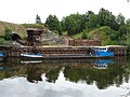
 Aggregate Boats, Ryall Quarry - geograph.org.uk - 1349394.jpg 640 × 455; 86 KB
-
 Aggregate pile at Ryall Quarry - geograph.org.uk - 1832813.jpg 640 × 409; 227 KB
-
 Agricultural garage on the A38 - geograph.org.uk - 861289.jpg 640 × 456; 289 KB
-
 Arable field at Ryall - geograph.org.uk - 4841340.jpg 800 × 600; 167 KB
-
 Arid farmland near Ryall - geograph.org.uk - 2542312.jpg 1,024 × 680; 295 KB
-
 Barge by Ryall Quarry - geograph.org.uk - 6178554.jpg 1,024 × 768; 220 KB
-
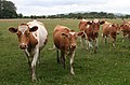 Cattle on Smitmoor Common. - geograph.org.uk - 867319.jpg 640 × 421; 271 KB
-
 Converted pub in Ryall - geograph.org.uk - 5142289.jpg 1,024 × 768; 152 KB
-
 Daffodils and the Blue Bell - geograph.org.uk - 1776203.jpg 640 × 426; 74 KB
-
 Direction signs on A38 at Ryall - geograph.org.uk - 3258683.jpg 1,600 × 1,165; 293 KB
-
 Drain across Smithmoor Common - geograph.org.uk - 866671.jpg 640 × 427; 281 KB
-
 Farmland at Ryall - geograph.org.uk - 2542303.jpg 1,024 × 680; 258 KB
-
 Fishing Platform, Upper Ham - geograph.org.uk - 1349426.jpg 640 × 455; 130 KB
-
 Footpath at Ryall - geograph.org.uk - 4841972.jpg 1,024 × 768; 396 KB
-
 Footpath to Ryall - geograph.org.uk - 2357790.jpg 640 × 480; 66 KB
-

-
 Former Horse & Groom Inn - geograph.org.uk - 764601.jpg 640 × 480; 65 KB
-
 Gravel grading plant, Ryall - geograph.org.uk - 4915366.jpg 800 × 691; 215 KB
-
 House in Holly Green, Ryall, Worcestershire - geograph.org.uk - 5197908.jpg 1,600 × 1,200; 320 KB
-
 House in Ryall - geograph.org.uk - 1191707.jpg 640 × 426; 61 KB
-
 In the parade ring - geograph.org.uk - 4414396.jpg 800 × 531; 136 KB
-
 Lake at Ryall - geograph.org.uk - 4408438.jpg 1,024 × 768; 248 KB
-
 Lay-by south of Ryall, with refreshments - geograph.org.uk - 3511554.jpg 1,024 × 768; 108 KB
-
 Meadowland near Ryall Court Farm - geograph.org.uk - 4230550.jpg 800 × 531; 153 KB
-

-
 Meadows near Ryall's Court - geograph.org.uk - 1367404.jpg 640 × 436; 268 KB
-
 Mistletoe trees - geograph.org.uk - 861246.jpg 640 × 427; 306 KB
-
 New house in Ryall - geograph.org.uk - 5142297.jpg 800 × 600; 137 KB
-
 Oilseed rape field at Ryall - geograph.org.uk - 4940431.jpg 800 × 287; 68 KB
-
 Oilseed rape near Ryall - geograph.org.uk - 4940420.jpg 800 × 492; 110 KB
-
 Old orchard at Ryall - geograph.org.uk - 764586.jpg 640 × 480; 98 KB
-
 Panorama view near Ryall - geograph.org.uk - 5141076.jpg 800 × 267; 70 KB
-
 Parking area on the A38, Ryall - geograph.org.uk - 6240546.jpg 1,906 × 1,260; 1.2 MB
-
 Ploughed field at Ryall - geograph.org.uk - 5148787.jpg 800 × 450; 99 KB
-
 Ploughed field near The Grove - geograph.org.uk - 852590.jpg 640 × 423; 217 KB
-
 Polling Station at Ryall - geograph.org.uk - 5431313.jpg 1,024 × 768; 238 KB
-
 Polystyrene on the public footpath - 1 - geograph.org.uk - 764513.jpg 640 × 480; 125 KB
-
 Polystyrene on the public footpath - 2 - geograph.org.uk - 764533.jpg 640 × 480; 107 KB
-
 Power as the blackbird flies - geograph.org.uk - 866667.jpg 640 × 439; 208 KB
-
 Power lines near Ryall's Court - geograph.org.uk - 1360568.jpg 640 × 406; 235 KB
-
 Power over Smithmoor Common - geograph.org.uk - 866666.jpg 640 × 427; 223 KB
-
 Power over wheat field - geograph.org.uk - 861384.jpg 427 × 640; 241 KB
-
 Power path - geograph.org.uk - 865050.jpg 640 × 427; 250 KB
-
 Private property by the Severn - geograph.org.uk - 764545.jpg 640 × 480; 86 KB
-
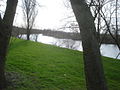
 River Severn below Ryall - geograph.org.uk - 1349430.jpg 640 × 455; 109 KB
-
 River Severn, Ryall - geograph.org.uk - 1349418.jpg 640 × 455; 109 KB
-
 River Severn, Ryall - geograph.org.uk - 1349429.jpg 640 × 455; 87 KB
-
 Rolling hills east of Ryall - geograph.org.uk - 765140.jpg 640 × 480; 76 KB
-
 Ryall Garage - geograph.org.uk - 1191698.jpg 640 × 426; 53 KB
-
 Ryall Garage - geograph.org.uk - 4542360.jpg 640 × 480; 63 KB
-
 Ryall Garage - geograph.org.uk - 4948599.jpg 1,600 × 1,066; 691 KB
-
 Ryall Garage - geograph.org.uk - 5217803.jpg 1,024 × 768; 164 KB
-
 Ryall Garage - geograph.org.uk - 852588.jpg 640 × 427; 231 KB
-
 Ryall Garage on the A38 - geograph.org.uk - 6240545.jpg 1,920 × 1,280; 1.18 MB
-
 Ryall Lane - geograph.org.uk - 764577.jpg 640 × 480; 72 KB
-
 Ryall Malvern Hills geograph-3192955-by-Ben-Brooksbank.jpg 925 × 540; 102 KB
-
 Ryall Meadow - geograph.org.uk - 764564.jpg 640 × 480; 61 KB
-
 Ryall road junction - geograph.org.uk - 852601.jpg 640 × 427; 296 KB
-
 Smithmoor Common - geograph.org.uk - 765496.jpg 640 × 480; 86 KB
-
 Smithmoor Common - geograph.org.uk - 867267.jpg 640 × 427; 260 KB
-
 Smithmoor Common - geograph.org.uk - 867294.jpg 640 × 427; 298 KB
-
 Snow-covered fields near Ryall - geograph.org.uk - 2204457.jpg 1,024 × 681; 113 KB
-
 Snow-covered meadowland near Ryall Court Farm - geograph.org.uk - 2203329.jpg 1,024 × 681; 157 KB
-
 Snowscape near Ryall - geograph.org.uk - 2209138.jpg 1,024 × 681; 219 KB
-
 Snowscape near Ryall Court Farm - geograph.org.uk - 2208275.jpg 1,024 × 681; 182 KB
-
 Staggered field boundaries - geograph.org.uk - 865148.jpg 640 × 427; 302 KB
-
 Steep slope at Ryall - geograph.org.uk - 764556.jpg 480 × 640; 128 KB
-
 Stile on the ridge path - geograph.org.uk - 865164.jpg 640 × 427; 299 KB
-
 Sudeley Cottage - geograph.org.uk - 858665.jpg 640 × 488; 304 KB
-
 Taylor Wimpey building site in Ryall - geograph.org.uk - 5221991.jpg 1,024 × 768; 185 KB
-
 The A38 near Ryall - geograph.org.uk - 2204465.jpg 1,024 × 681; 132 KB
-
 The Blue Bell Inn - geograph.org.uk - 4232117.jpg 640 × 478; 50 KB
-
 The Blue Bell inn at Ryall - geograph.org.uk - 3511546.jpg 1,024 × 768; 109 KB
-
 The Blue Bell, Ryall - geograph.org.uk - 1191702.jpg 640 × 426; 63 KB
-
 The Blue Bell, Ryall - geograph.org.uk - 2783765.jpg 640 × 480; 58 KB
-
 The Blue Bell, Ryall - geograph.org.uk - 715283.jpg 640 × 426; 70 KB
-
 The Blue Bell, Ryall - geograph.org.uk - 715294.jpg 640 × 426; 55 KB
-
 The Grove - geograph.org.uk - 861297.jpg 640 × 427; 275 KB
-
 The ridge , Smithmoor - geograph.org.uk - 861354.jpg 640 × 427; 281 KB
-
 The war memorial at Ryall - geograph.org.uk - 4948542.jpg 1,600 × 888; 667 KB
-
 Timber-framed house at Ryall - geograph.org.uk - 764568.jpg 640 × 480; 72 KB
-
 Top of the ridge - geograph.org.uk - 861369.jpg 640 × 427; 276 KB
-
 Track near Ryall's Court - geograph.org.uk - 992670.jpg 640 × 426; 78 KB
-
 Track to Ryall's Court - geograph.org.uk - 836265.jpg 640 × 480; 107 KB
-
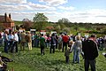
 Upton upon Severn Point to Point - geograph.org.uk - 459852.jpg 640 × 426; 116 KB
-
 Upton upon Severn Point-to-Point - geograph.org.uk - 459874.jpg 640 × 426; 97 KB
-
 Used car dealer at Ryall by A38 - geograph.org.uk - 3511542.jpg 1,024 × 768; 108 KB
-
 View to Ryall's Court Farm - geograph.org.uk - 2209285.jpg 1,024 × 681; 196 KB
-
 War Memorial at Ryall - geograph.org.uk - 715298.jpg 426 × 640; 102 KB
-
 War Memorial, The Grove, Ryall - geograph.org.uk - 3448.jpg 479 × 640; 99 KB
-
 Water meadow at Ryall's Court - geograph.org.uk - 763494.jpg 640 × 480; 56 KB
-
 Water trough in the wheat - geograph.org.uk - 858682.jpg 640 × 400; 264 KB
-
 Well marked path - geograph.org.uk - 865023.jpg 640 × 427; 273 KB
-
 Wheat fields - geograph.org.uk - 865154.jpg 640 × 427; 254 KB
-
 Wheat fields at Ryall - geograph.org.uk - 4610828.jpg 800 × 531; 157 KB
-
 Wheat fields near Ryall - geograph.org.uk - 4587092.jpg 800 × 531; 164 KB
-
 Withybed Cottage - geograph.org.uk - 858675.jpg 640 × 491; 78 KB
-
 Withybed Cottage - geograph.org.uk - 866682.jpg 640 × 435; 306 KB
-
 Withybed Cottage - geograph.org.uk - 867257.jpg 640 × 389; 255 KB
-
 Withybed Cottage - geograph.org.uk - 867371.jpg 640 × 414; 222 KB
-
 Upton upon Severn Point-to-Point - geograph.org.uk - 459861.jpg 640 × 426; 128 KB
-
 Upton-upon-Severn Point-to-Point - geograph.org.uk - 459886.jpg 640 × 426; 98 KB


