Category:Rivers of Montana
Vai alla navigazione
Vai alla ricerca
Stati degli USA: Alabama · Alaska · Arizona · Arkansas · California · Carolina del Nord · Carolina del Sud · Colorado · Connecticut · Dakota del Nord · Dakota del Sud · Delaware · Florida · Georgia · Hawaii · Idaho · Illinois · Indiana · Iowa · Kansas · Kentucky · Louisiana · Maine · Maryland · Massachusetts · Michigan · Minnesota · Mississippi · Missouri · Montana · Nebraska · Nevada · New Hampshire · New Jersey · New York · Nuovo Messico · Ohio · Oklahoma · Oregon · Pennsylvania · Rhode Island · Tennessee · Texas · Utah · Vermont · Virginia · Virginia Occidentale · Washington · Wisconsin · Wyoming – Washington
Guam · Porto Rico
Guam · Porto Rico
categoria di un progetto Wikimedia | |||||
| Carica un file multimediale | |||||
| Istanza di | |||||
|---|---|---|---|---|---|
| Argomenti della categoria | |||||
| Categoria contiene | |||||
| Montana | |||||
stato federato degli Stati Uniti d'America  someja satełitar in łujo     | |||||
| Audio della pronuncia | |||||
| Istanza di | |||||
| Parte di | |||||
| Prende il nome da | |||||
| Luogo | Stati Uniti d'America | ||||
| Situato sul mare / lago / fiume | |||||
| Capitale | |||||
| Organo legislativo | |||||
| Organo esecutivo | |||||
| Massima autorità giuridica | |||||
| Lingua ufficiale | |||||
| Inno |
| ||||
| Capo del governo |
| ||||
| Data di fondazione o creazione |
| ||||
| Punto più alto | |||||
| Popolazione |
| ||||
| Superficie |
| ||||
| Altezza sul mare |
| ||||
| Ha sostituito | |||||
| Distinto da | |||||
| Temperatura massima registrata |
| ||||
| Temperatura minima registrata |
| ||||
| sito web ufficiale | |||||
 | |||||
Sottocategorie
Questa categoria contiene le 69 sottocategorie indicate di seguito, su un totale di 69.
*
- River islands in Montana (2 F)
- Streambed boulders in Montana (14 F)
+
- Maps of rivers in Montana (23 F)
.
B
- Blackfoot River (28 F)
C
- Clearwater River (Montana) (2 F)
- Cow Creek (Montana) (14 F)
D
E
- East Gallatin River (15 F)
F
G
J
- Judith River (9 F)
K
L
- Ledford Creek (empty)
M
N
P
R
- Ruby River (12 F)
S
- Sarpy Basin, Montana (33 F)
- Sarpy Creek (Montana) (1 F)
- Shields River (16 F)
- Sixteen Mile Creek (Montana) (15 F)
- Smith River (Montana) (7 F)
- Specimen Creek (Montana) (2 F)
- Swiftcurrent Creek (7 F)
T
- Teton River (Montana) (12 F)
- Two Medicine River (10 F)
W
- Waterton River (7 F)
Y
- Yaak River (4 F)
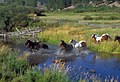
File nella categoria "Rivers of Montana"
Questa categoria contiene 50 file, indicati di seguito, su un totale di 50.
-
 20190329-FS-FlatheadNF-YFYF-040 (32581940247).jpg 7 952 × 5 304; 39,05 MB
-
 20190329-FS-FlatheadNF-YFYF-064 (47472037462).jpg 7 952 × 5 304; 44,36 MB
-
 20190329-FS-FlatheadNF-YFYF-111 (47471879152).jpg 7 952 × 5 304; 49,18 MB
-

-
 Annals of the Carnegie Museum (1908-1909) (18414943931).jpg 2 624 × 1 880; 1,27 MB
-
 Annual report of the American Bison Society (1907) (18435603001).jpg 3 472 × 2 238; 753 KB
-
 At N Yellowstone Trail Rd - Yellowstone River - Montana - 2013-07-07.jpg 3 000 × 1 987; 3,29 MB
-
 Blackfeet country. 32.jpg 1 536 × 1 253; 266 KB
-
 BlodgettCanyonMT.jpg 982 × 600; 195 KB
-
 Bulletin (Page 211) BHL3976298.jpg 1 976 × 3 062; 689 KB
-
 Bulletin (Page 342) BHL3976025.jpg 2 985 × 2 144; 905 KB
-
 CD3418-0006 - Flickr - USDAgov.jpg 2 903 × 1 975; 1,04 MB
-
 Centennial Mountains WSA (9441023835).jpg 4 320 × 2 879; 6,95 MB
-

-
 Cow & calf moose, Gallatin River (83a41395-0cb6-4654-843b-c318612ebdf8).jpg 5 652 × 3 768; 13,85 MB
-
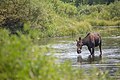 Cow moose, Gallatin River (6e1701a4-2be1-469c-8564-a8c4cd37c71b).jpg 5 760 × 3 840; 15,66 MB
-
 Cow moose, Gallatin River (c1953045-0207-450c-a326-43c995f3021d).jpg 3 840 × 5 760; 17,32 MB
-
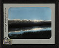 Evening sky and river near Blackfeet camp. 40a.jpg 1 536 × 1 266; 173 KB
-
 Headwaters of the Columbia River. 14.jpg 1 536 × 1 263; 232 KB
-
 Helena National Forest 99-7435 (5881429412).jpg 2 205 × 2 218; 234 KB
-

-
 Kalispell, MT, MT, USA - panoramio.jpg 3 456 × 4 608; 4,02 MB
-
 Kootenayrivermapnew.png 1 152 × 1 145; 2,18 MB
-
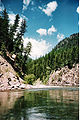
 Madison River near Ennis January 2015 03.JPG 3 264 × 2 448; 3,52 MB
-
 Marshy point with two moose in the distance. 15a.jpg 1 536 × 1 259; 184 KB
-
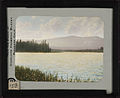
 Montana landscape. 2.jpg 1 536 × 1 264; 249 KB
-
 MontanaRivr.jpg 1 024 × 768; 449 KB
-
 MontanaScene.jpg 1 024 × 768; 457 KB
-
 MT Forest Fire Rapids.jpg 795 × 1 190; 272 KB
-
 MT Mountain River.jpg 795 × 1 190; 235 KB
-
 Photography by Victor Albert Grigas (1919-2017) MONTANA 1-40 XDo 1 00282 (50728311202).jpg 4 461 × 6 621; 9,76 MB
-

-
 Roscoe, Montana.jpg 1 026 × 696; 540 KB
-
 Scobeymontanariver.jpg 2 048 × 1 536; 652 KB
-
 Snow Melts into River near Iceberg Lake in Glacier National Park.jpg 2 048 × 1 360; 1,48 MB
-
 Spotted Bear River (9394850821).jpg 3 872 × 2 592; 4,3 MB
-
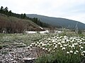
 Squaw Creek (Gallatin Range, Montana, USA) (19660474359).jpg 3 008 × 2 000; 3,51 MB
-
 U.S. Route 93 in Montana near Lower Stillwater Lake 01 (10323372474).jpg 2 848 × 4 288; 4,95 MB
-
 U.S. Route 93 in Montana near Lower Stillwater Lake 01 - white balanced (10322243725).jpg 2 848 × 4 288; 7,72 MB
-
 U.S. Route 93 in Montana near Lower Stillwater Lake 02 (10323530903).jpg 2 848 × 4 288; 4,84 MB
-
 U.S. Route 93 in Montana near Lower Stillwater Lake 02 - white balanced (10322367463).jpg 2 848 × 4 288; 9,55 MB
-
 StormCastleLookingSouth.jpg 5 184 × 3 456; 5,54 MB
-
 StRegisRiverMT.jpg 4 032 × 3 024; 3,97 MB
-
 Sun River.JPG 1 496 × 1 165; 513 KB
-
 Tree and river near Ninemile Remount Depot.jpg 5 184 × 3 456; 13,67 MB
-

-
 Water24 (25209095148).jpg 2 250 × 1 500; 4,5 MB
-
 Water28 (25209106408).jpg 2 250 × 1 500; 5,26 MB
-
 West Lake St. Mary - panoramio.jpg 4 288 × 2 848; 1,01 MB
-
 Whitefish River January 2, 2019.jpg 4 032 × 3 024; 5,16 MB
.jpg)
.jpg)
.jpg)
.jpg)
_(18414943931).jpg)
_(18435603001).jpg)


_BHL3976298.jpg)
_BHL3976025.jpg)

.jpg)

.jpg)
.jpg)
.jpg)


.jpg)


_MONTANA_1-40_XDo_1_00282_(50728311202).jpg)
.jpg)


.jpg)
_(19660474359).jpg)
.jpg)
.jpg)
.jpg)
.jpg)


.jpg)
.jpg)

