Category:Rivers of Indiana
Jump to navigation
Jump to search
States of the United States: Alabama · Alaska · Arizona · Arkansas · California · Colorado · Connecticut · Delaware · Florida · Georgia · Hawaii · Idaho · Illinois · Indiana · Iowa · Kansas · Kentucky · Louisiana · Maine · Maryland · Massachusetts · Michigan · Minnesota · Mississippi · Missouri · Montana · Nebraska · Nevada · New Hampshire · New Jersey · New Mexico · New York · North Carolina · North Dakota · Ohio · Oklahoma · Oregon · Pennsylvania · Rhode Island · South Carolina · South Dakota · Tennessee · Texas · Utah · Vermont · Virginia · Washington · West Virginia · Wisconsin · Wyoming – Washington, D.C.
Guam · Puerto Rico
Guam · Puerto Rico
Wikimedia category | |||||
| Upload media | |||||
| Instance of | |||||
|---|---|---|---|---|---|
| Category combines topics | |||||
| Category contains | |||||
| Indiana | |||||
state of the United States of America    | |||||
| Pronunciation audio | |||||
| Instance of | |||||
| Part of | |||||
| Named after | |||||
| Location |
| ||||
| Located in or next to body of water | |||||
| Capital |
| ||||
| Legislative body | |||||
| Executive body | |||||
| Highest judicial authority | |||||
| Official language | |||||
| Anthem | |||||
| Head of government |
| ||||
| Inception |
| ||||
| Highest point | |||||
| Population |
| ||||
| Area |
| ||||
| Elevation above sea level |
| ||||
| Different from | |||||
| Maximum temperature record |
| ||||
| Minimum temperature record |
| ||||
| official website | |||||
 | |||||
Subcategories
This category has the following 40 subcategories, out of 40 total.
*
- River banks in Indiana (51 F)
- River beaches in Indiana (1 F)
+
.
- River name signs in Indiana (2 F)
A
B
- Blue River (Indiana) (1 F)
C
- Cedar Creek (Indiana) (2 F)
E
F
- Fall Creek (Indiana) (6 F)
- Fox River (Indiana) (5 F)
I
K
L
M
O
S
T
W
Y
Media in category "Rivers of Indiana"
The following 37 files are in this category, out of 37 total.
-
 Big Blue River Henry County Indiana.JPG 2,048 × 1,536; 1.35 MB
-
 Big Pine Creek.JPG 4,752 × 3,168; 11.56 MB
-
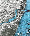 Bird's Eye View of Michigan City, 1869 A. Ruger.jpg 930 × 1,089; 998 KB
-
 Camp Fork at English.jpg 2,816 × 2,112; 3.12 MB
-
 East Fork of Whitewater River, Indiana and Ohio; final environmental statement (IA CAT78661517).pdf 1,129 × 1,577, 102 pages; 3.14 MB
-
 'Pogue's Run' by Jacob Cox, 1871.jpg 698 × 443; 53 KB
-
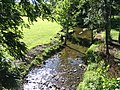 Creek from the Bridge - panoramio.jpg 2,048 × 1,536; 1.79 MB
-
 Deep river.jpg 1,920 × 1,280; 1.2 MB
-
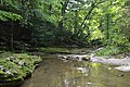 Downstream on McCormick's Creek.jpg 6,016 × 4,000; 6.36 MB
-
 Eel River at public access site off Indiana route 13 near Manchester Indiana.JPG 3,264 × 2,448; 1.87 MB
-
 Eel River Collamer Dam 1998.jpg 289 × 191; 15 KB
-
 Elkhart river.jpg 4,160 × 2,340; 5.82 MB
-
 Expanded Monitoring Site Locations.jpg 3,300 × 2,550; 2.93 MB
-
 Georgetown Creek (25506595396).jpg 4,000 × 2,992; 5.12 MB
-
 Huffman Mill Covered Bridge, bracing.jpg 2,816 × 1,584; 2.18 MB
-
 Kilmore Creek, Indiana.png 4,000 × 3,000; 26.48 MB
-
 Laughery Creek Bridge Dearborn County Indiana.jpg 4,964 × 3,420; 2.61 MB
-
 Mouth of Fox River. Tableau 5 by Sigismond Himely after Karl Bodmer.jpg 1,169 × 797; 991 KB
-
 Muscatatuck River (6166380652).jpg 1,024 × 683; 959 KB
-
 Muscatatuck River (6166381360).jpg 1,440 × 957; 1.27 MB
-
 Offield creek.jpg 700 × 525; 100 KB
-
 Overlooking Potato Creek.jpg 4,310 × 2,868; 7.33 MB
-
 Pipe Creek Falls Resort.jpg 2,816 × 1,584; 3.11 MB
-
 Riverside Boulevard (NBY 6069).jpg 824 × 522; 105 KB
-
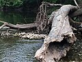
 Salt Creek from Kent Road.jpg 2,816 × 2,112; 3.8 MB
-
 Salt Creek upstream from Route 6 Bridge 2011-08-07.JPG 4,316 × 3,236; 7.54 MB
-
 Salt Creek Watershed USGS 2002.jpg 772 × 1,058; 544 KB
-
 Silver Creek Bridge n.d. (3192605224).jpg 2,080 × 1,462; 331 KB
-
 Strahl Creek P4140080 SP.jpg 1,984 × 1,488; 670 KB
-
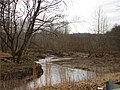
 Stream along West Kirkwood in Bloomington.jpg 2,816 × 2,112; 3.56 MB
-
 Students at Trail Creek Week.jpg 2,048 × 1,362; 292 KB
-
 Trail Creek upstream from Winding Creek Cove Bridge, Michigan City 2011-08-07.JPG 1,924 × 2,582; 3.19 MB
-
 Trail Creek Watershed Map 2006.jpg 440 × 388; 138 KB
-
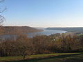 View of the Ohio River from Hanover Indiana.jpg 3,264 × 2,448; 2.05 MB
-
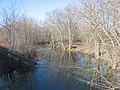
 West Branch Jackson Creek alongside Renwick Trail, Bloomington, IN USA.JPG 2,448 × 3,264; 3.91 MB
-
 White lick creek map.jpg 563 × 465; 125 KB
-
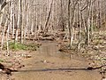
 WPA drainage channel at Maple, Bloomington West Side HD.jpg 2,816 × 2,112; 3.72 MB


.jpg)


.jpg)
.jpg)


.jpg)


.jpg)


