Category:Rivers of North Dakota
Jump to navigation
Jump to search
States of the United States: Alabama · Alaska · Arizona · Arkansas · California · Colorado · Connecticut · Delaware · Florida · Georgia · Hawaii · Idaho · Illinois · Indiana · Iowa · Kansas · Kentucky · Louisiana · Maine · Maryland · Massachusetts · Michigan · Minnesota · Mississippi · Missouri · Montana · Nebraska · Nevada · New Hampshire · New Jersey · New Mexico · New York · North Carolina · North Dakota · Ohio · Oklahoma · Oregon · Pennsylvania · Rhode Island · South Carolina · South Dakota · Tennessee · Texas · Utah · Vermont · Virginia · Washington · West Virginia · Wisconsin · Wyoming – Washington, D.C.
Guam · Puerto Rico
Guam · Puerto Rico
Wikimedia list article | |||||
| Upload media | |||||
| Instance of | |||||
|---|---|---|---|---|---|
| |||||
Subcategories
This category has the following 17 subcategories, out of 17 total.
*
- River banks in North Dakota (2 F)
+
- Maps of rivers in North Dakota (12 F)
.
H
- Heart River (North Dakota) (3 F)
J
K
- Knife River (8 F)
L
- Long Creek (Saskatchewan) (3 F)
M
R
S
Y
Media in category "Rivers of North Dakota"
The following 20 files are in this category, out of 20 total.
-
 Cannon Ball, ND.jpg 900 × 600; 193 KB
-
 Des lacs river melt.jpg 3,648 × 2,736; 4.86 MB
-
 Des Lacs River.jpg 4,320 × 3,240; 5.35 MB
-
 Green River near New Hradec ND.jpg 2,048 × 1,536; 2.19 MB
-
 Just Another Day in the Field (19298171271).jpg 2,400 × 1,800; 2.89 MB
-
 Little South Pembina River ND.jpg 1,600 × 1,200; 772 KB
-
 Maple River ND.jpg 394 × 282; 43 KB
-
 MapleRiverND2.JPG 922 × 692; 111 KB
-

-

-

-
 Theodore Roosevelt National Park and sun.jpg 4,719 × 3,146; 9.75 MB
-
 Tongue River North Dakota.jpg 432 × 280; 41 KB
-
 Turtle River ND.jpg 422 × 305; 93 KB
-
 USGS Gage House Cedar Creek North Dakota.jpg 500 × 375; 40 KB
-
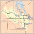
 Redrivernorthmap.png 500 × 499; 137 KB
-
 Wild Rice River ND.jpg 2,856 × 2,142; 2.22 MB
-
 Wild Rice River North Dakota.jpg 2,856 × 2,142; 2.22 MB
-
 Winter View (14045918771).jpg 2,592 × 1,944; 1.92 MB
-
 Wildricerivermap.png 500 × 499; 141 KB


.jpg)


.jpg)

.jpg)
.jpg)