Category:Rivers of Wyoming
Vai alla navigazione
Vai alla ricerca
Stati degli USA: Alabama · Alaska · Arizona · Arkansas · California · Carolina del Nord · Carolina del Sud · Colorado · Connecticut · Dakota del Nord · Dakota del Sud · Delaware · Florida · Georgia · Hawaii · Idaho · Illinois · Indiana · Iowa · Kansas · Kentucky · Louisiana · Maine · Maryland · Massachusetts · Michigan · Minnesota · Mississippi · Missouri · Montana · Nebraska · Nevada · New Hampshire · New Jersey · New York · Nuovo Messico · Ohio · Oklahoma · Oregon · Pennsylvania · Rhode Island · Tennessee · Texas · Utah · Vermont · Virginia · Virginia Occidentale · Washington · Wisconsin · Wyoming – Washington
Guam · Porto Rico
Guam · Porto Rico
categoria di un progetto Wikimedia | |||||
| Carica un file multimediale | |||||
| Istanza di | |||||
|---|---|---|---|---|---|
| Argomenti della categoria | |||||
| Categoria contiene | |||||
| Wyoming | |||||
stato federato degli Stati Uniti d'America      | |||||
| Audio della pronuncia | |||||
| Istanza di | |||||
| Parte di | |||||
| Prende il nome da | |||||
| Luogo | Stati Uniti d'America | ||||
| Capitale | |||||
| Organo legislativo | |||||
| Organo esecutivo | |||||
| Massima autorità giuridica |
| ||||
| Lingua ufficiale | |||||
| Inno |
| ||||
| Capo del governo |
| ||||
| Data di fondazione o creazione |
| ||||
| Punto più alto | |||||
| Popolazione |
| ||||
| Superficie |
| ||||
| Altezza sul mare |
| ||||
| Preceduto da | |||||
| Distinto da | |||||
| Temperatura massima registrata |
| ||||
| Temperatura minima registrata |
| ||||
| sito web ufficiale | |||||
 | |||||
Sottocategorie
Questa categoria contiene le 59 sottocategorie indicate di seguito, su un totale di 59.
*
+
.
- River name signs in Wyoming (1 F)
B
- Big Sandy River (Wyoming) (3 F)
- Black Rock Creek (Wyoming) (6 F)
C
E
- Encampment River (1 F)
F
G
- Greys River (2 F)
- Gros Ventre River (11 F)
H
L
- Lodgepole Creek (1 F)
M
- Middle Popo Agie River (7 F)
N
- North Laramie River (4 F)
O
P
R
S
T
W
- White Creek (Yellowstone) (4 F)
Y
File nella categoria "Rivers of Wyoming"
Questa categoria contiene 73 file, indicati di seguito, su un totale di 73.
-
 2003-08-18 Gibbon River in Yellowstone.jpg 2 560 × 1 920; 1,64 MB
-
 2003-08-19 Grand Loop Rd bridge over Gardner River in Yellowstone.jpg 2 560 × 1 920; 1,51 MB
-
 2012 08 04 bos-sfo wyoming 03 (8200901677).jpg 2 912 × 3 264; 7,88 MB
-
 Ayres Natural Bridge Park, Wyoming.jpg 3 231 × 2 154; 2,75 MB
-
 Ayres Natural Bridge power house.jpg 3 264 × 2 448; 1,98 MB
-
 Ayres Natural Bridge WY.jpg 1 984 × 1 312; 709 KB
-
 Bearriverwyoming.jpg 2 304 × 1 728; 925 KB
-
 Beartooth Highway - Runoff - NARA - 7717248.jpg 1 700 × 2 624; 1,24 MB
-
 BelcherRiver1964.jpg 1 999 × 1 355; 738 KB
-
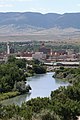 Casperskyline.jpg 800 × 1 200; 891 KB
-
 Cokeville Meadows National Wildlife Refuge (12911010794).jpg 1 280 × 813; 818 KB
-
 Cokeville Meadows National Wildlife Refuge (12911025644).jpg 1 280 × 850; 902 KB
-
 CQA Four Mile Bridge.jpg 4 624 × 3 683; 1,88 MB
-
 DDZ Bridge over New Fork River.jpg 4 656 × 3 651; 1,81 MB
-
 DOE Bridge over Laramie River.jpg 4 724 × 3 672; 1,11 MB
-
 ECS Bridge over Big Goose Creek.jpg 4 715 × 3 710; 2,49 MB
-
 EDL Peloux Bridge.jpg 4 650 × 3 677; 2,31 MB
-
 EFP Bridge over Owl Creek.jpg 4 683 × 3 661; 2,26 MB
-
 EJE Bridge over Shell Creek.jpg 4 735 × 3 717; 2,22 MB
-
 EWZ Bridge over East Channel of Laramie River.jpg 4 732 × 3 706; 3,02 MB
-
 Gardner RiverYNP2008.jpg 3 264 × 2 448; 3,59 MB
-
 GardnerRiver2006.jpg 3 072 × 2 304; 1,58 MB
-
 GardnerRiverYNP2008.jpg 3 072 × 2 304; 1,51 MB
-
 GardnerYellowstoneConfluence.jpg 3 072 × 2 304; 1,94 MB
-
 Gibbon River at Madison in Yellowstone.JPG 1 600 × 1 200; 221 KB
-
 GibbonRiverDuckRock1963.jpg 1 999 × 1 340; 682 KB
-
 Glendo State Park from above.jpg 1 984 × 1 312; 348 KB
-
 Glendo State Park.jpg 1 984 × 1 312; 404 KB
-
 Greybull River (Meeteetse, Wyoming, USA) 1 (42167674274).jpg 4 000 × 3 000; 4,42 MB
-
 Greybull River (Meeteetse, Wyoming, USA) 2 (41075800230).jpg 3 000 × 4 000; 4,19 MB
-
 Greybull River (Meeteetse, Wyoming, USA) 3 (41985561125).jpg 4 000 × 3 000; 4,23 MB
-
 Greybull River (Meeteetse, Wyoming, USA) 4 (42837751042).jpg 4 000 × 3 000; 4,21 MB
-
 Greybull River (Meeteetse, Wyoming, USA) 5 (28017139487).jpg 4 000 × 3 000; 4,81 MB
-
 Greybull River (Meeteetse, Wyoming, USA) 6 (29013882618).jpg 4 000 × 3 000; 4,62 MB
-
 Greybull River (Meeteetse, Wyoming, USA) 7 (42167820684).jpg 4 000 × 2 923; 5,62 MB
-
 Greybull River (Meeteetse, Wyoming, USA) 8 (42167844684).jpg 4 000 × 3 000; 4,6 MB
-
 GreybullRiver1963.jpg 10 464 × 7 376; 7,62 MB
-
 Gun Barrel Creek runs by Absaroka Mountain Lodge.jpg 667 × 1 000; 624 KB
-
 Head of Bear River, Wyoming - T. H. O'Sullivan, phot. LCCN2006685003.tif 8 870 × 6 830; 173,35 MB
-
 HobackRiver.gif 288 × 216; 52 KB
-
 LamarRiver1998.jpg 1 999 × 1 328; 613 KB
-
 Laramie River and valley, looking northeast. Albany County, Wyoming. - NARA - 516862.jpg 3 000 × 2 292; 1,53 MB
-
 Laramie River floodplain 1949.jpg 700 × 569; 284 KB
-
 Laramie River in Fort Laramie.jpg 600 × 356; 51 KB
-
 LewisRiver.jpg 2 816 × 2 120; 1,42 MB
-
 Libby Creek (Medicine Bow Mountains, Wyoming, USA) (24017298478).jpg 3 006 × 1 533; 3,72 MB
-
 Littl Popo Agie River.jpg 3 980 × 2 580; 8,34 MB
-
 Little Snake River.JPG 5 184 × 3 456; 6,81 MB
-
 Middle popo agie fall.jpg 3 024 × 4 032; 4,73 MB
-
 Mpopo.jpg 582 × 428; 73 KB
-
 North Fork Popo Agie River.jpg 4 608 × 3 072; 11,96 MB
-
 Nowood River near Manderson, Wyoming.jpg 4 032 × 3 024; 3,26 MB
-
 Part-of-Snake-River-in-Wyom.png 447 × 627; 568 KB
-
 Popoagie flow 1959-1969.png 1 748 × 1 150; 113 KB
-
 RescueCreekTrailBridgeGardnerRiver.jpg 3 072 × 2 304; 1,59 MB
-
 Shoshone National Forest - Wapiti Ranger District - October 2017 02.jpg 2 048 × 1 365; 290 KB
-
 Small creek (3943881301).jpg 1 067 × 1 600; 1 MB
-
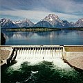 USBR Jackson Lake Dam 1.jpg 234 × 233; 68 KB
-
 USBR Jackson Lake Dam 2.jpg 232 × 234; 72 KB
-
 Sorber Run looking upstream in its upper reaches.JPG 2 056 × 3 088; 3,1 MB
-
 South Fork Owl Creek WY.jpg 3 264 × 2 448; 5,47 MB
-
 Spring Creek, joins Middle Chugwater Creek WY.jpg 2 912 × 3 240; 8,17 MB
-
 Ten sleep creek - panoramio.jpg 3 072 × 2 304; 2,25 MB
-
 Willet at Cokeville Meadows (14498729380).jpg 3 303 × 2 070; 2,53 MB
-
 Wind river in winter scenic.jpg 2 100 × 1 364; 147 KB
-

-
 Wpdms nasa topo clarks fork of the yellowstone river.jpg 300 × 250; 45 KB
-
 Wpdms nasa topo medicine bow river.jpg 300 × 250; 45 KB
-
 Wpdms nasa topo sweetwater river wyoming.jpg 300 × 250; 45 KB
-
 Wy fremont wind-river res.jpg 1 536 × 1 024; 409 KB
-
 Wyoming 01.tif 4 220 × 3 154; 38,08 MB
-
 Wyoming 03.tif 4 212 × 3 228; 38,9 MB
-
 Wyoming Sunset - Riverside (49949050458).jpg 1 768 × 1 080; 2,11 MB


.jpg)


.jpg)
.jpg)


_1_(42167674274).jpg)
_2_(41075800230).jpg)
_3_(41985561125).jpg)
_4_(42837751042).jpg)
_5_(28017139487).jpg)
_6_(29013882618).jpg)
_7_(42167820684).jpg)
_8_(42167844684).jpg)


_(24017298478).jpg)


.jpg)


.jpg)

_(14578447887).jpg)


.jpg)