Category:SVG locator maps of districts in Somaliland (location map scheme)
Jump to navigation
Jump to search

|
SVG maps in this category are part of a locator map series applying the (de) widespread location map scheme. Please see root category to browse for more. |
.svg)
.svg)
.svg)
.svg)
.svg)
.svg)
.svg)
Locator maps design recommendations ▼ | |
|---|---|
Principles
Design Guidelines are based on ▸location map design of the German map shop (in German). It's preferable to derive new locator maps from existing location maps. Please keep both size and ratio in this case. Thus the new locator maps may still be applied as location map (▸Guide). Marker color is supposed to be darkred. Waterbodies may be transparent, to show other objects better. Please be aware that this guide is only a recommendation. It’s not an inevitable law!
Highlight small areas
“Remote” areas and mini maps
Mini maps show where the depicted area actually is situated. Check out ▸Vorlage:Positionskarte+ (in German) and ▸Modèle:Carte en coin (in French) of how to insert a mini map in virtually every map.
Disputed areas
Greyed special objects
Backgrounds
|

-en.svg)

.svg)
.svg)
.svg)

_(US48).svg)
_(small_islands_magnified)_(-mini_map_-rivers).svg)
.svg)
_(extra_close)_(US48).svg)
.svg)
_(zoom).svg)

.svg)


_(UNMIK).svg)
.svg)
_(disputed_hatched).svg)
_(claimed_and_disputed_hatched).svg)
.svg)
.svg)
_(%2Ball_claims_hatched).svg)

.svg)
_(shade).svg)
_(shade)_(special_marker).svg)
_(-mini_map).svg)
_(-mini_map).svg)
_(-mini_map).svg)


.svg)

.svg)
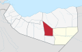
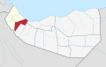
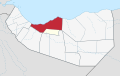
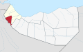
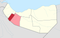
- SVG locator maps of the Districts of Somaliland.
Media in category "SVG locator maps of districts in Somaliland (location map scheme)"
The following 16 files are in this category, out of 16 total.
-
 Aynabo in Sool (Somaliland).svg 800 × 504; 69 KB
-
 Baki in Awdal (Somaliland).svg 800 × 504; 69 KB
-
 Berbera in Sahil (Somaliland).svg 800 × 504; 69 KB
-
 Borama in Awdal (Somaliland).svg 800 × 504; 69 KB
-
 Burao in Togdheer (Somaliland).svg 800 × 504; 69 KB
-
 Degmada Berbera.svg 800 × 504; 62 KB
-
 Degmada Gabiley.svg 800 × 504; 70 KB
-
 Degmada Hargeysa.svg 800 × 504; 70 KB
-
 Degmada Sheekh.svg 800 × 504; 62 KB
-
 El Afweyn in Sanaag (Somaliland).svg 800 × 504; 69 KB
-
 Gabiley in Marodijeh (Somaliland).svg 800 × 504; 69 KB
-
 Hargeisa in Marodijeh (Somaliland).svg 800 × 504; 69 KB
-
 Lughaya in Awdal (Somaliland).svg 800 × 504; 69 KB
-
 Odweyne in Togdheer (Somaliland).svg 800 × 504; 69 KB
-
 Sheikh in Sahil (Somaliland).svg 800 × 504; 69 KB
-
 Zeila in Awdal (Somaliland).svg 800 × 504; 69 KB
.svg)
.svg)
.svg)
.svg)
.svg)


.svg)
.svg)
.svg)
.svg)
.svg)
.svg)
.svg)