Category:SVG locator maps of regions of Senegal (orange location map scheme)
Jump to navigation
Jump to search

|
SVG maps in this category are part of a locator map series applying the (de) widespread location map scheme. Please see root category to browse for more. |
.svg)
.svg)
.svg)
.svg)
.svg)
.svg)
.svg)
Locator maps design recommendations ▼ | |
|---|---|
Principles
Design Guidelines are based on ▸location map design of the German map shop (in German). It's preferable to derive new locator maps from existing location maps. Please keep both size and ratio in this case. Thus the new locator maps may still be applied as location map (▸Guide). Marker color is supposed to be darkred. Waterbodies may be transparent, to show other objects better. Please be aware that this guide is only a recommendation. It’s not an inevitable law!
Highlight small areas
“Remote” areas and mini maps
Mini maps show where the depicted area actually is situated. Check out ▸Vorlage:Positionskarte+ (in German) and ▸Modèle:Carte en coin (in French) of how to insert a mini map in virtually every map.
Disputed areas
Greyed special objects
Backgrounds
|

-en.svg)

.svg)
.svg)
.svg)

_(US48).svg)
_(small_islands_magnified)_(-mini_map_-rivers).svg)
.svg)
_(extra_close)_(US48).svg)
.svg)
_(zoom).svg)

.svg)


_(UNMIK).svg)
.svg)
_(disputed_hatched).svg)
_(claimed_and_disputed_hatched).svg)
.svg)
.svg)
_(%2Ball_claims_hatched).svg)

.svg)
_(shade).svg)
_(shade)_(special_marker).svg)
_(-mini_map).svg)
_(-mini_map).svg)
_(-mini_map).svg)


.svg)

.svg)
Media in category "SVG locator maps of regions of Senegal (orange location map scheme)"
The following 14 files are in this category, out of 14 total.
-
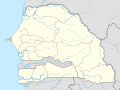 Senegal Dakar locator map.svg 1,266 × 954; 472 KB
-
 Senegal Diourbel locator map.svg 1,266 × 954; 475 KB
-
 Senegal Fatick locator map.svg 1,266 × 954; 487 KB
-
 Senegal Kaffrine locator map.svg 1,266 × 954; 474 KB
-
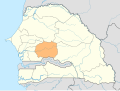
 Senegal Kaolack locator map.svg 1,266 × 954; 474 KB
-
 Senegal Kolda locator map.svg 1,266 × 954; 482 KB
-
 Senegal Kédougou locator map.svg 1,266 × 954; 486 KB
-
 Senegal Louga locator map.svg 1,266 × 954; 475 KB
-
 Senegal Matam locator map.svg 1,266 × 954; 478 KB
-
 Senegal Saint-Louis locator map.svg 1,266 × 954; 484 KB
-
 Senegal Sédhiou locator map.svg 1,266 × 954; 480 KB
-
 Senegal Tambacounda locator map.svg 1,266 × 954; 492 KB
-
 Senegal Thiès locator map.svg 1,266 × 954; 478 KB
-
 Senegal Ziguinchor locator map.svg 1,266 × 954; 482 KB


