Category:Schuylkill County, Pennsylvania
Saltar para a navegação
Saltar para a pesquisa
Counties of Pennsylvania : Adams · Allegheny · Armstrong · Beaver · Bedford · Berks · Blair · Bradford · Bucks · Butler · Cambria · Cameron · Carbon · Centre · Chester · Clarion · Clearfield · Clinton · Columbia · Crawford · Cumberland · Dauphin · Delaware · Elk · Erie · Fayette · Forest · Franklin · Fulton · Greene · Huntingdon · Indiana · Jefferson · Juniata · Lackawanna · Lancaster · Lawrence · Lebanon · Lehigh · Luzerne · Lycoming · McKean · Mercer · Mifflin · Monroe · Montgomery · Montour · Northampton · Northumberland · Perry · Philadelphia · Pike · Potter · Schuylkill · Snyder · Somerset · Sullivan · Susquehanna · Tioga · Union · Venango · Warren · Washington · Wayne · Westmoreland · Wyoming · York
county in Pennsylvania, United States .jpg)    | |||||
| Carregar ficheiro | |||||
| Instância de | |||||
|---|---|---|---|---|---|
| Nomeado em referência a | |||||
| Localização | Pensilvânia, EUA | ||||
| Capital | |||||
| Sede | |||||
| Data de criação ou fundação |
| ||||
| População |
| ||||
| Área |
| ||||
| sítio web oficial | |||||
 | |||||
Subcategorias
Esta categoria contém as seguintes 15 subcategorias (de um total de 15).
B
E
G
H
P
S
T
Multimédia na categoria "Schuylkill County, Pennsylvania"
Esta categoria contém os seguintes 84 ficheiros (de um total de 84).
-
 ABA Founders.jpg 800 × 640; 387 kB
-
-

-
 Buck Mountain (Pennsylvania).JPG 2 256 × 1 504; 1,14 MB
-
 Buck Mountain 2.JPG 2 256 × 1 504; 1,73 MB
-
 Buck Mountain from Buck Mountain Road.JPG 2 256 × 1 504; 2,64 MB
-
 Buck Mountain Road on Buck Mountain.JPG 2 256 × 1 504; 2,84 MB
-
 Bulletin - United States National Museum (1891) (20511517711).jpg 2 864 × 1 755; 963 kB
-
 Catawissa Creek from Foose Lane looking upstream 1.JPG 2 256 × 1 504; 3,09 MB
-
 Catawissa Creek from Foose Lane looking upstream 2.JPG 1 504 × 2 256; 3,05 MB
-
 Catawissa Creek in Zion Grove, Pennsylvania.JPG 3 264 × 2 448; 2,77 MB
-
 Catawissa Creek looking downstream from Foose Lane.JPG 1 504 × 2 256; 3,38 MB
-
 Catawissa Creek near Brandonville 1.JPG 2 256 × 1 504; 2,94 MB
-
 Catawissa Creek near Brandonville 2.JPG 2 256 × 1 454; 3,1 MB
-
 Catawissa Mountain from Buck Mountain Road 1.JPG 2 256 × 1 504; 1,87 MB
-
 Catawissa Mountain from Buck Mountain Road 2.JPG 2 256 × 1 504; 2,12 MB
-
 Catawissa Mountain from Buck Mountain Road 3.JPG 2 256 × 1 504; 2,28 MB
-
 Catawissa Mountain from Buck Mountain Road 4.JPG 2 256 × 1 504; 1,72 MB
-
 Collier 3408794865 9da12d1453 o.jpg 1 024 × 752; 93 kB
-
 Confluence of Stony Run with Little Catawissa Creek.JPG 2 256 × 1 504; 2,69 MB
-
 Crooked Run closeup.JPG 2 256 × 1 504; 2,98 MB
-
 Crooked Run.JPG 2 256 × 1 504; 3,16 MB
-
 Biographical and portrait cyclopedia of Schuylkill County Pennsylvania - comprising a historical sketch of the county (IA cu31924028854598).pdf 1 241 × 1 637, 890 páginas; 30,11 MB
-
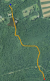 Davis Run satellite map.PNG 291 × 474; 304 kB
-
 Eastbrookside.jpg 672 × 424; 44 kB
-
 Entrance to the Eagle Rock Resort.JPG 2 256 × 1 504; 2,01 MB
-
 Far shot of mountain with wind turbines as seen from Buck Mountain Road.JPG 2 256 × 1 504; 2,01 MB
-
 Flickr - Nicholas T - Dimmed.jpg 2 816 × 2 112; 2,65 MB
-
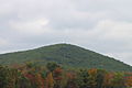
 Green Mountain (Pennsylvania).JPG 2 256 × 1 504; 1,75 MB
-
 Books from the Library of Congress (IA historyofnortham00rupp).pdf 639 × 1 083, 600 páginas; 28,01 MB
-
 On the Fossil Foot-Marks in the Red Sandstones of Pottsville, Schuylkill County, Penna (IA jstor-1005281).pdf 1 150 × 1 550, 15 páginas; 1,69 MB
-
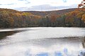
 Lake Wynonah Sunset August 23 2021.jpg 4 030 × 2 267; 2,39 MB
-
 Lettre de baptême américaine-1820.jpg 2 248 × 1 324; 1,29 MB
-
 Little Catawissa Creek from the Schuylkill County Bridge No. 95.JPG 2 256 × 1 504; 3,06 MB
-
 Little Catawissa Creek looking downstream.JPG 2 256 × 1 504; 2,08 MB
-
 Little Catawissa Creek looking upstream.JPG 2 256 × 1 504; 2,39 MB
-
 Little Mahanoy Creek satellite map.PNG 754 × 294; 500 kB
-
 Little Sugarloaf Mountain.JPG 2 256 × 1 504; 1,69 MB
-
 Lower Little Swatara Creek satellite map.PNG 982 × 198; 419 kB
-
 Map of Pennsylvania highlighting Schuylkill County.svg 1 980 × 1 138; 96 kB
-
 Messers Run satellite map.PNG 927 × 314; 589 kB
-
 Middle Taylor Township, PA, USA - panoramio (1).jpg 5 184 × 3 456; 9,93 MB
-
 Mountain with wind turbines as seen from Buck Mountain Road.JPG 2 256 × 1 504; 1,64 MB
-
 Mountains of southern Columbia and northern Schuylkill Counties, Pennsylvania.JPG 2 256 × 1 504; 1,39 MB
-
 Negro Hollow satellite map.PNG 287 × 521; 312 kB
-

-

-
-
-
 Pond on Stony Run 1.JPG 2 256 × 1 504; 2,38 MB
-
 Pond on Stony Run 2.JPG 2 256 × 1 504; 1,68 MB
-
 Pond on Stony Run 3.JPG 2 256 × 1 504; 1,67 MB
-
-
 Pumping Station Dam.JPG 2 256 × 1 504; 2,98 MB
-
 Pumping Station Reservoir 1.JPG 2 256 × 1 504; 2,18 MB
-
 Pumping Station Reservoir 2.JPG 2 256 × 1 504; 2,49 MB
-
 Pumping Station Reservoir 3.JPG 2 256 × 1 504; 2,14 MB
-
 Raccoon Creek looking downstream.JPG 1 504 × 2 256; 3,83 MB
-
 Raccoon Creek looking upstream.JPG 2 256 × 1 504; 3,4 MB
-
 Rattling Run looking upstream 2.JPG 2 256 × 1 504; 3,33 MB
-
 Road sign in Zions Grove, Pennsylvania.JPG 3 264 × 2 448; 2,75 MB
-
 Schuylkill Navigation Company 1870.jpg 8 291 × 5 336; 5,19 MB
-
 Seal of Schuylkill County, PA.png 876 × 876; 671 kB
-
 Seal of Schuylkill County, Pennsylvania.png 410 × 410; 242 kB
-
 Sharp Mountain NE peaks, USGS Mahanoy Pennsylvania Quadrant SE=maha92se.jpg 1 262 × 782; 261 kB
-
 Stony Run looking downstream.JPG 2 256 × 1 504; 2,39 MB
-
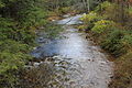
 Stony Run.JPG 2 256 × 1 504; 2,75 MB
-
 Tomhicken Creek from State Route 1005 (1).JPG 1 504 × 2 256; 2,34 MB
-
 Tuscarora, PA - Schuylkill County.jpg 1 090 × 634; 253 kB
-
 USA Schuylkill County, Pennsylvania age pyramid.svg 520 × 600; 7 kB
-
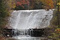
 Waterfall at Sweet Arrow Lake, Pine Grove, PA.jpg 3 940 × 2 628; 3,28 MB
-
 Wind turbine from Brandonville, Pennsylvania.JPG 2 256 × 1 504; 925 kB
-
 Wind turbines from Brandonville, Pennsylvania.JPG 2 256 × 1 504; 1,64 MB
-
 Wind turbines from the Pumping Station Reservoir 1.JPG 2 256 × 1 504; 1,68 MB
-
 Wind turbines from the Pumping Station Reservoir 2.JPG 2 256 × 1 504; 1,56 MB
-
 Wind turbines in Schuylkill County, Pennsylvania 1.JPG 2 256 × 1 504; 922 kB
-
 Wind turbines in Schuylkill County, Pennsylvania 2.JPG 2 256 × 1 504; 943 kB
-
 Wind turbines in Schuylkill County, Pennsylvania 3.JPG 2 256 × 1 504; 1,16 MB
-
 Wind turbines in Schuylkill County, Pennsylvania 4.JPG 2 256 × 1 504; 1,17 MB
-
 Wind turbines in Schuylkill County, Pennsylvania 5.JPG 2 256 × 1 504; 1,44 MB
-
-
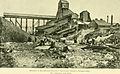
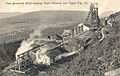
 Mahanoy Colliery, by Allen, A. M. (Amos M.), 1823-1907.jpg 760 × 386; 47 kB
-
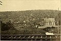
 Mine Hill Gap, from Robert N. Dennis collection of stereoscopic views.png 2 737 × 1 411; 5,24 MB
-
 Quakake (railroad) station, by Woodward, C. W. (Charles Warren).jpg 760 × 400; 50 kB

_(14568706890).jpg)
.JPG)


_(20511517711).jpg)


.JPG)


.jpg)


.jpg)


.JPG)


,_by_Woodward,_C._W._(Charles_Warren).jpg)
,_1823-1907.jpg)

_station,_by_Woodward,_C._W._(Charles_Warren).jpg)