Category:Street maps of Paris 14e arrondissement
Jump to navigation
Jump to search
|
Paris 1 • 2 • 3 • 4 • 5 • 6 • 7 • 8 • 9 • 10 • 11 • 12 • 13 • 14 • 15 • 16 • 17 • 18 • 19 • 20 |
| NO WIKIDATA ID FOUND! Search for Street maps of Paris 14e arrondissement on Wikidata | |
| Upload media |
Subcategories
This category has only the following subcategory.
Media in category "Street maps of Paris 14e arrondissement"
The following 8 files are in this category, out of 8 total.
-

-
 Paris 14e arrondissement - Eugène Andriveau-Goujon.jpg 5,304 × 4,014; 7.09 MB
-
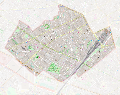
 Paris 14th arrondissement map with listings 2.png 3,460 × 3,008; 1.39 MB
-
 Paris 14th arrondissement map with listings.png 3,460 × 3,008; 980 KB
-
 Paris-atlas by Fernand Bournon - 34. 14e arrondissement - David Rumsey.jpg 4,695 × 5,999; 25.46 MB
-
 Paris.carte d'arrondissement.A14.jpg 1,322 × 1,067; 529 KB
-

-
 Vaugirard limites communales.svg 2,282 × 1,802; 27.09 MB


