Category:Street maps of Paris 7e arrondissement
Jump to navigation
Jump to search
|
Paris 1 • 2 • 3 • 4 • 5 • 6 • 7 • 8 • 9 • 10 • 11 • 12 • 13 • 14 • 15 • 16 • 17 • 18 • 19 • 20 |
| NO WIKIDATA ID FOUND! Search for Street maps of Paris 7e arrondissement on Wikidata | |
| Upload media |
Subcategories
This category has the following 2 subcategories, out of 2 total.
M
Media in category "Street maps of Paris 7e arrondissement"
The following 14 files are in this category, out of 14 total.
-
 Pariskarta från 1763 - Skoklosters slott - 86268.tif 5,893 × 3,906; 65.88 MB
-
 Fg St Germain 1790.JPG 4,744 × 4,066; 3.6 MB
-
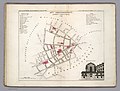
 Paris 7e arrondissement - Eugène Andriveau-Goujon.jpg 5,118 × 3,810; 6.02 MB
-
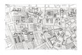
 Paris.carte d'arrondissement.A06.jpg 1,309 × 1,082; 535 KB
-
 Paris-atlas by Fernand Bournon - 20. 7e arrondissement - David Rumsey 2.jpg 5,898 × 4,501; 24.57 MB
-
 Paris-atlas by Fernand Bournon - 20. 7e arrondissement - David Rumsey.jpg 4,501 × 5,898; 23.99 MB
-
-

-
-

-

-
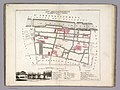
 Plan de l'exposition universelle de 1900.jpg 3,104 × 2,329; 12.64 MB
-
 Plan de l'Hôtel de Nesle de l'Abbaye de Saint-Germain des Prés.jpg 3,516 × 2,607; 6.09 MB
-


