Category:Taranaki Region
Zur Navigation springen
Zur Suche springen
Regions of New Zealand: Auckland · Bay of Plenty · Canterbury · Gisborne · Hawke's Bay · Manawatu-Whanganui · Marlborough · Nelson · Otago · Northland · Southland · Taranaki · Tasman · Waikato · Wellington · West Coast
Outlying islands, territories and dependencies: Antipodes Islands · Auckland Islands · Bounty Islands · Chatham Islands · Kermadec Islands · Snares Islands · Three Kings Islands · Tokelau – Territory with specific status: Ross Dependency
Associated countries: Cook Islands · Niue
Outlying islands, territories and dependencies: Antipodes Islands · Auckland Islands · Bounty Islands · Chatham Islands · Kermadec Islands · Snares Islands · Three Kings Islands · Tokelau – Territory with specific status: Ross Dependency
Associated countries: Cook Islands · Niue
Verwaltungsregion auf der Nordinsel von Neuseeland  Mount Taranaki eller Mount Egmont  | |||||
| Medium hochladen | |||||
| Ist ein(e) | |||||
|---|---|---|---|---|---|
| Ort | Neuseeland | ||||
| Hauptstadt | |||||
| Einwohnerzahl |
| ||||
| Fläche |
| ||||
| Verschieden von | |||||
| offizielle Website | |||||
 | |||||
Unterkategorien
Es werden 27 von insgesamt 27 Unterkategorien in dieser Kategorie angezeigt:
In Klammern die Anzahl der enthaltenen Kategorien (K), Seiten (S), Dateien (D)
- Streets in Taranaki (7 D)
!
*
B
C
D
E
G
H
M
- Mount Pouakai (1 D)
N
- William Henry Norman (1 D)
P
- Postcards of Taranaki Region (3 D)
- Pukearuhe White Cliffs (27 D)
R
- Taranaki rugby league team (6 D)
S
U
Medien in der Kategorie „Taranaki Region“
Folgende 118 Dateien sind in dieser Kategorie, von 118 insgesamt.
-
 NZ-Taranaki plain map.png 378 × 423; 10 KB
-
 A Taranaki farm, New Zealand, 1968 - Flickr - PhillipC.jpg 2.231 × 1.384; 2,45 MB
-
 A Taranaki intersection, 5 Feb. 2011 - Flickr - PhillipC.jpg 3.805 × 2.362; 1,97 MB
-
 Aerial view of New Plymouth Airport, Taranaki. (40124783124).jpg 900 × 681; 157 KB
-
 Battlefield of katikara 1863.jpg 694 × 568; 85 KB
-
 Bertrand road suspension bridge.jpg 1.200 × 938; 1,47 MB
-
 British positions in Huirangi (1861) (27888136846).jpg 3.651 × 2.320; 2,99 MB
-
 Brooklands Park, New Plymouth, Taranaki, New Zealand, 1968 - Flickr - PhillipC.jpg 1.800 × 1.200; 836 KB
-
 Cardiff Hall in Cardiff, New Zealand.jpg 2.048 × 1.536; 580 KB
-
 Cardiff School Inspector's Report - Taranaki, New Zealand (12226571826).jpg 4.466 × 3.769; 9,34 MB
-
 Cardiff, New Zealand, looking north.jpg 2.048 × 1.294; 810 KB
-
 Cardiff, New Zealand, looking south.jpg 2.048 × 1.536; 682 KB
-
 Chest Tattoo (53144296).jpeg 720 × 1.080; 105 KB
-
 Church near New Plymouth.jpg 3.072 × 2.048; 2,1 MB
-
 Circus approximans harassed.jpg 900 × 900; 596 KB
-
 Cyclone Bola (1988) - New Plymouth (32352014634).jpg 1.676 × 1.108; 168 KB
-
 Cyclone Bola (1988) Devon Street West (33039989102).jpg 1.676 × 1.108; 245 KB
-
 Cyclone Bola (1988) New Plymouth (32381529483).jpg 1.676 × 1.108; 317 KB
-
 Cyclone Bola (1988) New Plymouth (33039989852).jpg 1.676 × 1.108; 239 KB
-
 Cyclone Bola (1988) New Plymouth (33068991341).jpg 1.690 × 1.113; 1,59 MB
-
 Cyclone Bola (1988) New Plymouth (33154985596).jpg 1.676 × 1.108; 198 KB
-
 Cyclone Bola (1988) Taranaki (32381525693).jpg 1.676 × 1.108; 301 KB
-
 Cyclone Bola (1988) Taranaki (32381527273).jpg 1.676 × 1.108; 269 KB
-
 Cyclone Bola (1988) Taranaki (33068990211).jpg 1.676 × 1.108; 270 KB
-
 Cyclone Bola, 1988 - New Plymouth, New Zealand.jpg 1.676 × 1.108; 266 KB
-
 Disphyma australe kz4.jpg 4.608 × 3.072; 7,37 MB
-
 Disphyma australe kz5.jpg 3.794 × 2.529; 4,17 MB
-
 Disphyma australe kz6.jpg 4.608 × 3.072; 7,53 MB
-
 Disphyma australe kz8.jpg 4.380 × 2.920; 4,41 MB
-
 Douglas, Taranaki (NZ) 01.jpg 2.301 × 1.122; 197 KB
-
 East Road Garage (137310547).jpeg 2.048 × 1.152; 776 KB
-
 Emerald Hours in New Zealand (1906) · Lowth · 009.jpg 1.540 × 2.117; 487 KB
-
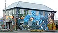
 Even in the quietest places, art springs forth - panoramio.jpg 1.880 × 2.816; 3,37 MB
-
 Farmland near Pukearuhe towards cliffs.jpg 1.024 × 768; 312 KB
-
 FMIB 34980 Catch of Trout, Taranaki District.jpeg 789 × 569; 152 KB
-
 Forgotten World Highway Building.jpg 1.664 × 2.496; 2,71 MB
-
 Forgotten World Highway Landscape.jpg 2.496 × 1.664; 1,8 MB
-
-
 Glistening black sand beach at White Cliffs.jpg 1.024 × 768; 321 KB
-

-

-
 The history of Taranaki, a standard work on the history of the province (IA historyoftaranak00welliala).pdf 797 × 1.300, 330 Seiten; 18,15 MB
-
 Ian Middleton.jpg 1.016 × 1.454; 285 KB
-
 In need of some TLC - panoramio (1).jpg 2.816 × 1.880; 3,25 MB
-
 In The Window (137323729).jpeg 2.048 × 1.360; 879 KB
-
 Inside rock arches at White Cliffs.jpg 1.024 × 768; 309 KB
-
 Kapuni Natural Gas. Production Plant, Taranaki (41487974881).jpg 900 × 693; 164 KB
-
 Kohuratahi Ladies Hockey Team 1935 named New Zealand.jpg 3.000 × 2.250; 1,5 MB
-
 Kohuratahi New Zealand territorials WW1 era.jpg 4.915 × 2.898; 10,54 MB
-
 Lahars at Mt Taranaki New Zealand.jpg 2.048 × 1.375; 1,14 MB
-
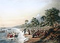
 Landscape with settlers (Te Papa, 1999-0003-1).jpg 4.869 × 3.570; 22,41 MB
-
 Leg Tattoo (53143690).jpeg 720 × 1.080; 142 KB
-
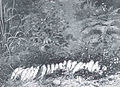
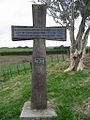 Mahoetahi cross.jpg 768 × 1.024; 358 KB
-
 Mahoetahi.jpg 1.024 × 768; 302 KB
-
 Mangatoki Church.jpg 4.220 × 2.813; 1,41 MB
-
 Mangonui Gorge, Taranaki, New Zealand, 1968 - Flickr - PhillipC.jpg 1.200 × 1.800; 515 KB
-
 Map and Cross Section of Taranaki Basin.jpg 500 × 791; 44 KB
-
 Mataitawa stockade and barracks north taranaki.jpg 1.017 × 863; 270 KB
-
 Men carrying cans labelled Hawera trout hatchery, (192-?) (4704317338).jpg 5.109 × 3.770; 5,56 MB
-
 Methanex - Methanol Plant.jpg 5.184 × 2.592; 12,2 MB
-

-
 Mount Taranaki aerial view fog.jpg 2.592 × 3.872; 5,03 MB
-
 Mt Damper Falls.jpg 2.844 × 4.282; 2,38 MB
-
 Mt. Damper Falls (New Zealand).jpg 576 × 768; 605 KB
-
 Mt. Taranaki - panoramio.jpg 2.884 × 1.872; 2,77 MB
-
 Murray and Janet Herbert, Tangarakau, Taranaki, 1968 - Flickr - PhillipC.jpg 897 × 1.496; 449 KB
-
 Mustering at Tangarakau, Taranaki, 1968 - Flickr - PhillipC.jpg 1.598 × 998; 1,1 MB
-
 Near Eltham - Taranaki.jpg 2.846 × 2.017; 4,89 MB
-
 New Plymouth - Coastal Walkway - panoramio.jpg 4.320 × 2.432; 7,5 MB
-

-
 Nikau palms near Waipingau Stream.jpg 1.024 × 768; 342 KB
-
 Oakura - panoramio.jpg 1.024 × 768; 365 KB
-
 Okau Road tunnel.jpg 4.282 × 2.844; 4,3 MB
-
 Otapawa pa, south taranaki.jpg 1.292 × 1.280; 196 KB
-
 Pan of the King Contry from the Toko Saddle - panoramio.jpg 19.887 × 1.605; 5,32 MB
-
 Parihaka-1.jpg 450 × 300; 62 KB
-
 Paritutu Beach.jpg 1.080 × 823; 113 KB
-
 Pauline, Taranaki, 1968 - Flickr - PhillipC.jpg 2.138 × 1.270; 2,47 MB
-
 Plain from the eastern side of Mount Taranaki.jpg 3.752 × 2.252; 6,52 MB
-
 Plymouthrdomata.JPG 10.800 × 2.388; 4,82 MB
-
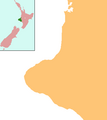
 Position of Taranaki.png 405 × 590; 7 KB
-
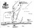
 Public Works map showing the railways North Island of New Zealand 1901.jpg 1.308 × 1.063; 396 KB
-
 Roads in the Tranaki District. ATLIB 292354.png 5.425 × 6.909; 26,73 MB
-
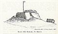 Sentry hill redoubt te morere.jpg 1.287 × 759; 188 KB
-
 Sketch of Sentry Hill Redoubt, S.P. Smith, June 1865 (17841115401).jpg 2.806 × 1.000; 207 KB
-
 Southern North Island, New Zealand (ISS-44).jpg 4.928 × 3.280; 2,29 MB
-
 Stream at Pukearuhe.jpg 1.024 × 768; 325 KB
-
 Surf Lodge 45.JPG 800 × 451; 210 KB
-
 Tangahoe River bridge.jpg 1.000 × 622; 234 KB
-
 Tangahoe River estuary.jpg 664 × 476; 121 KB
-
 Tangahoe Valley Road tunnel, Taranaki, New Zealand.jpg 3.825 × 2.384; 4,1 MB
-
 Tangarakau Gorge, Taranaki, New Zealand, 1969 - Flickr - PhillipC.jpg 1.200 × 1.800; 573 KB
-
 Taranaki coast near Patea - Flickr - PhillipC.jpg 1.652 × 1.116; 2,65 MB
-
 Taranaki hills.jpg 2.832 × 2.128; 1,92 MB
-
 Taranaki mobile home.jpg 4.795 × 2.697; 4,53 MB
-
 Taranaki sunset 27 April 2005 - Flickr - PhillipC.jpg 2.592 × 1.944; 2,79 MB
-
 Taranaki within North Island 2023.png 784 × 918; 101 KB
-
 Taranaki, New Zealand (October 1851, VIII, p.108).jpg 1.550 × 1.105; 796 KB
-
 Taranaki, New Zealand (Unsplash).jpg 5.312 × 2.988; 14,87 MB
-
 TaranakiRegionPopulationDensity.png 665 × 792; 66 KB
-
 TaranakiWater BlackDisc2014.svg 1.052 × 744; 56 KB
-
 TaranakiWater Ecoli2014.svg 1.052 × 744; 31 KB
-
 TaranakiWater Nitrogen2014.svg 1.052 × 744; 33 KB
-
 TaranakiWater Phosphorus2014.svg 1.052 × 744; 19 KB
-
 Tarryn in the forest near Mount Taranaki (7087594443).jpg 1.728 × 2.592; 912 KB
-
 Tasman Sea (248769507).jpeg 1.536 × 2.048; 1,17 MB
-
 Te weraroa pa waitotara.jpg 2.134 × 1.210; 475 KB
-
 The Crafty Fox - panoramio.jpg 1.024 × 768; 388 KB
-
 The manutahi redoubt, south taranaki.jpg 1.222 × 1.061; 206 KB
-
 The Tarankaki question.pdf 1.500 × 2.418, 16 Seiten; 22 MB
-
 The weraroa pa waitotara.jpg 2.116 × 1.144; 200 KB
-
 Toko Saddle - panoramio.jpg 2.816 × 1.880; 3,59 MB
-
 Toko, New Zealand.jpg 3.014 × 2.009; 3,53 MB
-
 Tree ferns and Nikau palms near Waipingau Stream.jpg 1.024 × 768; 342 KB
-
 Waitotara, Taranaki (Pā from the NZ Wars) (17100099537).jpg 900 × 685; 162 KB
-
 Waitotara, Taranaki (redoubt from the NZ Wars) (16685005984).jpg 900 × 695; 158 KB
-

-
 Whenuakura Marae, Taranaki, New Zealand.jpg 2.800 × 2.138; 5,65 MB


.jpg)


_(27888136846).jpg)


.jpg)


.jpeg)


_-_New_Plymouth_(32352014634).jpg)
_Devon_Street_West_(33039989102).jpg)
_New_Plymouth_(32381529483).jpg)
_New_Plymouth_(33039989852).jpg)
_New_Plymouth_(33068991341).jpg)
_New_Plymouth_(33154985596).jpg)
_Taranaki_(32381525693).jpg)
_Taranaki_(32381527273).jpg)
_Taranaki_(33068990211).jpg)


_01.jpg)
.jpeg)
_%C2%B7_Lowth_%C2%B7_009.jpg)


_(14779766814).jpg)
_(14779776404).jpg)

.jpg)
.jpeg)

.jpg)


.jpg)
.jpeg)


_(4704317338).jpg)

_artist_and_Thomas_Allom_(1804-1872)_lithographer.jpg)


.jpg)


.jpg)


.jpg)


.jpg)
.jpg)


.jpg)
.jpeg)


_(17100099537).jpg)
_(16685005984).jpg)


.jpg)