Category:Wayanad district
Jump to navigation
Jump to search

English: Wayanad district (Malayalam: വയനാട്, Vayanāṭ), in the north-east of Kerala, India, was formed on November 1, 1980, as the 12th district by carving out areas from Kozhikode and Kannur districts, comprising the taluks Mananthavady, Sultan Bathery and Vythiri. Kalpetta is the district headquarters as well as the only municipal town in the district. The region was known as Mayakshetra (Maya's land) in the earliest records. The town of Wayanad was known as Bayalnad before the 12th-century throughout the eras of Kadambas, Hoysalas, Gangas and Wodeyars. This region was home to ancient Jain and Hindu communities. With the conquest of Hyder Ali and Tipu Sultan, Wayanad became a garrison and several temples were emptied out to store ammunition and weapons. After the British colonial rule extended to what is now Wayanad district, one town was renamed Sultan Bathery.
Wayanad Wildlife Sanctuary is an animal sanctuary in Wayanad. The sanctuary is part of the Nilgiri Biosphere Reserve. The Western Ghats, Nilgiri Sub-Cluster (6,000+ km²), including all of the sanctuary, is under consideration by the UNESCO World Heritage Committee for selection as a World Heritage Site.
district of Kerala, India  На дороге к Ваянаду  | |||||
| Upload media | |||||
| Pronunciation audio | |||||
|---|---|---|---|---|---|
| Instance of | |||||
| Location | Kerala, India | ||||
| Capital | |||||
| Inception |
| ||||
| Population |
| ||||
| Area |
| ||||
| Elevation above sea level |
| ||||
| Different from | |||||
| official website | |||||
 | |||||
Subcategories
This category has the following 9 subcategories, out of 9 total.
Pages in category "Wayanad district"
This category contains only the following page.
Media in category "Wayanad district"
The following 48 files are in this category, out of 48 total.
-
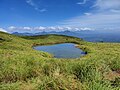 Chembra Peak Heart Lake.jpg 4,000 × 3,000; 4.44 MB
-
 Gardencity.jpg 1,080 × 1,072; 99 KB
-
 Ickara Plant Nursery 3.jpg 4,624 × 3,472; 8.4 MB
-
 Ickara Plant Nursery.jpg 4,624 × 3,472; 10.16 MB
-
 Kanthanpara Waterfalls, Wayanad.jpg 4,000 × 3,000; 5.12 MB
-
 Kunkichira museum wayanadu 02.jpg 5,184 × 3,888; 7.54 MB
-
 Kunkichira museum wayanadu 03.jpg 5,184 × 3,888; 6.3 MB
-
 Kunkichira museum wayanadu 04.jpg 5,184 × 3,888; 8.53 MB
-
 Kunkichira museum wayanadu 05.jpg 5,184 × 3,888; 8.32 MB
-
 Kunkichira museum wayanadu 06.jpg 5,184 × 3,888; 9.32 MB
-
 Kunkichira museum wayanadu 07.jpg 5,184 × 3,888; 8.38 MB
-
 Kunkichira museum wayanadu 08.jpg 5,184 × 3,888; 9.23 MB
-
 Kunkichira museum wayanadu 09.jpg 5,184 × 3,888; 8.76 MB
-
 Kunkichira museum wayanadu 10.jpg 5,184 × 3,888; 8.37 MB
-
 Kunkichira museum wayanadu 11.jpg 5,184 × 3,888; 7.86 MB
-
 Kunkichira museum wayanadu 12.jpg 5,184 × 3,888; 8.77 MB
-
 Kunkichira museum wayanadu 13.jpg 5,184 × 3,888; 8.1 MB
-
 Kunkichira museum wayanadu 14.jpg 5,184 × 3,888; 7.92 MB
-
 Kunkichira museum wayanadu 15.jpg 5,184 × 3,888; 8.27 MB
-
 Kunkichira museum wayanadu 16.jpg 5,184 × 3,888; 8.34 MB
-
 Kunkichira museum wayanadu 17.jpg 5,184 × 3,888; 8.31 MB
-
 Kunkichira museum wayanadu 18.jpg 5,184 × 3,888; 9.25 MB
-
 Kunkichira museum wayanadu 19.jpg 5,184 × 3,888; 9.21 MB
-
 Kunkichira museum wayanadu 20.jpg 5,184 × 3,888; 8.89 MB
-
 Kunkichira museum wayanadu 21.jpg 5,184 × 3,888; 8.93 MB
-
 Kunkichira museum wayanadu 22.jpg 5,184 × 3,888; 8.45 MB
-
 Kunkichira museum wayanadu 23.jpg 5,184 × 3,888; 8.89 MB
-
 Kunkichira museum wayanadu 24.jpg 3,888 × 5,184; 8.57 MB
-
 Kunkichira museum wayanadu 25.jpg 5,184 × 3,888; 8.27 MB
-
 Kunkichira museum wayanadu 26.jpg 5,184 × 3,888; 8.4 MB
-
 Kunkichira museum wayanadu 27.jpg 5,184 × 3,888; 8.42 MB
-
 Kunkichira museum wayanadu 28.jpg 5,184 × 3,888; 8.6 MB
-
 Kunkichira museum wayanadu 29.jpg 5,184 × 3,888; 8.79 MB
-
 Kunkichira museum wayanadu 30.jpg 5,184 × 3,888; 8.87 MB
-
 Kunkichira museum wayanadu 31.jpg 5,184 × 3,888; 8.15 MB
-
 Kunkichira museum wayanadu 32.jpg 5,184 × 3,888; 8.38 MB
-
 Kunkichira museum wayanadu 33.jpg 5,184 × 3,888; 8.36 MB
-
 Kunkichira museum wayanadu 34.jpg 5,184 × 3,888; 8.1 MB
-
 Kunkichira museum wayanadu 35.jpg 5,184 × 3,888; 7.51 MB
-
 Kunkichira museum wayanadu 36.jpg 5,184 × 3,888; 8.26 MB
-
 Kunkichira museum wayanadu 37.jpg 5,184 × 3,888; 7.56 MB
-
 Kunkichira museum wayanadu 38.jpg 5,184 × 3,888; 7.71 MB
-
 Kunkichira museum wayanadu 39.jpg 5,184 × 3,888; 9.23 MB
-
 Nightsky, Wayanad 2.jpg 4,000 × 3,000; 5.94 MB
-
 Nightsky, Wayanad 4.jpg 3,000 × 4,000; 5.26 MB
-
 Nightsky, Wayanad.jpg 4,000 × 3,000; 5.07 MB
-
 Rice field in wayanad,kerala,India.jpg 1,280 × 960; 281 KB
-
 Valliyoorkavuulthsavam.!.jpg 4,080 × 1,840; 2.03 MB


