File:1882 Andriveau-Goujon Pocket Map of Paris, France - Geographicus - Paris-andriveau-1882.jpg
Jump to navigation
Jump to search

Size of this preview: 787 × 599 pixels. Other resolutions: 315 × 240 pixels | 630 × 480 pixels | 1,008 × 768 pixels | 1,280 × 975 pixels | 2,560 × 1,950 pixels | 6,000 × 4,570 pixels.
Original file (6,000 × 4,570 pixels, file size: 10.58 MB, MIME type: image/jpeg)
Captions
Captions
Add a one-line explanation of what this file represents
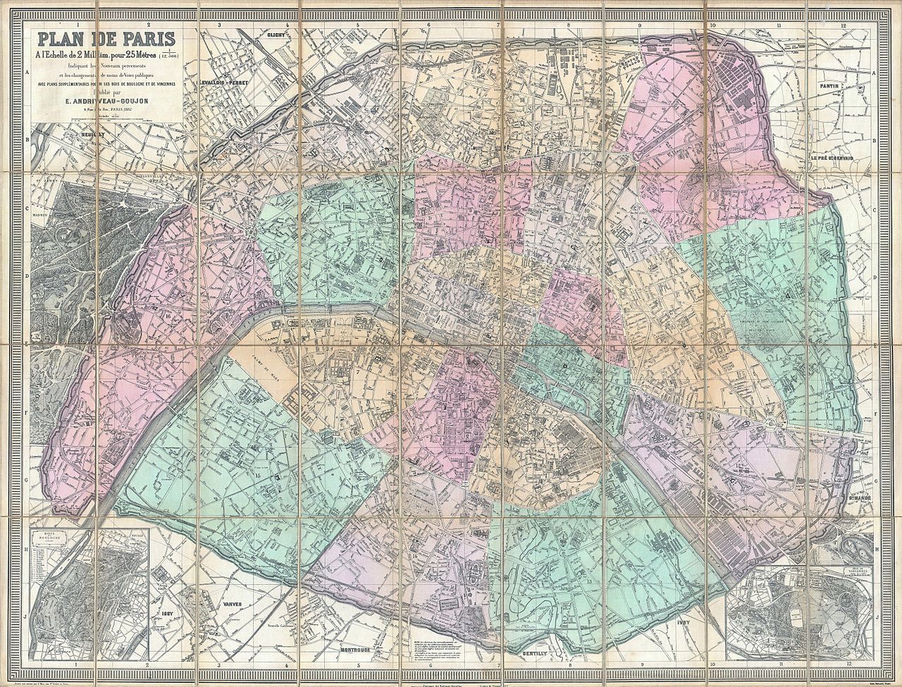
| Eugène Andriveau-Goujon: Plan de Paris a l'Echelle de 2 Millim, pour 25 Metres, Indiquant les Nouveaux percements et les changements de noms de Voies publiques avec plans supplementaires pour Les Bois de Boulogne et de Vincennes.
( |
||||||||||||||
|---|---|---|---|---|---|---|---|---|---|---|---|---|---|---|
| Artist |
|
|||||||||||||
| Title |
Plan de Paris a l'Echelle de 2 Millim, pour 25 Metres, Indiquant les Nouveaux percements et les changements de noms de Voies publiques avec plans supplementaires pour Les Bois de Boulogne et de Vincennes. |
|||||||||||||
| Description |
English: A stunningly executed 1882 large format folding pocket map of Paris, France by E. Andriveau-Goujon. Focuses on the old walled center of Paris from Neuilly in the northwest to Pantin in the northeast, Issy in the southwest, and Ivry in the southeast. Inset maps detail the gardens of Bois de Boulogne and Bois de Vincennes. Offers extraordinary detail of the city on a scale of 1:12,500. Details individual buildings, streets, monuments, gardens and palaces. Shows exceptionally remarkable attention to detail in the public gardens where subtle expressions of landscape design are apparent. Predates the Eiffel tower. Color coded by arrondissement. Engraved by P. Mea of 70 Rue St. Victor, Paris for E. Andriveau-Goujon of 4 Rue du Bac, Paris, 1882. |
|||||||||||||
| Date | 1882 (dated) | |||||||||||||
| Dimensions | height: 32.2 in (81.9 cm); width: 42 in (106.6 cm) | |||||||||||||
| Accession number |
Geographicus link: Paris-andriveau-1882 |
|||||||||||||
| Source/Photographer |
|
|||||||||||||
| Permission (Reusing this file) |
|
|||||||||||||
derivative works[edit]
Derivative works of this file: 1882 Andriveau-Goujon Pocket Map of Paris, France - Geographicus - Paris-andriveau-1882 - Père-Lachaise.jpg
File history
Click on a date/time to view the file as it appeared at that time.
| Date/Time | Thumbnail | Dimensions | User | Comment | |
|---|---|---|---|---|---|
| current | 09:29, 19 March 2011 | | 6,000 × 4,570 (10.58 MB) | BotMultichill (talk | contribs) | {{subst:User:Multichill/Geographicus |link=http://www.geographicus.com/P/AntiqueMap/Paris-andriveau-1882 |product_name=1882 Andriveau-Goujon Pocket Map of Paris, France |map_title=Plan de Paris a l'Echelle de 2 Millim, pour 25 Metres, Indiquant les Nouvea |
You cannot overwrite this file.
File usage on Commons
The following 3 pages use this file:
File usage on other wikis
The following other wikis use this file:
- Usage on fr.wikipedia.org
- Usage on la.wikipedia.org