File:1943 Japanese World War II Aviation Map of Taiwan or Formosa - Geographicus - Taiwan-japan-1943.jpg

Original file (6,000 × 5,469 pixels, file size: 6.61 MB, MIME type: image/jpeg)
Captions
Captions
| Taiwan | |||||
|---|---|---|---|---|---|
| Artist | |||||
| Title |
Taiwan |
||||
| Description |
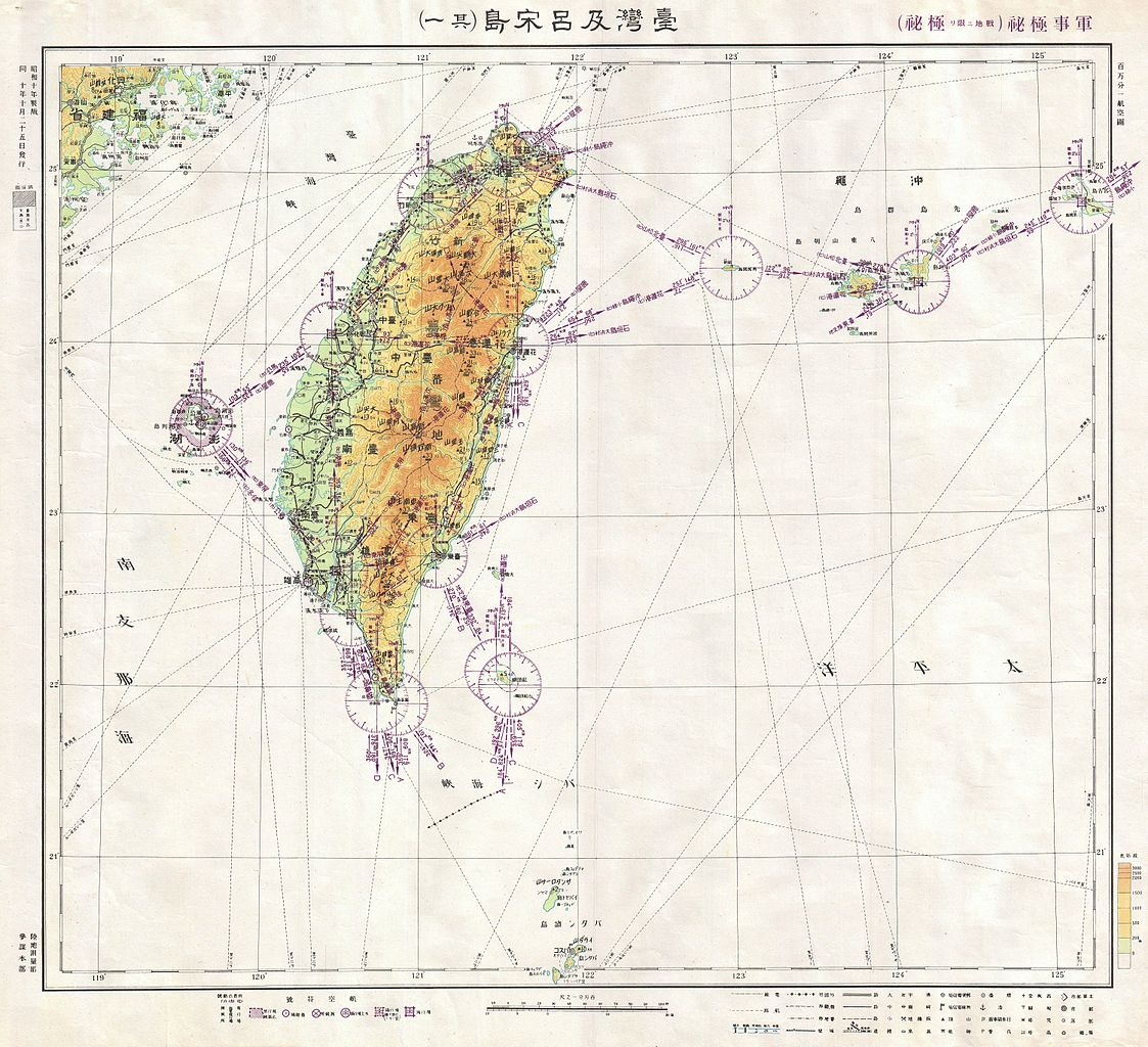
English: This is a rare World War II era Japanese Aviation map of the island of Formosa or Taiwan. Features the island with superb detail, especially with regard to navigational instructions and topography. Include the nearest Chinese coast as well as nearby islands. All text is in Japanese. This map comes from a collection of material sized by the U. S. Military during World War II. They were sent to the office of General MacArthur in Manila. The owner of this chart headed a unit of Volunteer NISEI translator recruited to translate and de-code documents seized on the Pacific Front. |
||||
| Date | 1942 (dated) | ||||
| Dimensions | height: 27 in (68.5 cm); width: 29 in (73.6 cm) | ||||
| Accession number |
Geographicus link: Taiwan-japan-1943 |
||||
| Source/Photographer |
Independent Issue.
|
||||
| Permission (Reusing this file) |
|
||||

File history
Click on a date/time to view the file as it appeared at that time.
| Date/Time | Thumbnail | Dimensions | User | Comment | |
|---|---|---|---|---|---|
| current | 21:57, 17 March 2011 | | 6,000 × 5,469 (6.61 MB) | BotMultichill (talk | contribs) | {{subst:User:Multichill/Geographicus |link=http://www.geographicus.com/P/AntiqueMap/Taiwan-japan-1943 |product_name=1943 Japanese World War II Aviation Map of Taiwan or Formosa |map_title=Taiwan |description=This is a rare World War II era Japanese Aviati |
You cannot overwrite this file.
File usage on Commons
The following page uses this file:
File usage on other wikis
The following other wikis use this file:
- Usage on en.wikipedia.org