File:Aycliff, Dover - geograph.org.uk - 308543.jpg
Jump to navigation
Jump to search
No higher resolution available.
Aycliff,_Dover_-_geograph.org.uk_-_308543.jpg (640 × 433 pixels, file size: 129 KB, MIME type: image/jpeg)
Captions
Captions
Add a one-line explanation of what this file represents
Summary[edit]
| Description |
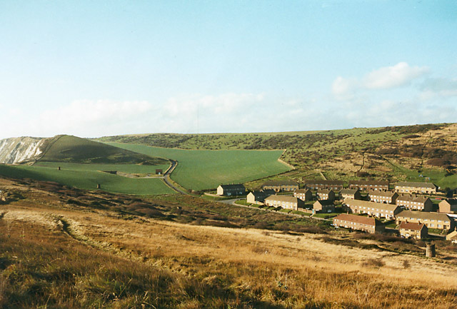
English: Aycliff, Dover This is the western edge of Dover, before the A20 was made into a dual carriageway and rerouted through here. There was just a single-track road through an unspoilt valley running parallel to the coastline. In the middle left of the green field is the entrance to a tunnel, dug in 1973 for channel tunnel works then, and providing vehicular access to the railway depot at the foot of Shakespeare cliff. This access was later used in the 1980s for building the Channel Tunnel, see 1632798. |
| Date | |
| Source | From geograph.org.uk |
| Author | Peter Facey |
| Attribution (required by the license) | Peter Facey / Aycliff, Dover / |
| Camera location | | View this and other nearby images on: OpenStreetMap |
|---|
_heading:292.00&language=en)
| Object location | | View this and other nearby images on: OpenStreetMap |
|---|
_heading:292.00&language=en)
Licensing[edit]

|
This image was taken from the Geograph project collection. See this photograph's page on the Geograph website for the photographer's contact details. The copyright on this image is owned by Peter Facey and is licensed for reuse under the Creative Commons Attribution-ShareAlike 2.0 license.
|
This file is licensed under the Creative Commons Attribution-Share Alike 2.0 Generic license.
Attribution: Peter Facey
- You are free:
- to share – to copy, distribute and transmit the work
- to remix – to adapt the work
- Under the following conditions:
- attribution – You must give appropriate credit, provide a link to the license, and indicate if changes were made. You may do so in any reasonable manner, but not in any way that suggests the licensor endorses you or your use.
- share alike – If you remix, transform, or build upon the material, you must distribute your contributions under the same or compatible license as the original.
File history
Click on a date/time to view the file as it appeared at that time.
| Date/Time | Thumbnail | Dimensions | User | Comment | |
|---|---|---|---|---|---|
| current | 21:24, 22 December 2010 | | 640 × 433 (129 KB) | GeographBot (talk | contribs) | == {{int:filedesc}} == {{Information |description={{en|1=Aycliff, Dover This is the western edge of Dover, before the A20 was made into a dual carriageway and rerouted through here. There was just a single-track road through an unspoilt valley running par |
You cannot overwrite this file.
File usage on Commons
There are no pages that use this file.