File:Bristol UK locator map 2010.svg
Ir a la navegación
Ir a la búsqueda

Tamaño de esta previsualización PNG del archivo SVG: 494 × 600 píxeles. Otras resoluciones: 198 × 240 píxeles | 395 × 480 píxeles | 633 × 768 píxeles | 843 × 1024 píxeles | 1687 × 2048 píxeles | 1108 × 1345 píxeles.
Archivo original (archivo SVG, nominalmente 1108 × 1345 píxeles, tamaño de archivo: 302 kB)
Leyendas
Leyendas
Añade una explicación corta acerca de lo que representa este archivo
Resumen[editar]
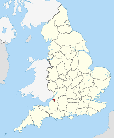
| Descripción | Location of the ceremonial county of Bristol within England. |
| Fecha | |
| Fuente |
National Geospatial-Intelligence Agency
|
| Autor | Nilfanion |
Licencia[editar]
Yo, titular de los derechos de autor de esta obra, la publico en los términos de las siguientes licencias:
Este archivo se encuentra bajo la licencia Creative Commons Genérica de Atribución/Compartir-Igual 3.0.
- Eres libre:
- de compartir – de copiar, distribuir y transmitir el trabajo
- de remezclar – de adaptar el trabajo
- Bajo las siguientes condiciones:
- atribución – Debes otorgar el crédito correspondiente, proporcionar un enlace a la licencia e indicar si realizaste algún cambio. Puedes hacerlo de cualquier manera razonable pero no de manera que sugiera que el licenciante te respalda a ti o al uso que hagas del trabajo.
- compartir igual – En caso de mezclar, transformar o modificar este trabajo, deberás distribuir el trabajo resultante bajo la misma licencia o una compatible como el original.

|
Se autoriza la copia, distribución y modificación de este documento bajo los términos de la licencia de documentación libre GNU, versión 1.2 o cualquier otra que posteriormente publique la Fundación para el Software Libre; sin secciones invariables, textos de portada, ni textos de contraportada. Se incluye una copia de la dicha licencia en la sección titulada Licencia de Documentación Libre GNU. |
Puedes usar la licencia que prefieras.

|
This is one of the images forming part of the Valued image set: Locator maps of the Ceremonial counties of England on Wikimedia Commons. The image set has been assessed under the valued image set criteria and is considered the most valued set on Commons within the scope:
Locator maps of the Ceremonial counties of England
You can see its nomination at Commons:Valued image candidates/Locator maps of English ceremonial counties. |
Historial del archivo
Haz clic sobre una fecha y hora para ver el archivo tal como apareció en ese momento.
| Fecha y hora | Miniatura | Dimensiones | Usuario | Comentario | |
|---|---|---|---|---|---|
| actual | 22:30 23 nov 2010 | | 1108 × 1345 (302 kB) | Nilfanion (discusión | contribs.) | == Summary == {{Information |Description=Location of the ceremonial county of Bristol within England. |Source=Ordnance Survey [https://www.ordnancesurvey.co.uk/opendatadownload/products.html OpenData]: *County boundarie |
No puedes sobrescribir este archivo.
Usos del archivo
Las siguientes páginas usan este archivo:
- Bristol
- Valued image set: Locator maps of the Ceremonial counties of England
- User:Nilfanion/Unparished areas
- Commons:Valued image candidates/Locator maps of English ceremonial counties
- Category:Almshouses in Bristol
- Category:Alumni by school in Bristol
- Category:Births in Bristol
- Category:Bridges in Bristol
- Category:Bristol
- Category:Bristol in the 18th century
- Category:Bristol in the 1940s
- Category:Bristol in the 1950s
- Category:Bristol in the 1960s
- Category:Bristol in the 1970s
- Category:Bristol in the 1980s
- Category:Bristol in the 1990s
- Category:Bristol in the 19th century
- Category:Bristol in the 2000s
- Category:Bristol in the 2010s
- Category:Bristol in the 2020s
- Category:Bristol in the 20th century
- Category:Bristol in the 21st century
- Category:Deaths in Bristol
- Category:Disused railway stations in Bristol
- Category:Events in Bristol
- Category:Hospitals in Bristol
- Category:Local government in Bristol
- Category:Maps of Bristol
- Category:Rail transport in Bristol
- Category:Railway stations in Bristol
- Category:Rivers of Bristol
- Category:Roads in Bristol
- Category:Streets in Bristol
- Category:Towers in Bristol
- Category:Tunnels in Bristol
- Category:Visitor attractions in Bristol
Uso global del archivo
Las wikis siguientes utilizan este archivo:
- Uso en ar.wikipedia.org
- Uso en arz.wikipedia.org
- Uso en ast.wikipedia.org
- Uso en bg.wikipedia.org
- Uso en ca.wikipedia.org
- Uso en cs.wikipedia.org
- Uso en de.wikipedia.org
- Uso en diq.wikipedia.org
- Uso en el.wikipedia.org
- Uso en en.wikipedia.org
- Snuff Mills
- Knowle, Bristol
- The Chessels
- Lawrence Weston, Bristol
- Template:Bristol-geo-stub
- Stoke Lodge
- Sneyd Park
- Golden Hill, Bristol
- Monks Park
- Windmill Hill, Bristol
- Bristol Central (UK Parliament constituency)
- Hengrove
- Speedwell, Bristol
- Westbury Park, Bristol
- Bullock's Park
- Ashton Vale
- Hillfields, Bristol
- Kingsdown, Bristol
- Trinity Road Police Station
- Former Bank of England, Bristol
- Old Post Office, Bristol
- Quakers Friars
- St Nicholas' Almshouses
- Mauretania, Bristol
- Kings Weston Hill
- Foster's Almshouses, Bristol
- Merchant Hall
- Bristol Marina
- Silicon Gorge
- Clifton East (former ward)
- Whitchurch Park (ward)
- Filwood (ward)
- St George East
- Northern Stormwater Interceptor, Bristol
- Ashton Gate, Bristol
- Millennium Square, Bristol
- Great Stoke
- Begbrook
- Purdown
- User:Dr. Blofeld/April 2011
Ver más uso global de este archivo.