File:Bristol UK locator map 2010.svg
Siirry navigaatioon
Siirry hakuun

Tämän PNG-esikatselun koko koskien SVG-tiedostoa: 494 × 600 kuvapistettä. Muut resoluutiot: 198 × 240 kuvapistettä | 395 × 480 kuvapistettä | 633 × 768 kuvapistettä | 843 × 1 024 kuvapistettä | 1 687 × 2 048 kuvapistettä | 1 108 × 1 345 kuvapistettä.
Alkuperäinen tiedosto (SVG-tiedosto; oletustarkkuus 1 108 × 1 345 kuvapistettä; tiedostokoko 302 KiB)
Kuvatekstit
Kuvatekstit
Lisää yhden rivin pituinen kuvaus tästä tiedostosta
Yhteenveto[muokkaa]
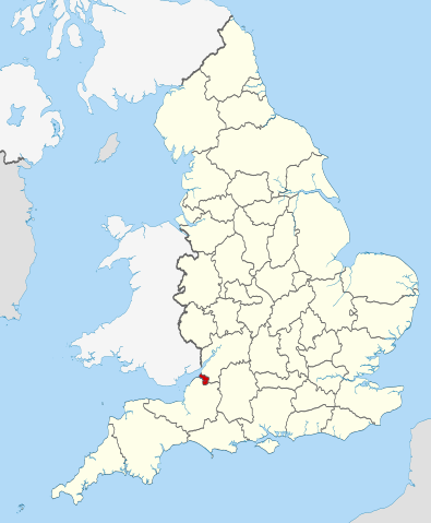
| Kuvaus | Location of the ceremonial county of Bristol within England. |
| Päiväys | |
| Lähde |
National Geospatial-Intelligence Agency
|
| Tekijä | Nilfanion |
Lisenssi[muokkaa]
Minä, tämän teoksen tekijänoikeuksien haltija, julkaisen täten tämän teoksen seuraavilla lisensseillä:
Tämä tiedosto on lisensoitu Creative Commons Nimeä-JaaSamoin 3.0 Ei sovitettu -lisenssillä.
- Voit:
- jakaa – kopioida, levittää ja esittää teosta
- remiksata – valmistaa muutettuja teoksia
- Seuraavilla ehdoilla:
- nimeäminen – Sinun on mainittava lähde asianmukaisesti, tarjottava linkki lisenssiin sekä merkittävä, mikäli olet tehnyt muutoksia. Voit tehdä yllä olevan millä tahansa kohtuullisella tavalla, mutta et siten, että annat ymmärtää lisenssinantajan suosittelevan sinua tai teoksen käyttöäsi.
- jaa samoin – Jos muutat tai perustat tähän työhön, voit jakaa tuloksena syntyvää työtä vain tällä tai tämän kaltaisella lisenssillä.

|
Voit kopioida, levittää ja/tai muuttaa tätä asiakirjaa GNU Free Documentation License -lisenssin version 1.2 tai minkä tahansa Free Software Foundationin julkaiseman myöhemmän version ehtojen alaisena; ei koske muuttumattomia kohtia, etukannen tekstejä eikä takakannen tekstejä. Kopio tästä lisenssistä on saatavilla osiossa GNU Free Documentation License. |
Voit valita haluamasi lisenssin.

|
This is one of the images forming part of the Valued image set: Locator maps of the Ceremonial counties of England on Wikimedia Commons. The image set has been assessed under the valued image set criteria and is considered the most valued set on Commons within the scope:
Locator maps of the Ceremonial counties of England
You can see its nomination at Commons:Valued image candidates/Locator maps of English ceremonial counties. |
Tiedoston historia
Päiväystä napsauttamalla näet, millainen tiedosto oli kyseisellä hetkellä.
| Päiväys | Pienoiskuva | Koko | Käyttäjä | Kommentti | |
|---|---|---|---|---|---|
| nykyinen | 23. marraskuuta 2010 kello 22.30 | | 1 108 × 1 345 (302 KiB) | Nilfanion (keskustelu | muokkaukset) | == Summary == {{Information |Description=Location of the ceremonial county of Bristol within England. |Source=Ordnance Survey [https://www.ordnancesurvey.co.uk/opendatadownload/products.html OpenData]: *County boundarie |
Et voi tallentaa uutta tiedostoa tämän tilalle.
Tiedoston käyttö
Seuraavat 36 sivua käyttävät tätä tiedostoa:
- Bristol
- Valued image set: Locator maps of the Ceremonial counties of England
- User:Nilfanion/Unparished areas
- Commons:Valued image candidates/Locator maps of English ceremonial counties
- Category:Almshouses in Bristol
- Category:Alumni by school in Bristol
- Category:Births in Bristol
- Category:Bridges in Bristol
- Category:Bristol
- Category:Bristol in the 18th century
- Category:Bristol in the 1940s
- Category:Bristol in the 1950s
- Category:Bristol in the 1960s
- Category:Bristol in the 1970s
- Category:Bristol in the 1980s
- Category:Bristol in the 1990s
- Category:Bristol in the 19th century
- Category:Bristol in the 2000s
- Category:Bristol in the 2010s
- Category:Bristol in the 2020s
- Category:Bristol in the 20th century
- Category:Bristol in the 21st century
- Category:Deaths in Bristol
- Category:Disused railway stations in Bristol
- Category:Events in Bristol
- Category:Hospitals in Bristol
- Category:Local government in Bristol
- Category:Maps of Bristol
- Category:Rail transport in Bristol
- Category:Railway stations in Bristol
- Category:Rivers of Bristol
- Category:Roads in Bristol
- Category:Streets in Bristol
- Category:Towers in Bristol
- Category:Tunnels in Bristol
- Category:Visitor attractions in Bristol
Tiedoston järjestelmänlaajuinen käyttö
Seuraavat muut wikit käyttävät tätä tiedostoa:
- Käyttö kohteessa ar.wikipedia.org
- Käyttö kohteessa arz.wikipedia.org
- Käyttö kohteessa ast.wikipedia.org
- Käyttö kohteessa bg.wikipedia.org
- Käyttö kohteessa ca.wikipedia.org
- Käyttö kohteessa cs.wikipedia.org
- Käyttö kohteessa de.wikipedia.org
- Käyttö kohteessa diq.wikipedia.org
- Käyttö kohteessa el.wikipedia.org
- Käyttö kohteessa en.wikipedia.org
- Snuff Mills
- Knowle, Bristol
- The Chessels
- Lawrence Weston, Bristol
- Template:Bristol-geo-stub
- Stoke Lodge
- Sneyd Park
- Golden Hill, Bristol
- Monks Park
- Windmill Hill, Bristol
- Bristol Central (UK Parliament constituency)
- Hengrove
- Speedwell, Bristol
- Westbury Park, Bristol
- Bullock's Park
- Ashton Vale
- Hillfields, Bristol
- Kingsdown, Bristol
- Trinity Road Police Station
- Former Bank of England, Bristol
- Old Post Office, Bristol
- Quakers Friars
- St Nicholas' Almshouses
- Mauretania, Bristol
- Kings Weston Hill
- Foster's Almshouses, Bristol
- Merchant Hall
- Bristol Marina
- Silicon Gorge
- Clifton East (former ward)
- Whitchurch Park (ward)
- Filwood (ward)
- St George East
- Northern Stormwater Interceptor, Bristol
- Ashton Gate, Bristol
- Millennium Square, Bristol
- Great Stoke
- Begbrook
- Purdown
- User:Dr. Blofeld/April 2011
Näytä lisää tämän tiedoston järjestelmänlaajuista käyttöä.