File:Carte de la Louisiane cours du Mississipi et pais voisins. NYPL484201.tiff
Jump to navigation
Jump to search

Size of this JPG preview of this TIF file: 800 × 599 pixels. Other resolutions: 320 × 240 pixels | 640 × 480 pixels | 1,024 × 767 pixels | 1,280 × 959 pixels | 2,560 × 1,918 pixels | 5,140 × 3,851 pixels.
Original file (5,140 × 3,851 pixels, file size: 56.64 MB, MIME type: image/tiff)
Captions
Captions
Add a one-line explanation of what this file represents
Summary
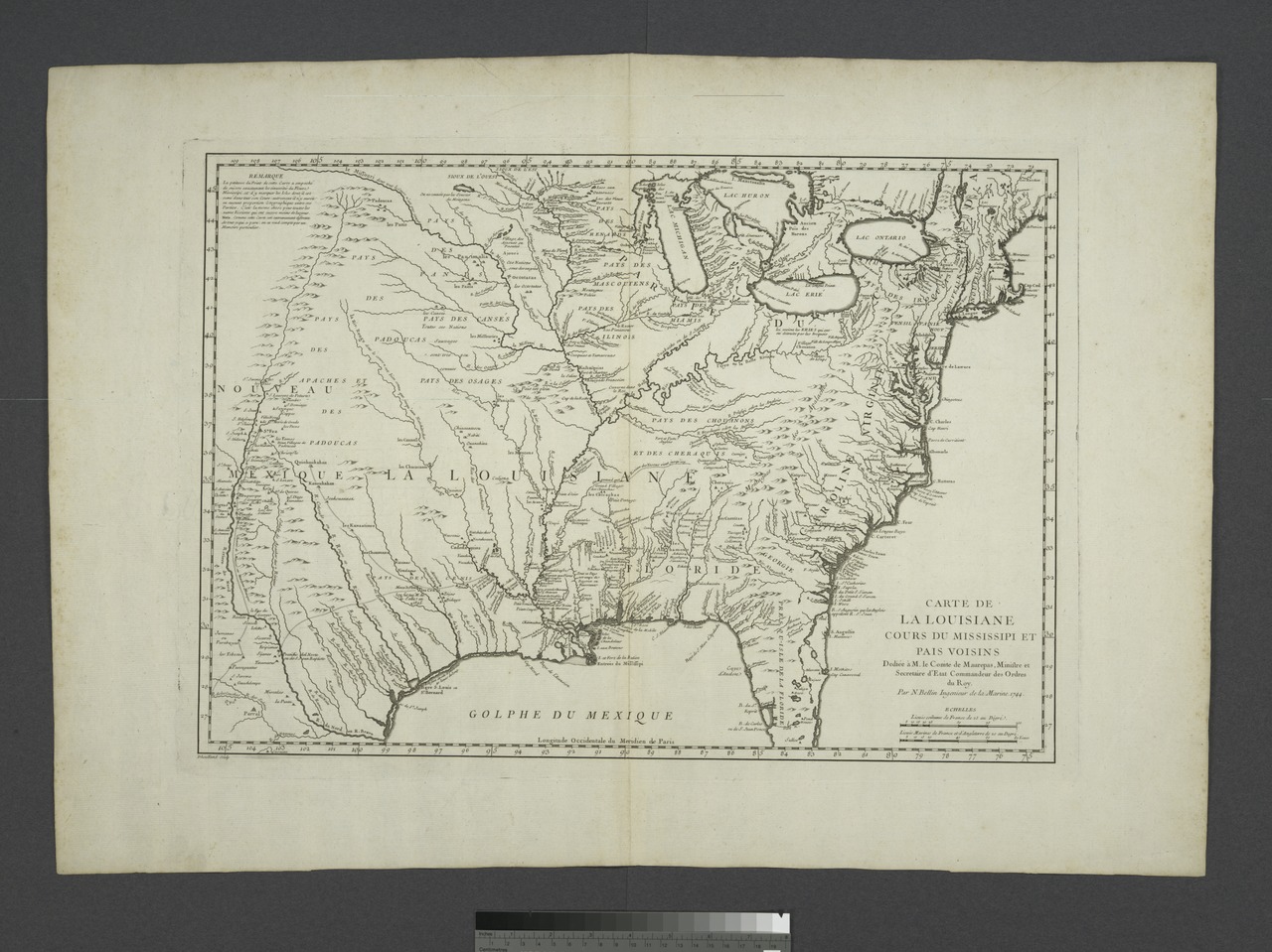
[edit]| Description | Carte de la Louisiane cours du Mississipi et pais voisins.; Lawrence H. Slaughter Collection of English maps, charts, globes, books and atlases / Charts and maps | |||||||||||||||||||||||
| Notes | Covers eastern United States from the Atlantic Ocean to the Rio Grande. ''Note 2.'') Relief shown pictorially. ''Note 3.'') "Dedièe à M. le Comte de Maurepas, Ministre et Secretaire d'Etat Commandeur des Ordres du Roy." ''Note 4.'') Appears in Charlevoix's Histoire et description gènèrale de la Nouvelle France, 1744, and in Bellin's Cartes et plans de l'Amerique, 1745. ''Note 5.'') "Longitude occidentale du meridien de Paris." | |||||||||||||||||||||||
| Item physical description | 1 map; 38 x 54 cm. | |||||||||||||||||||||||
| Catalogue call number | Map Div. 97-6082 [LHS 454] | |||||||||||||||||||||||
| Standard reference | Cumming, 170; Phillips, 10267; BM maps, v.9, column 262 | |||||||||||||||||||||||
| Date | ||||||||||||||||||||||||
| Source |
http://digitalgallery.nypl.org/nypldigital/dgkeysearchdetail.cfm?imageID=484201
|
|||||||||||||||||||||||
| Author | ||||||||||||||||||||||||
| Permission (Reusing this file) |
From The Lionel Pincus and Princess Firyal Map Division. http://maps.nypl.org
|
|||||||||||||||||||||||
| Location | Stephen A. Schwarzman Building / The Lionel Pincus and Princess Firyal Map Division | |||||||||||||||||||||||
| Digital item published | 2-28-2005; updated 3-25-2011 | |||||||||||||||||||||||
| Digital ID | 484201 | |||||||||||||||||||||||

The making of this file was supported by Wikimedia UK.
To see other files made with the support of Wikimedia UK, please see the category Supported by Wikimedia UK.
|
File history
Click on a date/time to view the file as it appeared at that time.
| Date/Time | Thumbnail | Dimensions | User | Comment | |
|---|---|---|---|---|---|
| current | 07:37, 6 May 2014 |  | 5,140 × 3,851 (56.64 MB) | Fæ (talk | contribs) | GWToolset: Creating mediafile for Fæ. Tranche 3 3501-5495 (repairs) @ 4 May 2014, 10:46 BST |
You cannot overwrite this file.
File usage on Commons
There are no pages that use this file.