File:Etats-Unis de l'Amerique septentrionale avec les Isles Royale, de Terre Neuve, de St. Jean, l'Acadie etc NYPL465233.tiff
Jump to navigation
Jump to search

Size of this JPG preview of this TIF file: 779 × 599 pixels. Other resolutions: 312 × 240 pixels | 624 × 480 pixels | 998 × 768 pixels | 1,280 × 985 pixels | 2,560 × 1,970 pixels | 5,107 × 3,929 pixels.
Original file (5,107 × 3,929 pixels, file size: 57.41 MB, MIME type: image/tiff)
Captions
Captions
Add a one-line explanation of what this file represents
Summary
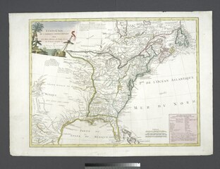
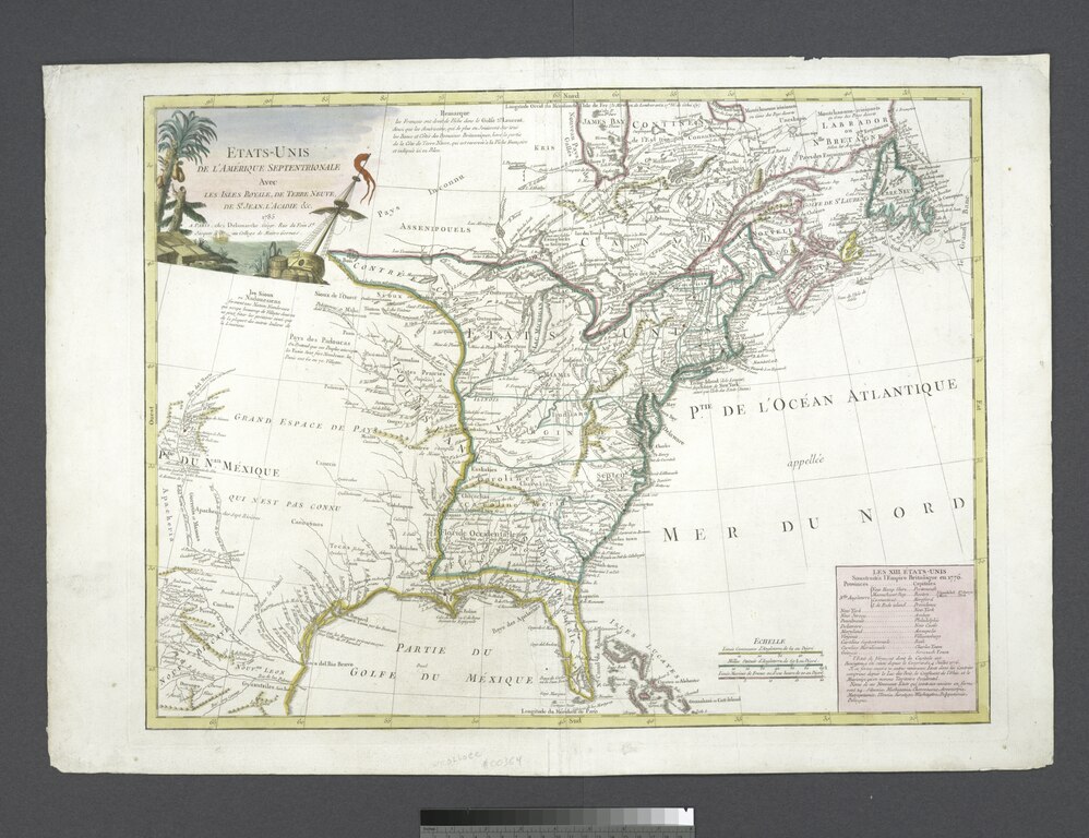
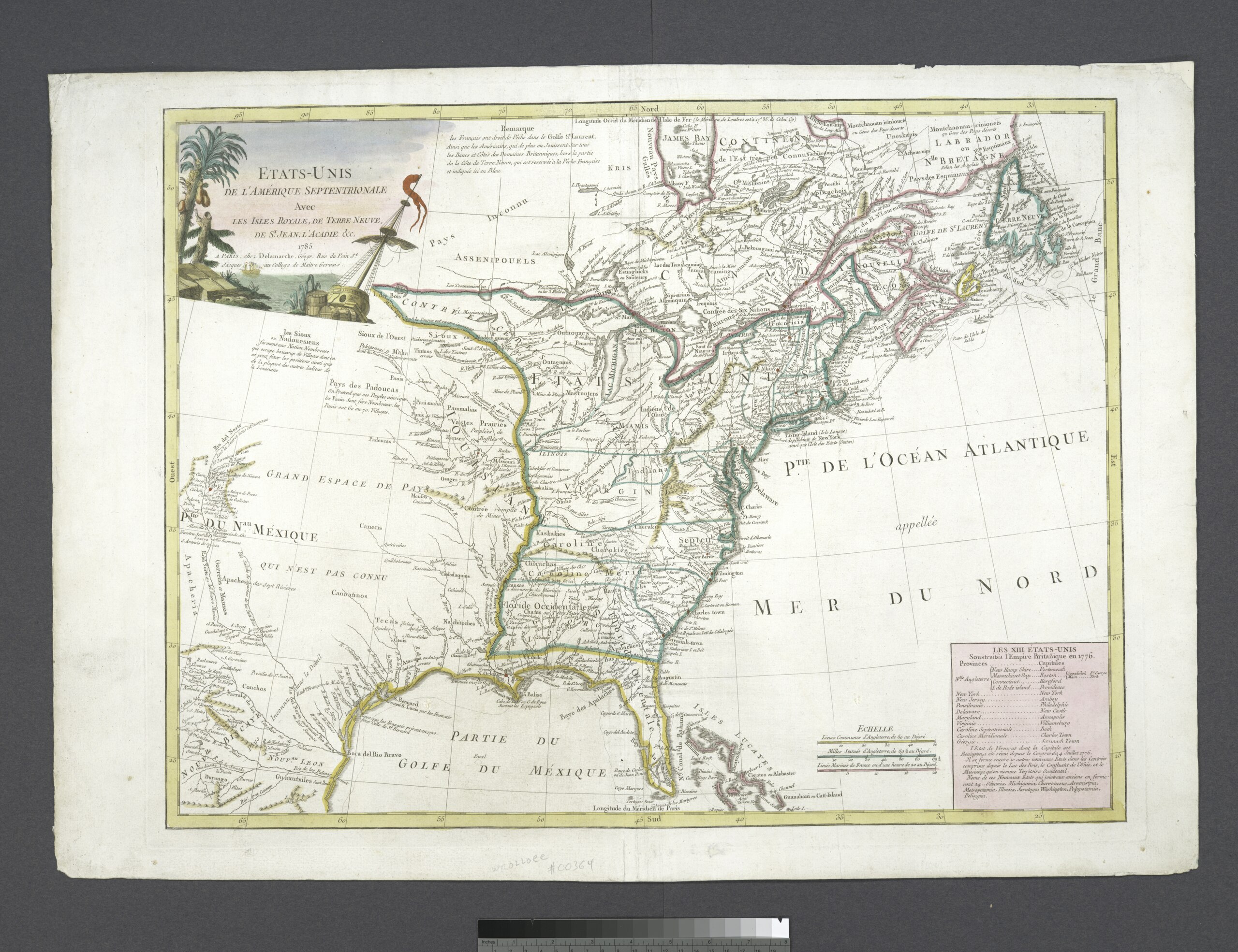
[edit]| Description | Etats-Unis de l'Amerique septentrionale avec les Isles Royale, de Terre Neuve, de St. Jean, l'Acadie etc; Lawrence H. Slaughter Collection of English maps, charts, globes, books and atlases / Charts and maps | |||||||||||||||||||||||
| Notes | Appears in Robert de Vaugondy's Atlas universel. [1793?]. ''Note 2.'') Copy in Map Div. 96-7694: John H. Levine Bequest. ''Note 3.'') Copy in Map Div. 97-6154: Lawrence H. Slaughter collection. ''Note 4.'') Includes notes and a listing of the 13 original states plus Vermont and the proposed name of 10 new states provided for in the Jeffersonian Ordinance of 1784, e.g. Silvania, Michigania ... ''Note 5.'') Lawrence H. Slaughter Collection ; 550.l. ''Note 6.'') National Endowment for the Humanities Grant for Access to Early Maps of the Middle Atlantic Seaboard. ''Note 7.'') Prime meridian: Isle de Fer and Paris. ''Note 8.'') Relief shown pictorially. | |||||||||||||||||||||||
| Item physical description | 1 map : hand col. ; 46 x 61 cm. | |||||||||||||||||||||||
| Catalogue call number | Map Div. 97-6154 [LHS 550.l] | |||||||||||||||||||||||
| Standard reference | Karpinski, L.C. Printed maps of Michigan, CIII; Phillips 678 [et al.] | |||||||||||||||||||||||
| Date | ||||||||||||||||||||||||
| Source |
http://digitalgallery.nypl.org/nypldigital/dgkeysearchdetail.cfm?imageID=465233
|
|||||||||||||||||||||||
| Author | Delamarche, Charles Francois, 1740-1817 -- Cartographer | |||||||||||||||||||||||
| Permission (Reusing this file) |
From The Lionel Pincus and Princess Firyal Map Division. http://maps.nypl.org
|
|||||||||||||||||||||||
| Location | Stephen A. Schwarzman Building / The Lionel Pincus and Princess Firyal Map Division | |||||||||||||||||||||||
| Digital item published | 2-26-2005; updated 3-25-2011 | |||||||||||||||||||||||
| Digital ID | 465233 | |||||||||||||||||||||||

The making of this file was supported by Wikimedia UK.
To see other files made with the support of Wikimedia UK, please see the category Supported by Wikimedia UK.
|
File history
Click on a date/time to view the file as it appeared at that time.
| Date/Time | Thumbnail | Dimensions | User | Comment | |
|---|---|---|---|---|---|
| current | 13:23, 29 April 2014 |  | 5,107 × 3,929 (57.41 MB) | Fæ (talk | contribs) | GWToolset:: Creating mediafile for Fæ. Tranche 3 5495-7474 (repairs) |
You cannot overwrite this file.
File usage on Commons
There are no pages that use this file.