File:Freely interpreted floor map of Alhambra Spain.svg
Jump to navigation
Jump to search

Size of this PNG preview of this SVG file: 800 × 405 pixels. Other resolutions: 320 × 162 pixels | 640 × 324 pixels | 1,024 × 519 pixels | 1,280 × 648 pixels | 2,560 × 1,297 pixels | 5,923 × 3,000 pixels.
Original file (SVG file, nominally 5,923 × 3,000 pixels, file size: 528 KB)
Captions
Captions
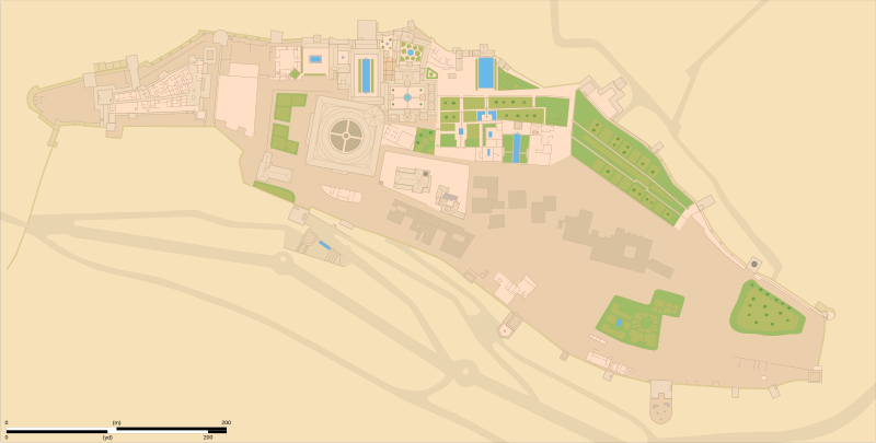
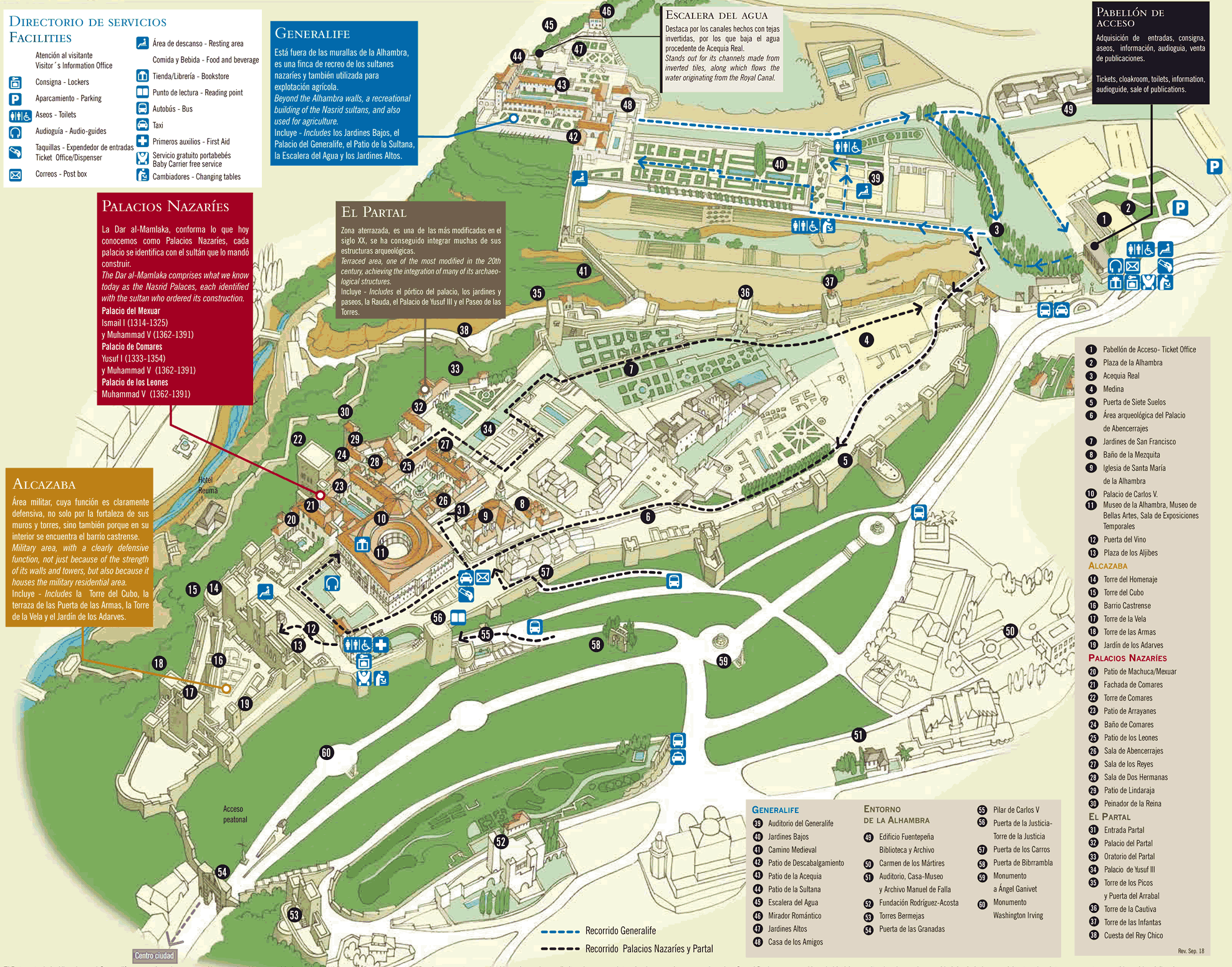
Freely interpreted floor map of Alhambra Spain
Summary[edit]
| Description |
English: Freely interpreted floor map of Alhambra Spain
This is a free interpretation and a mix of the different sources stated below. It's not specific to any given time or state of the existence of Alhambra Spain.
|
||||||||||||||||||||||||||
| Date | |||||||||||||||||||||||||||
| Source |
Own work based on:
|
||||||||||||||||||||||||||
| Author | Goran_tek-en | ||||||||||||||||||||||||||
| Permission (Reusing this file) |
This file is licensed under the Creative Commons Attribution-Share Alike 4.0 International license. Attribution: Goran_tek-en
|
||||||||||||||||||||||||||
| Other versions |
|
||||||||||||||||||||||||||
| SVG development | This vector image was created with Inkscape. |
||||||||||||||||||||||||||


.png)
| Object location | | View this and other nearby images on: OpenStreetMap |
|---|


_p310_ALHAMBRA.jpg)
File history
Click on a date/time to view the file as it appeared at that time.
| Date/Time | Thumbnail | Dimensions | User | Comment | |
|---|---|---|---|---|---|
| current | 19:33, 15 February 2023 | | 5,923 × 3,000 (528 KB) | Goran tek-en (talk | contribs) | {{Information |description ={{en|Freely interpreted floor map of Alhambra Spain}}<br> This is a free interpretation and a mix of the different sources stated below. It's not specific to any given time or state of the existence of Alhambra Spain. {{Institution |wikidata=Q47476}} |date =2023-02-15 |source ={{Own based|Alhambra 2015 004.jpg|Alhambra general plan (numbered).png|O'SHEAS (1895) p310 ALHAMBRA.jpg|Maps template-en.svg|b1=Hubertl|b2=R Prazeres|b3=British Libr... |
You cannot overwrite this file.
File usage on Commons
The following 4 pages use this file: