File:Georgia (orthographic projection with inset).svg
跳转到导航
跳转到搜索

此SVG文件的PNG预览的大小:550 × 550像素。 其他分辨率:240 × 240像素 | 480 × 480像素 | 768 × 768像素 | 1,024 × 1,024像素 | 2,048 × 2,048像素。
原始文件 (SVG文件,尺寸为550 × 550像素,文件大小:689 KB)
说明
说明
添加一行文字以描述该文件所表现的内容
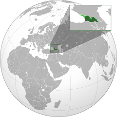
喬治亞(正投影圖)
摘要[编辑]
| 描述 |
English: The orthographic projection map of Georgia.
.svg) |
| 日期 | |
| 来源 |
基于如下对象的个人作品: Georgia (orthographic projection).svg |
| 作者 |
|
| 授权 (二次使用本文件) |
本文件采用知识共享署名-相同方式共享 3.0 未本地化版本许可协议授权。
|
| 其他版本 |
|
| SVG开发 |
.svg)
.svg)
.svg)
.svg)
.svg)
.svg)
.svg)
.svg)
.svg)
.svg)
.svg)
.svg)
.svg)
.svg)
.svg)
.svg)
.svg)
.svg)
.svg)
.svg)
.svg)
.svg)
.svg)
.svg)
.svg)
.svg)
.svg)
.svg)
.svg)
.svg)
.svg)
.svg)
.svg)
.svg)
.svg)
.svg)
.svg)
.svg)
.svg)
.svg)
.svg)
.svg)
.svg)
.svg)
.svg)
.svg)
.svg)
.svg)
.svg)
.svg)
.svg)
.svg)
.svg)
.svg)
.svg)
.svg)
.svg)
.svg)
.svg)
.svg)
.svg)
.svg)
.svg)
.svg)
.svg)
.svg)
.svg)
.svg)
.svg)
.svg)
.svg)
.svg)
.svg)

.svg)

.svg)

.svg)
.svg)
.svg)
.svg)
.svg)
.svg)
.svg)


.svg)
.svg)
.svg)
.svg)
.svg)
.svg)
.svg)

.svg)
.svg)
.svg)
.svg)
.svg)
.svg)
.svg)
.svg)
.svg)
.svg)

.svg)
.svg)
.svg)
.svg)
.svg)
.svg)
.svg)
_without_national_boundaries.svg)
.svg)
.svg)
.svg)
.svg)
.svg)
.svg)

.svg)
.svg)
.png)
.svg)
.svg)
.svg)
.svg)

.svg)
.svg)
.svg)
.svg)
.svg)
.svg)
.svg)
.svg)
.svg)
.svg)
.svg)

.svg)
.svg)
.svg)
.svg)
.svg)
.svg)
.svg)
.svg)
.svg)

.svg)
.svg)

.svg)
.svg)
.svg)
.svg)
.svg)
.svg)
.svg)
.svg)
.svg)
.svg)
.svg)
.svg)
.svg)
.svg)
.svg)
.svg)
.svg)
.svg)
.svg)
.svg)
.svg)
.svg)
.svg)
.svg)
.svg)
.svg)
.svg)
_-_Crimea_disputed.svg)
.svg)
.svg)
.svg)
.svg)
.svg)
.svg)
.svg)
.svg)
.svg)
.svg)
.svg)
_political.svg)
.svg)
.svg)
.svg)
.svg)
_-_Crimea_disputed_-_no_borders.svg)
.svg)
.svg)
.svg)
.svg)
.svg)
.svg)
.svg)
.svg)
.svg)
.svg)
.svg)

.svg)
.svg)
.svg)

.png)
.svg)
.svg)
.svg)
.svg)
.svg)
.svg)
.svg)
.svg)
.svg)
.svg)
.svg)
.svg)
.svg)
.svg)
.svg)
.svg)
.svg)
.svg)
.svg)
.svg)
.svg)
.svg)
.svg)
.svg)
.svg)
.svg)
.svg)
.svg)
.svg)
.svg)
.svg)
.svg)
.svg)
.svg)
.png)
.svg)
.svg)
.svg)
_(orthographic_projection).png)

.svg&action=edit§ion=1)
原始上传日志[编辑]
.svg&action=edit§ion=2)
This image is a derivative work of the following images:
- Georgia (orthographic projection).svg licensed with Cc-by-sa-3.0
- 2011-04-17T17:57:02Z Sigismun 550x550 (575027 Bytes) I have been yelled at that we are not allowed to rewrite existing maps. So why not create a separate file?
- 2011-04-17T10:58:04Z Night w 550x550 (791516 Bytes) {{Information |Description ={{en|1=Locator map of Georgia}} |Source =Own work |Author =Night w |Date = |Permission = |other_versions = }} match up boxes, reduce lineage
- 2011-04-17T10:16:42Z Night w 550x550 (801072 Bytes) try this?
- 2011-04-17T10:11:14Z Chipmunkdavis 550x550 (716474 Bytes) Thickening green lines, light green colouring the same as the India map, adding light green to large map to match inset, shrinking inset slightly
- 2011-04-17T08:42:59Z Night w 550x550 (738790 Bytes) added inset
- 2011-01-08T00:04:53Z Kentronhayastan 550x550 (575027 Bytes) better quality
- 2010-01-11T21:11:06Z Izzedine 680x680 (337039 Bytes) {{Information |Description={{en|1=Location of Georgia.}} |Source=Own work |Author=Izzedine |Date=2010-01-11 |Permission= |other_versions= }}
- Europe Location Georgia uncontrolled highlighted.svg licensed with PD-self
- 2011-04-17T09:09:50Z Chipmunkdavis 1024x1024 (532451 Bytes) Filling out the entire of Georgia, a little bit was missing in the southeast.
- 2011-04-09T23:21:28Z Dinamik 1024x1024 (533250 Bytes) original version
- 2011-04-09T23:10:44Z ComtesseDeMingrelie 1000x1000 (436609 Bytes) Reverted to version as of 13:07, 1 February 2011
- 2011-02-01T17:14:28Z Chipmunkdavis 1024x1024 (533250 Bytes) Back to original. Arbitrary borders between continents do not need to be shown on any map showing the locations of countries. This is even more true with the undefined border between Europe and Asia, which changes depending o
- 2011-02-01T13:07:16Z Diaoha 1000x1000 (436609 Bytes) Difference between Asia and Europe must be seen.
- 2011-01-30T14:27:42Z Chipmunkdavis 1024x1024 (533250 Bytes) Back to version at 03:45, 10 March 2010, original without the two different shades of grey
- 2010-06-23T19:43:49Z Yuriy Kolodin 1000x1000 (436609 Bytes) No relation to Georgia. Georgia is not a member of EU
- 2010-06-23T11:09:16Z Diaoha 1000x1000 (2081069 Bytes) a
- 2010-06-23T11:06:35Z Diaoha 1000x1000 (2107459 Bytes) z:)
- 2010-06-23T11:04:29Z Diaoha 1000x1000 (2107459 Bytes) Minor
- 2010-06-23T10:39:39Z Diaoha 1000x1000 (440827 Bytes) :А
- 2010-06-23T10:36:33Z Diaoha 1000x1000 (436609 Bytes) :Д
- 2010-03-09T19:45:38Z Dinamik 1024x1024 (533250 Bytes) original version by Nicolay Sidorov
- 2010-02-27T14:21:17Z Diaoha 1024x1024 (533334 Bytes) No POV in Commons.
- 2010-02-27T01:33:34Z Dinamik 1024x1024 (533250 Bytes) this file was transfered from ru-wiki by you;if you think,that it is POV-pushing,please,nominate it for deletion
- 2010-02-26T08:59:56Z Diaoha 1024x1024 (533334 Bytes) Reverted POV pushing.
- 2010-02-26T00:26:40Z Dinamik 1024x1024 (533250 Bytes) please,choose for your file another name;don't overwrite the image of Nicolay Sidorov
- 2010-02-25T07:17:08Z Diaoha 1024x1024 (533334 Bytes) Reverted POV pushing.
- 2010-02-24T22:30:49Z Dinamik 1024x1024 (533250 Bytes) please,don't overwrite somebody else's image by the another file with the same name;back to original version by Nicolay Sidorov
- 2010-02-24T11:19:51Z Diaoha 1024x1024 (533334 Bytes) Reverted Sepratistic propoganda.
- 2010-02-24T05:40:47Z Hayk 1024x1024 (533250 Bytes) de-facto situation, revert to original version by Nicolay Sidorov
- 2010-02-23T16:47:24Z Diaoha 1024x1024 (533334 Bytes) Reverted Sepratistic propoganda.
- 2010-02-22T15:47:48Z Dinamik 1024x1024 (533250 Bytes) if you think,that image of Nikolay Sidorov is non-encyclopaedic,you can nominate it for delection;please,don't overwrite it
- 2010-02-21T14:52:20Z Diaoha 1024x1024 (533334 Bytes) Reverted separatistic propaganda
- 2010-02-20T19:19:28Z Dinamik 1024x1024 (533250 Bytes) we can make another map(without propaganda) and upload it,but with another name
- 2010-02-19T15:20:41Z Diaoha 1024x1024 (533334 Bytes) Reverted separatistic propaganda
- 2010-02-18T23:07:27Z Hayk 1024x1024 (533250 Bytes) de-facto situation, revert to original version by Nicolay Sidorov
- 2010-02-17T16:41:15Z Diaoha 1024x1024 (533334 Bytes) Reverted to version as of 17:42, 16 February 2010
- 2010-02-16T22:07:33Z Dinamik 1024x1024 (533250 Bytes) map gives information about de-facto situation;it isn't propaganda
- 2010-02-16T17:42:37Z Diaoha 1024x1024 (533334 Bytes) Reverted propaganda
- 2010-02-16T16:19:29Z Hayk 1024x1024 (533250 Bytes) revert to original version by Nicolay Sidorov
- 2010-02-16T03:29:55Z Diaoha 1024x1024 (533334 Bytes) Stop separatistic propaganda
- 2010-02-15T23:05:55Z Hayk 1024x1024 (533250 Bytes) don't overwrit image w/ standart grey-green colors, revert to original version by Nicolay Sidorov
- 2010-02-15T11:44:43Z Diaoha 1024x1024 (533334 Bytes) How long will you be supporting the separatists? The colours do it
- 2010-02-14T21:42:33Z Dinamik 1024x1024 (533250 Bytes) colors can't support or oppose,they only give information;anyone can make another map with another name
- 2010-02-14T08:27:15Z Diaoha 1024x1024 (533334 Bytes) Colours that don't csupport separatists
- 2010-02-08T05:30:13Z Dinamik 1024x1024 (533250 Bytes) old colors-standart grey-green maps colors;original version by Nicolay Sidorov
- 2010-02-06T09:44:23Z Diaoha 1024x1024 (533334 Bytes) new supposed colors are awful;readers consider them as separate states; back to original version
- 2010-02-05T21:03:21Z Dinamik 1024x1024 (533250 Bytes) new supposed colors are too similar; back to original version
- 2010-02-05T11:11:59Z Diaoha 1024x1024 (533334 Bytes) (new supposed colors are awful;readers consider them as separate states)
- 2010-02-02T20:59:07Z Dinamik 1024x1024 (533250 Bytes) new supposed colors are almost the same;readers don't see differences well
- 2010-01-30T07:33:01Z Diaoha 1024x1024 (533334 Bytes) Technikal correction
- 2010-01-25T22:14:05Z Dinamik 1024x1024 (533250 Bytes) technical correction
- 2010-01-25T22:12:51Z Dinamik 1024x1024 (533250 Bytes) If we want to upload file,that was done by the another principles,we should choose another name for it
- 2010-01-24T07:46:23Z Diaoha 1024x1024 (1075754 Bytes) f
- 2010-01-24T06:46:47Z Diaoha 1024x1024 (533250 Bytes) We CAN
- 2010-01-23T22:39:35Z Dinamik 1024x1024 (533250 Bytes) technical correction
- 2010-01-22T06:24:28Z Dinamik 1024x1024 (533250 Bytes) technical correction
- 2010-01-22T06:23:10Z Dinamik 1024x1024 (533250 Bytes) original version by Nicolay Sidorov (was uploaded in ru-wiki)
- 2010-01-20T11:36:56Z Diaoha 1024x1024 (527293 Bytes) Discuss first, gentlemen.
Uploaded with derivativeFX
| 注解 | 该图片含有注解:在维基媒体共享资源上查看注解 |
.svg)
文件历史
点击某个日期/时间查看对应时刻的文件。
| 日期/时间 | 缩略图 | 大小 | 用户 | 备注 | |
|---|---|---|---|---|---|
| 当前 | 2020年6月26日 (五) 11:54 | | 550 × 550(689 KB) | Hogweard(留言 | 贡献) | South Sudan border |
| 2016年11月19日 (六) 03:52 |  | 550 × 550(701 KB) | Chipmunkdavis(留言 | 贡献) | Revert to standard conventions. All lines appearing on my monitor, possibly a browser issue. | |
| 2016年10月26日 (三) 07:49 |  | 550 × 550(2.39 MB) | Giorgi Balakhadze(留言 | 贡献) | I wrote that when it is shown in 250px in articles Abkhazia all disappears, this pattern better saves contours. | |
| 2016年10月26日 (三) 01:53 |  | 550 × 550(701 KB) | Gyumrilak(留言 | 贡献) | Reverted to version as of 21:59, 23 July 2011 (UTC) Why are you doing that? The unrecognized regions were represented well already. | |
| 2016年10月25日 (二) 18:35 |  | 550 × 550(2.39 MB) | Giorgi Balakhadze(留言 | 贡献) | Removing hidden layers. Pattern lines for better representation of the country's north-west border when the file is used in articles. (it disappears with light green) | |
| 2011年7月23日 (六) 21:59 |  | 550 × 550(701 KB) | Night w(留言 | 贡献) | shading extension and lines | |
| 2011年7月2日 (六) 02:08 |  | 550 × 550(699 KB) | Kentronhayastan(留言 | 贡献) | upgraded the style of the inset | |
| 2011年4月18日 (一) 09:07 |  | 550 × 550(700 KB) | Chipmunkdavis(留言 | 贡献) | {{Information |Description={{en|1=Location of Georgia.}} {{ru| {{en|1={{EU-SVG-en|Georgia}}}}. карта расположения Грузии}} |date = 2009 |Source=*File:Georgia_(orthographic_projection).svg *[[:File:Europe_Location_Georgia |
您不可以覆盖此文件。
文件用途
超过100个页面使用本文件。 下面的列表只显示使用本文件的前100个页面。完整列表可用。
.svg)
- Grey–green orthographic projections maps
- საქართველო
- User:Heraldry/Projections
- User:Ssolbergj/orthographic
- File:ALBA (orthographic projection).png
- File:Africa (orthographic projection).svg
- File:African Union (orthographic projection).svg
- File:Almoravid map.svg
- File:America do Sul (orthographic projection).jpg
- File:Americas (orthographic projection).svg
- File:Andean Community (orthographic projection).svg
- File:Antarctica (orthographic projection).svg
- File:Antillas (orthographic projection).svg
- File:Arctic (orthographic projection).svg
- File:Argentina (orthographic projection).png
- File:Argentina (orthographic projection).svg
- File:Aridoamerica (orthographic projection).svg
- File:Armenia (orthographic projection).svg
- File:Asia (orthographic projection).svg
- File:Association of Southeast Asian Nations (orthographic projection).svg
- File:Australia-New Guinea (orthographic projection).svg
- File:Australia (orthographic projection).svg
- File:Australia map with outlying islands.svg
- File:Bhutan (orthographic projection).svg
- File:Brazil (orthographic projection).svg
- File:CECAFA-Map.svg
- File:Canada (orthographic projection).svg
- File:Cape Verde (orthographic projection).svg
- File:Central America (orthographic projection).svg
- File:Central Asia (orthographic projection).svg
- File:Chile (orthographic projection).svg
- File:Colombia (orthographic projection).svg
- File:Democratic Republic of the Congo (orthographic projection).svg
- File:Dominion of Pakistan & Indian Controlled Kashmir (orthographic projection).svg
- File:East Asia (orthographic projection).svg
- File:Ecuador (orthographic projection).svg
- File:Europe (orthographic projection).svg
- File:European Union (orthographic projection).svg
- File:Federal Republic of Central America (orthographic projection).svg
- File:First Brazilian Empire (orthographic projection).svg
- File:First Mexican Empire (orthographic projection).svg
- File:Georgia (orthographic projection).svg
- File:Germany (orthographic projection).svg
- File:Global European Union.svg
- File:Great Colombia (orthographic projection).svg
- File:Greater Middle East (orthographic projection).svg
- File:Haiti (orthographic projection).svg
- File:India (orthographic projection).svg
- File:Indonesia (orthographic projection).svg
- File:Iran (orthographic projection).svg
- File:Iraq (orthographic projection).svg
- File:Jamaica (orthographic projection).svg
- File:Japan (orthographic projection).svg
- File:Kazakhstan (orthographic projection).svg
- File:Latin America (orthographic projection).svg
- File:Lusophone America (orthographic projection).svg
- File:MERCOSUR (orthographic projection).svg
- File:Madagascar (orthographic projection).svg
- File:Maghreb (orthographic projection).svg
- File:Malaysia (orthographic projection).svg
- File:Mayan languages (orthographic projection).svg
- File:Mesoamerica (orthographic projection) with borders.svg
- File:Mexico (orthographic projection).svg
- File:Mexico and Central America (orthographic projection).svg
- File:Middle East (orthographic projection).svg
- File:Mongolia (orthographic projection).svg
- File:New Spain (orthographic projection).svg
- File:New Zealand (orthographic projection).svg
- File:Nigeria (orthographic projection).svg
- File:North Africa (orthographic projection).svg
- File:North America (orthographic projection).svg
- File:North American Agreement (orthographic projection).svg
- File:North Korea (orthographic projection).svg
- File:Papua New Guinea (orthographic projection).svg
- File:Paraguay (orthographic projection).svg
- File:People's Republic of China (orthographic projection).svg
- File:Peru (orthographic projection).svg
- File:Peru–Bolivia Confederation (orthographic projection).svg
- File:Philippines (orthographic projection).svg
- File:Republic of Artsakh (orthographic projection).svg
- File:Republic of China (orthographic projection).svg
- File:Rio Group (orthographic projection).svg
- File:Roman Empire (orthographic projection).svg
- File:Russian Federation (orthographic projection).svg
- File:Second Mexican Empire (orthographic projection).svg
- File:South Asia (orthographic projection) without national boundaries.svg
- File:South Korea (orthographic projection).svg
- File:Southern Europe (orthographic projection).svg
- File:Tawantinsuyu (orthographic projection).svg
- File:The Philippines and ASEAN (orthographic projection).svg
- File:Third Reich (orthographic projection).svg
- File:Tunisia (orthographic projection).svg
- File:Turkey (orthographic projection).svg
- File:Union of South American Nations (orthographic projection).svg
- File:Union of Soviet Socialist Republics (orthographic projection).svg
- File:United Provinces of Central America (orthographic projection).svg
- File:Venezuela (orthographic projection).svg
- File:Viceroyalty of Peru (orthographic projection).svg
- File:Viceroyalty of the Río de la Plata (orthographic projection).svg
- File:Wilsonian Armenia (orthographic projection).svg
.png)
.svg)
.jpg)
.svg)
.svg)
.png)
.svg)
.svg)
.svg)
.svg)
.svg)
.svg)
.svg)
.svg)
_with_borders.svg)
.svg)
.svg)
.svg)
.svg)
.svg)
.svg)
.svg)
查看连接到这个文件的更多链接。
全域文件用途
以下其他wiki使用此文件:
- af.wikipedia.org上的用途
- am.wikipedia.org上的用途
- arc.wikipedia.org上的用途
- ar.wikipedia.org上的用途
- arz.wikipedia.org上的用途
- ast.wikipedia.org上的用途
- azb.wikipedia.org上的用途
- az.wikipedia.org上的用途
- ba.wikipedia.org上的用途
- bcl.wikipedia.org上的用途
- be.wikipedia.org上的用途
- ca.wikipedia.org上的用途
- cdo.wikipedia.org上的用途
- ceb.wikipedia.org上的用途
- ce.wikipedia.org上的用途
- cs.wikipedia.org上的用途
- de.wikivoyage.org上的用途
- diq.wikipedia.org上的用途
- en.wikipedia.org上的用途
- Georgia (country)
- List of sovereign states and dependent territories in Asia
- List of companies of Georgia (country)
- User:K!r!lleXXI
- Telephone numbers in Georgia (country)
- List of sovereign states and dependent territories in Eurasia
- Module talk:Location map/data/Syria
- Human trafficking in Georgia (country)
- Wikipedia talk:WikiProject Ukraine/Archive 4
- Wikipedia:Graphics Lab/Map workshop/Archive/Nov 2013
- User:AlexandreAssatiani/sandbox/Georgia
- en.wikinews.org上的用途
- Wikinews:Template messages/Infoboxes/Countries
- Template:Georgia
- Unidentified plane reportedly shot down in Kodori gorge
- Georgian President faces election challenge
- Georgian spy plane shot down
- Abkhazia to close border with Georgia following bomb blasts
- Georgia panicked by fake Russia invasion broadcast
- Georgian woman celebrates 130th birthday
- Template:Infobox/lookup/Georgia (country)
- Georgian tennis player Nikoloz Basilashvili arrested on domestic violence charge
- en.wiktionary.org上的用途
- es.wikipedia.org上的用途
- eu.wikipedia.org上的用途
- fa.wikipedia.org上的用途
- fi.wikivoyage.org上的用途
- fr.wikipedia.org上的用途
查看此文件的更多全域用途。
.svg)
.svg&oldid=871181717)