File:Hawaii Island topographic map-fr.svg
跳转到导航
跳转到搜索

此SVG文件的PNG预览的大小:728 × 600像素。 其他分辨率:291 × 240像素 | 583 × 480像素 | 932 × 768像素 | 1,243 × 1,024像素 | 2,485 × 2,048像素 | 3,110 × 2,563像素。
原始文件 (SVG文件,尺寸为3,110 × 2,563像素,文件大小:2.11 MB)
说明
说明
添加一行文字以描述该文件所表现的内容
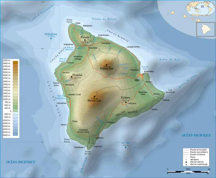
Hawaii Island topographic map
摘要
[编辑]| 描写 | |||
| 日期 | |||
| 来源 |
Français : Travail personnel.
Sources :
Logiciels utilisés :
Autres données :
English: Personal work.
Sources:
Software used:
Other Details:
|
||
| 創作作者 | |||
| 地理参考 | 如果不适当,请设置 warp_status = skip 为隐藏。 | ||
| 其他版本 | |||
| 署名 (由许可协议要求) | © Sémhur / Wikimedia Commons / | ||
| Assessments |
|
||
| SVG | W3C-validity not checked.
|
||
| Graphic Lab |


| 相机位置 | | 在以下服务上查看本图像和附近其他图像: OpenStreetMap |
|---|
许可协议
[编辑]
我,本作品著作权人,特此采用以下许可协议发表本作品:
| 非营利著作权:本艺术作品是自由的,您可以依据自由艺术作品许可协议的条款传播和/或修改本艺术作品。您可以在Copyleft Attitude网站或其他网站找到该许可协议的样本。 |
This file is licensed under the Creative Commons Attribution-Share Alike Attribution-Share Alike 4.0 International, 3.0 Unported, 2.5 Generic, 2.0 Generic and 1.0 Generic license.
- 您可以自由地:
- 共享 – 复制、发行并传播本作品
- 修改 – 改编作品
- 惟须遵守下列条件:
- 署名 – 您必须对作品进行署名,提供授权条款的链接,并说明是否对原始内容进行了更改。您可以用任何合理的方式来署名,但不得以任何方式表明许可人认可您或您的使用。
- 相同方式共享 – 如果您再混合、转换或者基于本作品进行创作,您必须以与原先许可协议相同或相兼容的许可协议分发您贡献的作品。
您可以选择您需要的许可协议。
文件历史
点击某个日期/时间查看对应时刻的文件。
| 日期/时间 | 缩略图 | 大小 | 用户 | 备注 | |
|---|---|---|---|---|---|
| 当前 | 2009年2月16日 (一) 12:24 | | 3,110 × 2,563(2.11 MB) | Sémhur(留言 | 贡献) | Valid SVG |
| 2008年5月7日 (三) 17:31 |  | 3,110 × 2,563(2.19 MB) | Sémhur(留言 | 贡献) | Route coupée trop courte, je rallonge. | |
| 2008年5月2日 (五) 17:57 |  | 3,110 × 2,563(2.18 MB) | Sémhur(留言 | 贡献) | Suppression d'une partie d'une route détruite par une coulée de lave | |
| 2008年5月1日 (四) 10:37 |  | 3,110 × 2,563(2.18 MB) | Sémhur(留言 | 贡献) | New version, with vectorized shaded relief | |
| 2008年4月29日 (二) 18:35 |  | 3,110 × 2,563(1,017 KB) | Sting(留言 | 贡献) | Slight correction | |
| 2008年4月29日 (二) 18:11 |  | 3,110 × 2,563(1,017 KB) | Sting(留言 | 贡献) | Added legend | |
| 2008年4月22日 (二) 16:01 |  | 3,110 × 2,563(1,012 KB) | Sémhur(留言 | 贡献) | Espacement de lettres (oubli) | |
| 2008年4月19日 (六) 08:45 |  | 3,110 × 2,563(1,011 KB) | Sémhur(留言 | 贡献) | Correction de l'altitude du Mauna Loa et espacement de lettres | |
| 2008年4月17日 (四) 19:04 |  | 3,110 × 2,563(995 KB) | Sémhur(留言 | 贡献) | Correction d'un problème avec le relief | |
| 2008年4月17日 (四) 18:47 |  | 3,110 × 2,563(996 KB) | Sémhur(留言 | 贡献) | == Description == {{Information |Description= {{en| Topographic Map in french of the island of Hawaii.}} {{fr| Carte topographique de l'île de Hawaii.}} |Source=Travail personnel. {{clr}} Sources : * Fond de carte : |
您不可以覆盖此文件。
文件用途
以下85个页面使用本文件:
- Wikimedia Conference Japan 2009/Commons写真展
- User:Aristeas/check
- User:John Cummings/gallerytest
- User:L.Kenzel/Category
- User:Miya/Introduction
- User:Miya/POTY/Diagrams2008
- User:Notafish/Votes 2008
- User:Sémhur
- User:Sémhur/Profile
- User talk:Sting/Archive 01
- Commons:Bu proje sayfasının diğer dil sürümleri
- Commons:Conhece os nossos ilustradores
- Commons:Conoce a nuestros ilustradores
- Commons:Descobreix els nostres il.lustradors
- Commons:Descobrètz nòstres illustrators
- Commons:Découvrez nos illustrateurs
- Commons:Featured picture candidates/Image:Hawaii Island topographic map-fr.svg
- Commons:Featured picture candidates/Log/May 2008
- Commons:Featured pictures/Non-photographic media/Computer-generated
- Commons:Featured pictures/Non-photographic media/Entertainment
- Commons:Featured pictures/Non-photographic media/Exteriors
- Commons:Featured pictures/Non-photographic media/Maps
- Commons:Featured pictures/Non-photographic media/Others
- Commons:Featured pictures/Non-photographic media/People
- Commons:Featured pictures/Non-photographic media/Printed
- Commons:Featured pictures/Non-photographic media/Religion
- Commons:Featured pictures/Non-photographic media/Science
- Commons:Meet our illustrators
- Commons:Meet our illustrators/People
- Commons:Picture of the Year/2008/Galleries/All
- Commons:Picture of the Year/2008/Galleries/Diagrams
- Commons:Picture of the Year/2008/Results/Round 1/Gallery/All
- Commons:Picture of the Year/2008/Results/Round 1/Gallery/Diagrams
- Commons:Picture of the Year 2008/File:Hawaii Island topographic map-fr.svg
- Commons:Potd/2010-02 (da)
- Commons:Potd/2010-02 (de)
- Commons:Potd/2010-02 (nl)
- Commons:Potd/2010-02 (pt)
- Commons:Poznaj naszych grafików
- Commons:Scopri i nostri illustratori
- Commons:Scummigghia ê nostri llustratura
- Commons:Unsere Illustratoren stellen sich vor
- Commons:Unseri Illustratore stelle sich vor
- Commons:Upoznajte naše ilustratore
- Commons:Çizerlerimizle tanışın
- Commons:Запознајте ги нашите илустратори
- Commons:Знайомтесь з нашими ілюстраторами
- Commons:Знакомьтесь с нашими иллюстраторами
- Commons:قابل رسامينا
- Commons:私達のイラストレータをご紹介します
- Commons:结识我们的插图师
- Commons:우리들의 삽화가를 만나보세요
- File:Hawaii Island topographic map-en.svg
- File:Hawaii Island topographic map-fr-vectorized.svg
- File:Hawaii saare kaart.png
- Template:Non-photographic FP galleries top
- Template:Other versions/Hawaii Island topographic map
- Template:Potd/2010-02
- Template:Potd/2010-02-12
- Template:Potd/2010-02-12 (bn)
- Template:Potd/2010-02-12 (bs)
- Template:Potd/2010-02-12 (ca)
- Template:Potd/2010-02-12 (cs)
- Template:Potd/2010-02-12 (da)
- Template:Potd/2010-02-12 (de)
- Template:Potd/2010-02-12 (en)
- Template:Potd/2010-02-12 (es)
- Template:Potd/2010-02-12 (fa)
- Template:Potd/2010-02-12 (fi)
- Template:Potd/2010-02-12 (fr)
- Template:Potd/2010-02-12 (hu)
- Template:Potd/2010-02-12 (it)
- Template:Potd/2010-02-12 (ko)
- Template:Potd/2010-02-12 (mk)
- Template:Potd/2010-02-12 (nl)
- Template:Potd/2010-02-12 (pam)
- Template:Potd/2010-02-12 (pl)
- Template:Potd/2010-02-12 (pt)
- Template:Potd/2010-02-12 (ro)
- Template:Potd/2010-02-12 (ru)
- Template:Potd/2010-02-12 (sv)
- Template:Potd/2010-02-12 (uk)
- Template:Potd/2010-02-12 (zh-hans)
- Template:Potd/2010-02-12 (zh-hant)
- Template:Potd/2010-02 (zh-hans)
全域文件用途
以下其他wiki使用此文件:
- af.wikipedia.org上的用途
- ar.wikipedia.org上的用途
- bn.wikipedia.org上的用途
- crh.wikipedia.org上的用途
- cv.wikipedia.org上的用途
- en.wikipedia.org上的用途
- eo.wikipedia.org上的用途
- es.wikipedia.org上的用途
- eu.wikipedia.org上的用途
- fr.wikipedia.org上的用途
- Analogique
- Mauna Kea
- Mauna Loa
- Utilisateur:Sémhur
- Hawaï (île)
- Hualālai
- Discussion aide:Cartographie
- Discussion Wikipédia:Wikiconcours/mars 2008/Équipes/Équipe 5
- Projet:Impression/Wikigraphistes
- Utilisateur:Sémhur/Récompenses
- Wikipédia:Image du jour/juin 2010
- Wikipédia:Image du jour/16 juin 2010
- Kohala (volcan)
- Cap Kumukahi
- Phare du cap Kumukahi
- Discussion Wikipédia:Atelier graphique/Archive 10
- fr.wikinews.org上的用途
- hu.wikipedia.org上的用途
- id.wikipedia.org上的用途
- it.wikipedia.org上的用途
- ko.wikipedia.org上的用途
- krc.wikipedia.org上的用途
- lbe.wikipedia.org上的用途
- lv.wikipedia.org上的用途
- mg.wikipedia.org上的用途
- mk.wikipedia.org上的用途
- mt.wikipedia.org上的用途
查看此文件的更多全域用途。