File:Maria 2017-09-20 1045Z.jpg
(Redirected from File:Hurricane Maria Makes Landfall in Puerto Rico (37224066361).jpg)

Size of this preview: 800 × 565 pixels. Other resolutions: 320 × 226 pixels | 640 × 452 pixels | 1,020 × 720 pixels.
Original file (1,020 × 720 pixels, file size: 410 KB, MIME type: image/jpeg)
Captions
Captions
Add a one-line explanation of what this file represents

.jpg&redirect=no)
Summary[edit]
| Description |
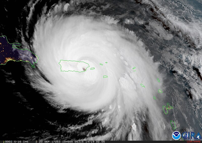
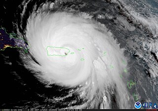
English: This GOES-16 geocolor image was captured as Category 4 Hurricane Maria made landfall near Yabucoa, Puerto Rico, around 6:15 a.m. EDT on September 20, 2017.
Maria knocked out radar on the island just before Maria made landfall. With this critical technology disabled and a major hurricane approaching, forecasters were able to utilize data from NOAA’s latest geostationary satellite, GOES-16, to track the storm in real-time. Learn more at www.goes-r.gov/mission/hurricaneMaria.html Image credit: CIRA |
| Date | |
| Source | https://www.flickr.com/photos/noaasatellites/37224066361/ |
| Author | NOAA |
Licensing[edit]
| This image was originally posted to Flickr by NOAASatellites at https://flickr.com/photos/125201706@N06/37224066361. It was reviewed on 22 September 2017 by FlickreviewR and was confirmed to be licensed under the terms of the Public Domain Mark. |
This image is in the public domain because it contains materials that originally came from the U.S. National Oceanic and Atmospheric Administration, taken or made as part of an employee's official duties.
|
File history
Click on a date/time to view the file as it appeared at that time.
| Date/Time | Thumbnail | Dimensions | User | Comment | |
|---|---|---|---|---|---|
| current | 01:12, 22 September 2017 | | 1,020 × 720 (410 KB) | A1Cafel (talk | contribs) | User created page with UploadWizard |
You cannot overwrite this file.
File usage on Commons
The following page uses this file:
File usage on other wikis
The following other wikis use this file:
- Usage on fi.wikipedia.org