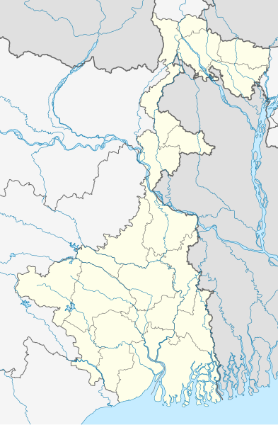
File:India West Bengal location map.svg

原始文件 (SVG文件,尺寸为974 × 1,486像素,文件大小:633 KB)
说明
说明
摘要
[编辑]| 描述India West Bengal location map.svg |
Quadratische Plattkarte, N-S-Streckung 110 %. Geographische Begrenzung der Karte:
Equirectangular projection, N/S stretching 110 %. Geographic limits of the map:
|
|
| 日期 | ||
| 来源 |
自己的作品, using
|
|
| 作者 | NordNordWest | |
| 授权 (二次使用本文件) |
本文件采用知识共享署名-相同方式共享 3.0 德国许可协议授权。
 本文件采用知识共享署名-相同方式共享 3.0 德国许可协议授权。
 |

|
azərbaycanca ∙ čeština ∙ Deutsch ∙ Deutsch (Sie-Form) ∙ English ∙ español ∙ français ∙ italiano ∙ latviešu ∙ magyar ∙ Nederlands ∙ Plattdüütsch ∙ polski ∙ português ∙ română ∙ sicilianu ∙ slovenščina ∙ suomi ∙ македонски ∙ русский ∙ ქართული ∙ հայերեն ∙ বাংলা ∙ ไทย ∙ +/−
|
文件历史
点击某个日期/时间查看对应时刻的文件。
| 日期/时间 | 缩略图 | 大小 | 用户 | 备注 | |
|---|---|---|---|---|---|
| 当前 | 2022年5月13日 (五) 03:47 |  | 974 × 1,486(633 KB) | C1MM(留言 | 贡献) | Corrected Bihar/Jharkhand border |
| 2021年4月5日 (一) 04:32 |  | 1,039 × 1,585(726 KB) | C1MM(留言 | 贡献) | Corrected rivers and coastline | |
| 2021年3月11日 (四) 07:51 |  | 1,039 × 1,585(360 KB) | Sbb1413(留言 | 贡献) | Updated to include newer districts. | |
| 2010年4月1日 (四) 19:52 |  | 1,039 × 1,585(332 KB) | NordNordWest(留言 | 贡献) | =={{int:filedesc}}== {{Information |Description= {{de|Positionskarte von Westbengalen, Indien}} Quadratische Plattkarte, N-S-Streckung 110 %. Geographische Begrenzung der Karte: * N: 27.4° N * S: 21.3° N * W: 85.6° O |
您不可以覆盖此文件。
文件用途
以下44个页面使用本文件:
- পশ্চিমবঙ্গ
- User:MdsShakil/Bangladesh/2022 May 11-20
- User:NordNordWest/Gallery/Location maps
- File:West Bengal location map.svg(文件重定向)
- Category:Airports in West Bengal
- Category:Archaeological sites in West Bengal
- Category:Births in West Bengal
- Category:Bridges in West Bengal
- Category:Buddhism in West Bengal
- Category:Canals in West Bengal
- Category:Dams in West Bengal
- Category:Deaths in West Bengal
- Category:Festivals of West Bengal
- Category:Film directors from West Bengal
- Category:Films set in West Bengal
- Category:Flora of West Bengal
- Category:Forts in West Bengal
- Category:Hill stations in West Bengal
- Category:Hills of West Bengal
- Category:Hospitals in West Bengal
- Category:Jain temples in West Bengal
- Category:Judaism in West Bengal
- Category:Lakes of West Bengal
- Category:Local government in West Bengal
- Category:Maps of West Bengal
- Category:Monuments of National Importance in West Bengal
- Category:Mountains of West Bengal
- Category:Museums in West Bengal
- Category:Palaces in West Bengal
- Category:Populated places in West Bengal
- Category:Postcards of West Bengal
- Category:Power plants in West Bengal
- Category:Rail transport in West Bengal
- Category:Railway junction stations in West Bengal
- Category:Railway stations in West Bengal
- Category:Rivers of West Bengal
- Category:Roads in West Bengal
- Category:Semaphores in West Bengal
- Category:Shiva temples in West Bengal
- Category:Sports venues in West Bengal
- Category:Temples in West Bengal
- Category:Transport in West Bengal
- Category:Visitor attractions in West Bengal
- Category:West Bengal
全域文件用途
以下其他wiki使用此文件:
- ceb.wikipedia.org上的用途
- de.wikipedia.org上的用途
- de.wikivoyage.org上的用途
- en.wikipedia.org上的用途
- Kolkata
- Kalimpong
- Dum Dum
- Serampore College
- Shantiniketan
- Howrah
- Netaji Subhas Chandra Bose International Airport
- Asansol
- Murshidabad
- Jadavpur
- Mahananda Wildlife Sanctuary
- Kharagpur
- Siliguri
- Narendrapur
- Shibpur
- Teesta Bazaar
- Lava, West Bengal
- Barasat
- Chandannagar
- Bardhaman
- Bagdogra Airport
- Bagdogra
- New Jalpaiguri Junction railway station
- Barrackpore
- Tamluk
- Garbeta
- Durgapur
- Serampore
- Haldia
- Midnapore
- Belur, West Bengal
- Jaldapara National Park
- Mayapur
- Bhatpara
- Adra, Purulia
- Jalpaiguri
- Naxalbari
- Dakshineswar
- Hugli-Chuchura
- Palashi
- Alipurduar
- Purulia
- Halisahar
- Batanagar
- Panihati
- Khardaha
查看此文件的更多全域用途。
元数据
此文件含有额外信息,这些信息可能是创建或数字化该文件时使用的数码相机或扫描仪所添加的。如果文件已从其原始状态修改,某些详细信息可能无法完全反映修改后的文件。
| 宽度 | 274.99548mm |
|---|---|
| 高度 | 419.37015mm |
