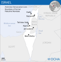
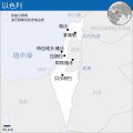
File:Israel - Location Map (2012) - ISR - UNOCHA.svg
- Fichier
- Historique du fichier
- Utilisations locales du fichier
- Utilisations du fichier sur d’autres wikis
- Métadonnées

Fichier d’origine (Fichier SVG, nominalement de 250 × 250 pixels, taille : 141 kio)
Légendes
Légendes
Description
[modifier]| DescriptionIsrael - Location Map (2012) - ISR - UNOCHA.svg |
English: Locator map of Israel. العربية: خريطة إسرائيل. |
| Date | |
| Source |
English: [1], OCHA, UNCS |
| Auteur | |
| Autres versions |
|
| SVG information InfoField |
Conditions d’utilisation
[modifier]- Vous êtes libre :
- de partager – de copier, distribuer et transmettre cette œuvre
- d’adapter – de modifier cette œuvre
- Sous les conditions suivantes :
- paternité – Vous devez donner les informations appropriées concernant l'auteur, fournir un lien vers la licence et indiquer si des modifications ont été faites. Vous pouvez faire cela par tout moyen raisonnable, mais en aucune façon suggérant que l’auteur vous soutient ou approuve l’utilisation que vous en faites.
 This map is part of a collection of 216 free country maps, created by the UN Office for the Coordination of Humanitarian Affairs (OCHA), to be used in print, web or broadcast products.
The ReliefWeb Location Maps released here are maps that highlight a country, its capital, major populated places and the surrounding regions. Attribution Requirements
Using the map without modifications: ensure that the sources and the disclaimer are below the map. Credit as follows: "Credit: OCHA". For use with alteration: remove the OCHA logo and disclaimer following any modification to the map, but keep the data sources as mentioned below the map. Credit the modified map as follows: "Based on OCHA map". You are responsible for the content of your map. We are keen to receive your feedback and hear how you used OCHA's maps. We would be grateful if you would notify us by e-mail and share your work with us. UN Disclaimer
The designations employed and the presentation of material of this map do not imply the expression of any opinion whatsoever on the part of the Secretariat of the United Nations concerning the legal status of any country, territory, city or area or of its authorities or concerning the delimitation of its frontiers or boundaries. |
|
Une autorisation pour utiliser ce fichier via la (les) licence(s) ci-dessous a été vérifiée et archivée dans le système VRT ; elle est disponible sous le numéro de ticket #2014031410007248 pour les agents disposant d'un accès sur VRTS. Si vous souhaitez réutiliser ce travail, il n'est pas nécessaire de détenir davantage de permissions que celles données par la licence indiquée sur cette page. Voir aussi cette page pour la réutilisation du contenu hors de Wikimedia. Pour vérifier cette autorisation, n'hésitez pas à contacter un membre de l'équipe VRT.
Lien vers le ticket : https://ticket.wikimedia.org/otrs/index.pl?Action=AgentTicketZoom&TicketNumber=2014031410007248
|

|
Des informations concernant cette image étaient incrustées dans l'image originale. Ces informations ont été déplacées dans les métadonnées et/ou la page de description de l'image. Ainsi, l'image est plus facilement réutilisable, l'information n'est pas restreinte à une langue particulière et il est plus facile de modifier ou rechercher l'information. Wikimedia Commons déconseille fortement l'incrustation visible d'informations dans les images. Toutes les licences acceptées sur Commons permettent les modifications du type de celles qui ont été effectuées ici, qui correspondent à la création d'une œuvre dérivée.
Si des informations regardant le droit d'auteur ont été enlevées et que l'image n'est pas dans le domaine public, remplacez ce modèle par {{Attribution metadata from licensed image}}.
беларуская (тарашкевіца) | català | Deutsch | English | español | فارسی | français | galego | magyar | italiano | македонски | മലയാളം | português | русский | sicilianu | slovenščina | svenska | Indonesia | 中文 | +/− |
Historique du fichier
Cliquer sur une date et heure pour voir le fichier tel qu'il était à ce moment-là.
| Date et heure | Vignette | Dimensions | Utilisateur | Commentaire | |
|---|---|---|---|---|---|
| actuel | 8 octobre 2023 à 08:26 |  | 250 × 250 (141 kio) | Trần Nguyễn Minh Huy (d | contributions) | File uploaded using svgtranslate tool (https://svgtranslate.toolforge.org/). Added translation for vi. |
| 27 juillet 2022 à 06:39 |  | 250 × 250 (140 kio) | Enkhsaihan2005 (d | contributions) | File uploaded using svgtranslate tool (https://svgtranslate.toolforge.org/). Added translation for mn. | |
| 27 juillet 2022 à 06:38 |  | 250 × 250 (139 kio) | Enkhsaihan2005 (d | contributions) | File uploaded using svgtranslate tool (https://svgtranslate.toolforge.org/). Added translation for mn. | |
| 28 mars 2022 à 01:48 |  | 250 × 250 (136 kio) | Nyilvoskt (d | contributions) | File uploaded using svgtranslate tool (https://svgtranslate.toolforge.org/). Added translation for id. | |
| 17 février 2022 à 15:21 |  | 250 × 250 (134 kio) | Kurmanbek (d | contributions) | File uploaded using svgtranslate tool (https://svgtranslate.toolforge.org/). Added translation for tr. | |
| 17 février 2016 à 22:27 |  | 250 × 250 (130 kio) | Wereldburger758 (d | contributions) | Resized page to drawing. Removal watermark. Validation of image. | |
| 19 août 2014 à 03:21 |  | 250 × 250 (185 kio) | Pharos (d | contributions) | == {{int:filedesc}} == {{Information |description={{en|1=Locator map of Chile.}} |date=2013 |source={{en|1=[http://reliefweb.int/map/chile/chile-location-map-2013 Chile Locator Map (ReliefWeb)]}} |author={{en|1=[[w:en:United Nations Offi... |
Vous ne pouvez pas remplacer ce fichier.
Utilisations locales du fichier
Les 7 pages suivantes utilisent ce fichier :
- User:Chinggis6/Favorites
- User:Chumwa/OgreBot/Potential transport maps/2016 February 10-19
- User:Geagea/Israel/2016 February 17
- File:Israel - Location Map (2012) - ISR - UNOCHA-ar.svg
- File:Israel - Location Map (2012) - ISR - UNOCHA-id.svg
- File:Israel - Location Map (2012) - ISR - UNOCHA-ur.svg
- File:Israel - Location Map (2012) - ISR - UNOCHA-zh.svg
Utilisations du fichier sur d’autres wikis
Les autres wikis suivants utilisent ce fichier :
- Utilisation sur ann.wikipedia.org
- Utilisation sur ar.wikipedia.org
- Utilisation sur az.wikipedia.org
- Utilisation sur ban.wikipedia.org
- Utilisation sur bcl.wikipedia.org
- Utilisation sur bh.wikipedia.org
- Utilisation sur blk.wikipedia.org
- Utilisation sur bxr.wikipedia.org
- Utilisation sur dty.wikipedia.org
- Utilisation sur en.wikipedia.org
- Utilisation sur es.wikipedia.org
- Utilisation sur eu.wikipedia.org
- Utilisation sur fa.wikipedia.org
- Utilisation sur fr.wikipedia.org
- Utilisation sur gu.wikipedia.org
- Utilisation sur hy.wikipedia.org
- Utilisation sur iba.wikipedia.org
- Utilisation sur id.wikipedia.org
- Utilisation sur incubator.wikimedia.org
- Utilisation sur ka.wikipedia.org
- Utilisation sur ks.wikipedia.org
- Utilisation sur lo.wikipedia.org
- Utilisation sur ml.wikipedia.org
- Utilisation sur mn.wikipedia.org
- Utilisation sur mzn.wikipedia.org
- Utilisation sur ne.wikipedia.org
- Utilisation sur nso.wikipedia.org
- Utilisation sur pa.wikipedia.org
- Utilisation sur pnb.wikipedia.org
- Utilisation sur ro.wikipedia.org
- Utilisation sur ru.wikipedia.org
- Utilisation sur sco.wikipedia.org
- Utilisation sur sd.wikipedia.org
- Utilisation sur si.wikipedia.org
- Utilisation sur sl.wikipedia.org
- Utilisation sur sq.wikipedia.org
- Utilisation sur su.wikipedia.org
Voir davantage sur l’utilisation globale de ce fichier.
Métadonnées
Ce fichier contient des informations supplémentaires, probablement ajoutées par l'appareil photo numérique ou le numériseur utilisé pour le créer.
Si le fichier a été modifié depuis son état original, certains détails peuvent ne pas refléter entièrement l'image modifiée.
| Largeur | 249.981 |
|---|---|
| Hauteur | 250.10699 |


