File:Junction near Holm Dale (geograph 4150325).jpg
Jump to navigation
Jump to search

Size of this preview: 800 × 571 pixels. Other resolutions: 320 × 229 pixels | 640 × 457 pixels | 1,024 × 731 pixels | 1,280 × 914 pixels | 2,814 × 2,010 pixels.
Original file (2,814 × 2,010 pixels, file size: 1.05 MB, MIME type: image/jpeg)
Captions
Captions
Add a one-line explanation of what this file represents
Summary
[edit].jpg&action=edit§ion=1)
| Description |
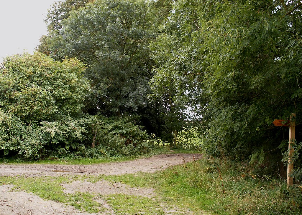
English: Junction near Holm Dale, Huggate, East Riding of Yorkshire, England. The Yorkshire Wolds Way drops down into Holm Dale at a point near a finger post just seen in the background. A view from the other side is seen in SE8758 : Top of Holm Dale. The near finger post marks a bridleway along Green Lane to Holmfield Farm whilst to the right a byway called Cowpasture Road runs to the A166. |
| Date | |
| Source | From geograph.org.uk |
| Author | Christopher Hall |
| Permission (Reusing this file) |
Creative Commons Attribution Share-alike license 2.0 |
| Attribution (required by the license) | Christopher Hall / Junction near Holm Dale / |
.jpg)
| Camera location | | View this and other nearby images on: OpenStreetMap |
|---|
.jpg¶ms=054.015206_N_-000.667206_E_globe:Earth_type:camera_source:geograph-osgb36(SE87435851)_heading:157.00&language=en)
| Object location | | View this and other nearby images on: OpenStreetMap |
|---|
.jpg¶ms=054.014840_N_-000.667070_E_globe:Earth_class:object_type:object_source:geograph-osgb36(SE87445847)_heading:157.00&language=en)
Licensing
[edit].jpg&action=edit§ion=2)

|
This image was taken from the Geograph project collection. See this photograph's page on the Geograph website for the photographer's contact details. The copyright on this image is owned by Christopher Hall and is licensed for reuse under the Creative Commons Attribution-ShareAlike 2.0 license.
|
This file is licensed under the Creative Commons Attribution-Share Alike 2.0 Generic license.
Attribution: Christopher Hall
- You are free:
- to share – to copy, distribute and transmit the work
- to remix – to adapt the work
- Under the following conditions:
- attribution – You must give appropriate credit, provide a link to the license, and indicate if changes were made. You may do so in any reasonable manner, but not in any way that suggests the licensor endorses you or your use.
- share alike – If you remix, transform, or build upon the material, you must distribute your contributions under the same or compatible license as the original.
File history
Click on a date/time to view the file as it appeared at that time.
| Date/Time | Thumbnail | Dimensions | User | Comment | |
|---|---|---|---|---|---|
| current | 23:40, 7 December 2021 | | 2,814 × 2,010 (1.05 MB) | Keith D (talk | contribs) | == {{int:filedesc}} == {{Information |Description={{en|1=Junction near Holm Dale, Huggate, East Riding of Yorkshire, England.<br />The Yorkshire Wolds Way drops down into Holm Dale at a point near a finger post just seen in the background. A view from the other side is seen in SE8758 : Top of Holm Dale. The near finger post marks a bridleway along Green Lane to Holmfield Farm whilst to the right... |
You cannot overwrite this file.
File usage on Commons
There are no pages that use this file.
.jpg&oldid=716070179)