File:Map of Kharkov (1896).jpg
Jump to navigation
Jump to search

Size of this preview: 800 × 577 pixels. Other resolutions: 320 × 231 pixels | 640 × 461 pixels | 1,024 × 738 pixels | 1,280 × 923 pixels | 2,000 × 1,442 pixels.
Original file (2,000 × 1,442 pixels, file size: 433 KB, MIME type: image/jpeg)
Captions
Captions
Add a one-line explanation of what this file represents
| Description |
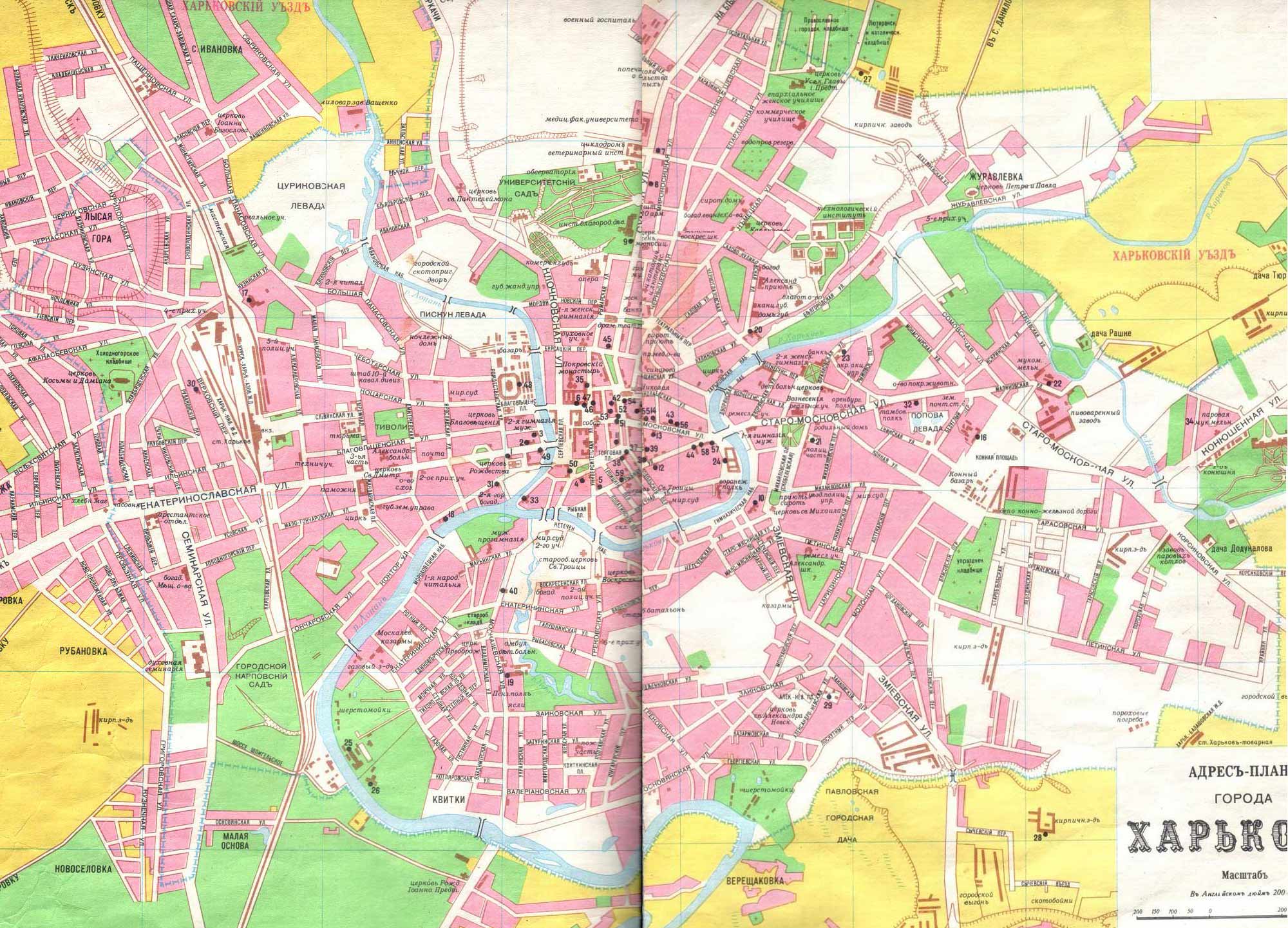
English: Map of Kharkiv
Русский: Карта Харькова |
|||
| Date | ||||
| Source | http://tourist.kharkov.ua/map/history/kharkov_1896.jpg | |||
| Author | Unknown author | |||
| Permission (Reusing this file) |
|

File history
Click on a date/time to view the file as it appeared at that time.
| Date/Time | Thumbnail | Dimensions | User | Comment | |
|---|---|---|---|---|---|
| current | 07:57, 2 July 2008 | | 2,000 × 1,442 (433 KB) | Butko (talk | contribs) | {{Information |Description= {{en|Map of Kharkov}} {{ru|Карта Харькова}} |Source=http://tourist.kharkov.ua/map/history/kharkov_1896.jpg |Date=1896 |Author=unknown |Permission={{PD-Ukraine}} |other_versions= }} Category:Maps of Kharkov [[C |
You cannot overwrite this file.
File usage on Commons
The following page uses this file:
.jpg&oldid=911941646)