File:Montana regions map.png
Jump to navigation
Jump to search
Size of this preview: 800 × 476 pixels. Other resolutions: 320 × 190 pixels | 640 × 381 pixels | 1,024 × 609 pixels | 1,280 × 762 pixels | 2,542 × 1,513 pixels.
Original file (2,542 × 1,513 pixels, file size: 1.16 MB, MIME type: image/png)
Captions
Captions
Add a one-line explanation of what this file represents
Summary[edit]
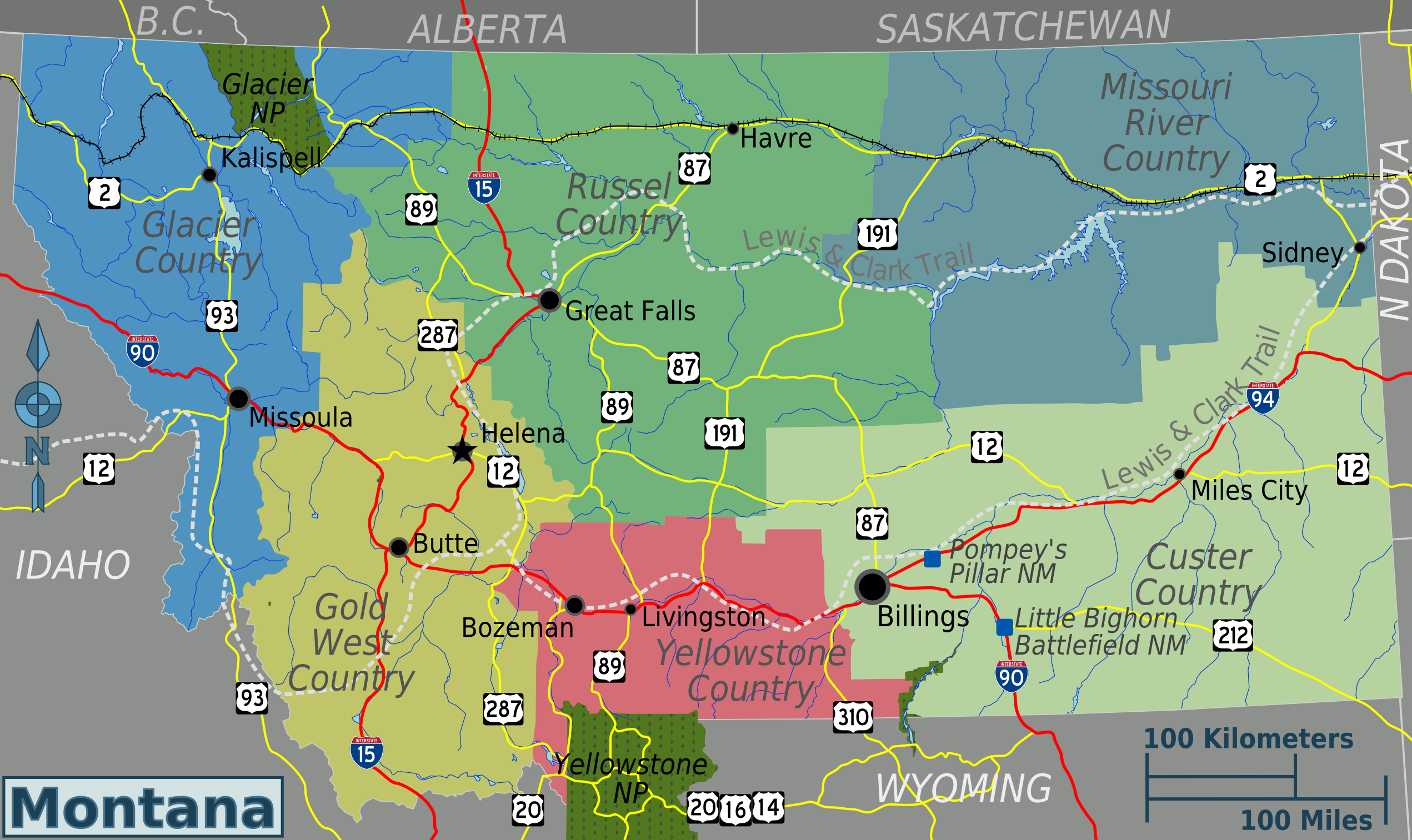
| Description | Montana regions map for use on Wikivoyage, English version |
| Date | |
| Source | Own work based on the USG map |
| Author | Peter Fitzgerald |
| Other versions |
Licensing[edit]
This file is licensed under the Creative Commons Attribution 3.0 Unported license.
- You are free:
- to share – to copy, distribute and transmit the work
- to remix – to adapt the work
- Under the following conditions:
- attribution – You must give appropriate credit, provide a link to the license, and indicate if changes were made. You may do so in any reasonable manner, but not in any way that suggests the licensor endorses you or your use.
Original upload log[edit]
| This file was imported from Wikivoyage WTS. |
The original description page was here. All following user names refer to wts.wikivoyage-old.
- 2009-10-29 06:34 (WT-shared) Peterfitzgerald archive copy at the Wayback Machine 2542×1513 (1215680 bytes) {{Imagecredit|credit=Peter Fitzgerald|captureDate=29 October 2009|location=Montana|source=[[:Image:Montana regions map.svg]]|caption=Montana (Import from wikitravel.org/shared)
File history
Click on a date/time to view the file as it appeared at that time.
| Date/Time | Thumbnail | Dimensions | User | Comment | |
|---|---|---|---|---|---|
| current | 01:26, 18 November 2012 | | 2,542 × 1,513 (1.16 MB) | MGA73bot2 (talk | contribs) | {{BotMoveToCommons|wts.oldwikivoyage|year={{subst:CURRENTYEAR}}|month={{subst:CURRENTMONTHNAME}}|day={{subst:CURRENTDAY}}}} == {{int:filedesc}} == {{Information |description=Montana regions map. English version, Montana * Map of: Montana¤ |date=29 Oct... |
You cannot overwrite this file.
File usage on Commons
There are no pages that use this file.
File usage on other wikis
The following other wikis use this file: