File:Mountain bike trail, Llandegla Forest - geograph.org.uk - 1219519.jpg
Jump to navigation
Jump to search
Size of this preview: 400 × 600 pixels. Other resolutions: 160 × 240 pixels | 427 × 640 pixels.
Original file (427 × 640 pixels, file size: 128 KB, MIME type: image/jpeg)
Captions
Captions
Add a one-line explanation of what this file represents
Summary
[edit]| Description |
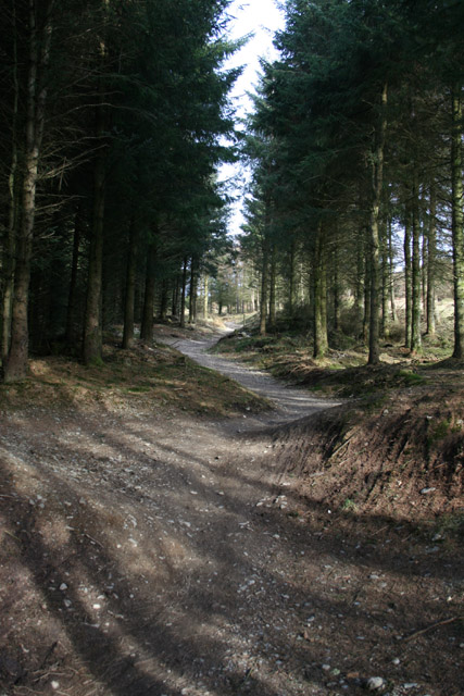
English: Mountain bike trail, Llandegla Forest UPM Tilhill has constructed a network of graded mountain bike trails in Llandegla Forest, suitable for a range of cycling abilities from beginner to expert; there is no access for walkers on these trails. This 7.5 mile beginner trail runs immediately north east of the forestry track marked on the OS map, near the edge of the plantation. The distance is in SJ2149. For more information, see: http://www.coedllandegla.com/index.htm |
| Date | |
| Source | From geograph.org.uk |
| Author | Espresso Addict |
| Attribution (required by the license) | Espresso Addict / Mountain bike trail, Llandegla Forest / |
| Camera location | | View this and other nearby images on: OpenStreetMap |
|---|
| Object location | | View this and other nearby images on: OpenStreetMap |
|---|
Licensing
[edit]
|
This image was taken from the Geograph project collection. See this photograph's page on the Geograph website for the photographer's contact details. The copyright on this image is owned by Espresso Addict and is licensed for reuse under the Creative Commons Attribution-ShareAlike 2.0 license.
|
This file is licensed under the Creative Commons Attribution-Share Alike 2.0 Generic license.
Attribution: Espresso Addict
- You are free:
- to share – to copy, distribute and transmit the work
- to remix – to adapt the work
- Under the following conditions:
- attribution – You must give appropriate credit, provide a link to the license, and indicate if changes were made. You may do so in any reasonable manner, but not in any way that suggests the licensor endorses you or your use.
- share alike – If you remix, transform, or build upon the material, you must distribute your contributions under the same or compatible license as the original.

_heading:135.00&language=en)
_heading:135.00&language=en)
File history
Click on a date/time to view the file as it appeared at that time.
| Date/Time | Thumbnail | Dimensions | User | Comment | |
|---|---|---|---|---|---|
| current | 05:56, 30 December 2011 | | 427 × 640 (128 KB) | Rotatebot (talk | contribs) | Bot: Reset EXIF-specified Orientation of image (EXIF-Orientation set from 6 to 1, rotated 0°) |
| 07:09, 26 February 2011 |  | 640 × 427 (129 KB) | GeographBot (talk | contribs) | == {{int:filedesc}} == {{Information |description={{en|1=Mountain bike trail, Llandegla Forest UPM Tilhill has constructed a network of graded mountain bike trails in Llandegla Forest, suitable for a range of cycling abilities from beginner to expert; the |
You cannot overwrite this file.
File usage on Commons
There are no pages that use this file.