File:Paris en 1760, Fac-similé du Plan de Robert de Vaougondy - Paris Musées.jpg
Jump to navigation
Jump to search

Size of this preview: 800 × 541 pixels. Other resolutions: 320 × 216 pixels | 640 × 432 pixels | 1,024 × 692 pixels | 1,280 × 865 pixels | 2,560 × 1,730 pixels | 12,456 × 8,416 pixels.
Original file (12,456 × 8,416 pixels, file size: 84.26 MB, MIME type: image/jpeg)
Captions
Captions
Add a one-line explanation of what this file represents
Summary
[edit]| Warning | The original file is very high-resolution. It might not load properly or could cause your browser to freeze when opened at full size. |
|---|
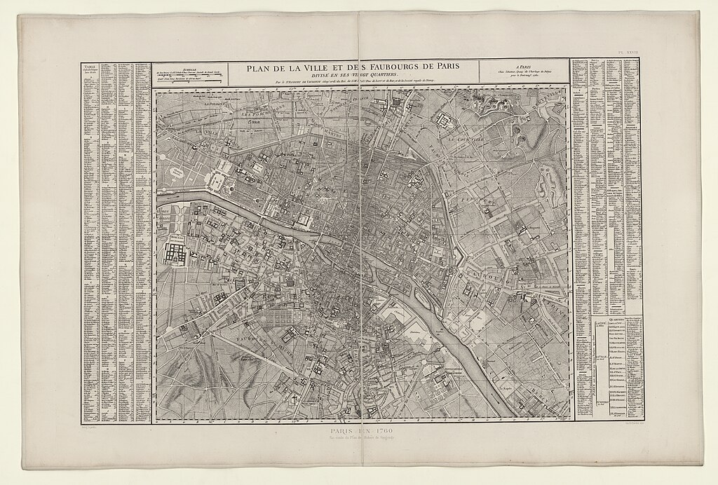
| Title |
PL. XXVIII / Plan de la Ville et des faubourgs de Paris / divisé en ses vingt quartiers. / Paris en 1760 / Fac-similé du Plan de Robert de Vaougondy. |
||||||||||||||||||||||||||
| Description |
English: An old map of Paris. |
||||||||||||||||||||||||||
| Source |
|
||||||||||||||||||||||||||
| Creator |
Paul Dujardin |
||||||||||||||||||||||||||
| Geotemporal data | |||||||||||||||||||||||||||
| Map location | Paris | ||||||||||||||||||||||||||
| Georeferencing | If inappropriate please set warp_status = skip to hide. | ||||||||||||||||||||||||||
| Bibliographic data | |||||||||||||||||||||||||||
| Part of the series | Atlas des anciens Plans de Paris | ||||||||||||||||||||||||||
| Language | french | ||||||||||||||||||||||||||
| Place of publication | Paris | ||||||||||||||||||||||||||
| Printed by |
Ch. Chardon (Aîné) |
||||||||||||||||||||||||||
| Archival data | |||||||||||||||||||||||||||
| Collection |
|
||||||||||||||||||||||||||
| Dimensions | 67.7 x 100.2 cm | ||||||||||||||||||||||||||
| Medium | Rotogravure | ||||||||||||||||||||||||||

Licensing
[edit]
|
This work is in the public domain in its country of origin and other countries and areas where the copyright term is the author's life plus 100 years or fewer. | |
| This file has been identified as being free of known restrictions under copyright law, including all related and neighboring rights. | |
File history
Click on a date/time to view the file as it appeared at that time.
| Date/Time | Thumbnail | Dimensions | User | Comment | |
|---|---|---|---|---|---|
| current | 13:00, 15 September 2021 | | 12,456 × 8,416 (84.26 MB) | Paris 16 (talk | contribs) | Uploaded own work with UploadWizard |
You cannot overwrite this file.
File usage on Commons
The following 2 pages use this file: