File:Path alongside the Beverley and Barmston Drain (geograph 6147459).jpg
Jump to navigation
Jump to search
Size of this preview: 800 × 600 pixels. Other resolutions: 320 × 240 pixels | 640 × 480 pixels | 1,024 × 768 pixels.
Original file (1,024 × 768 pixels, file size: 262 KB, MIME type: image/jpeg)
Captions
Captions
Add a one-line explanation of what this file represents
Summary
[edit].jpg&action=edit§ion=1)
| Description |
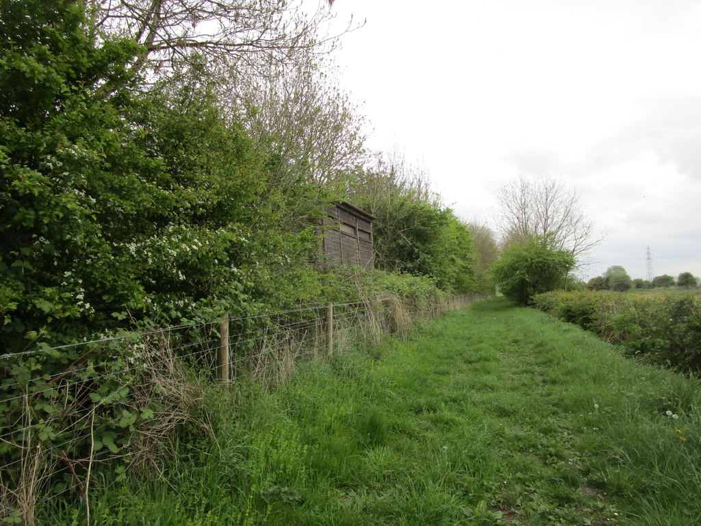
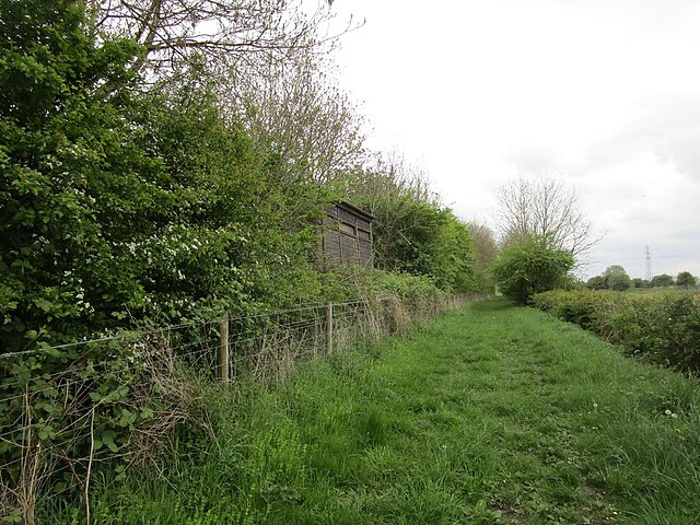
English: Path alongside the Beverley and Barmston Drain, Watton, East Riding of Yorkshire, England. A bird hide can be seen on the left. |
| Date | |
| Source | From geograph.org.uk |
| Author | Jonathan Thacker |
| Permission (Reusing this file) |
Creative Commons Attribution Share-alike license 2.0 |
| Attribution (required by the license) | Jonathan Thacker / Path alongside the Beverley and Barmston Drain / |
| Camera location | | View this and other nearby images on: OpenStreetMap |
|---|
.jpg¶ms=053.914933_N_-000.378068_E_globe:Earth_type:camera_source:geograph-osgb36(TA06634775)_heading:225.00&language=en)
| Object location | | View this and other nearby images on: OpenStreetMap |
|---|
.jpg¶ms=053.914760_N_-000.378380_E_globe:Earth_class:object_type:object_source:geograph-osgb36(TA06614773)_heading:225.00&language=en)
Licensing
[edit].jpg&action=edit§ion=2)

|
This image was taken from the Geograph project collection. See this photograph's page on the Geograph website for the photographer's contact details. The copyright on this image is owned by Jonathan Thacker and is licensed for reuse under the Creative Commons Attribution-ShareAlike 2.0 license.
|
This file is licensed under the Creative Commons Attribution-Share Alike 2.0 Generic license.
Attribution: Jonathan Thacker
- You are free:
- to share – to copy, distribute and transmit the work
- to remix – to adapt the work
- Under the following conditions:
- attribution – You must give appropriate credit, provide a link to the license, and indicate if changes were made. You may do so in any reasonable manner, but not in any way that suggests the licensor endorses you or your use.
- share alike – If you remix, transform, or build upon the material, you must distribute your contributions under the same or compatible license as the original.
File history
Click on a date/time to view the file as it appeared at that time.
| Date/Time | Thumbnail | Dimensions | User | Comment | |
|---|---|---|---|---|---|
| current | 20:28, 14 June 2023 | | 1,024 × 768 (262 KB) | Keith D (talk | contribs) | == {{int:filedesc}} == {{Information |Description={{en|1=Path alongside the Beverley and Barmston Drain, Watton, East Riding of Yorkshire, England.<br />A bird hide can be seen on the left.}} |Source=From [https://www.geograph.org.uk/photo/6147459 geograph.org.uk] |Date=2019-05-10 |Author=[https://www.geograph.org.uk/profile/46229 Jonathan Thacker] |Permission=Creative Commons Attribution Share-alike license 2.0 |Other... |
You cannot overwrite this file.
File usage on Commons
The following page uses this file:
.jpg&oldid=774599120)
Categories:
- Watton Carr Nature Reserve
- Beverley and Barmston Drain
- Bridleways in the East Riding of Yorkshire
- Bird hides in the East Riding of Yorkshire
- Fences in the East Riding of Yorkshire
- Hedges in Watton, East Riding of Yorkshire
- Trees in Watton, East Riding of Yorkshire
- Electricity pylons in the East Riding of Yorkshire
- May 2019 in the East Riding of Yorkshire