File:Rettenegg - Schwarzriegelmoos.JPG
Jump to navigation
Jump to search
Size of this preview: 800 × 533 pixels. Other resolutions: 320 × 213 pixels | 640 × 427 pixels | 1,024 × 683 pixels | 1,280 × 854 pixels | 2,560 × 1,707 pixels | 4,190 × 2,794 pixels.
Original file (4,190 × 2,794 pixels, file size: 9.7 MB, MIME type: image/jpeg)
Captions
Captions
Add a one-line explanation of what this file represents
Summary
[edit]| Description |
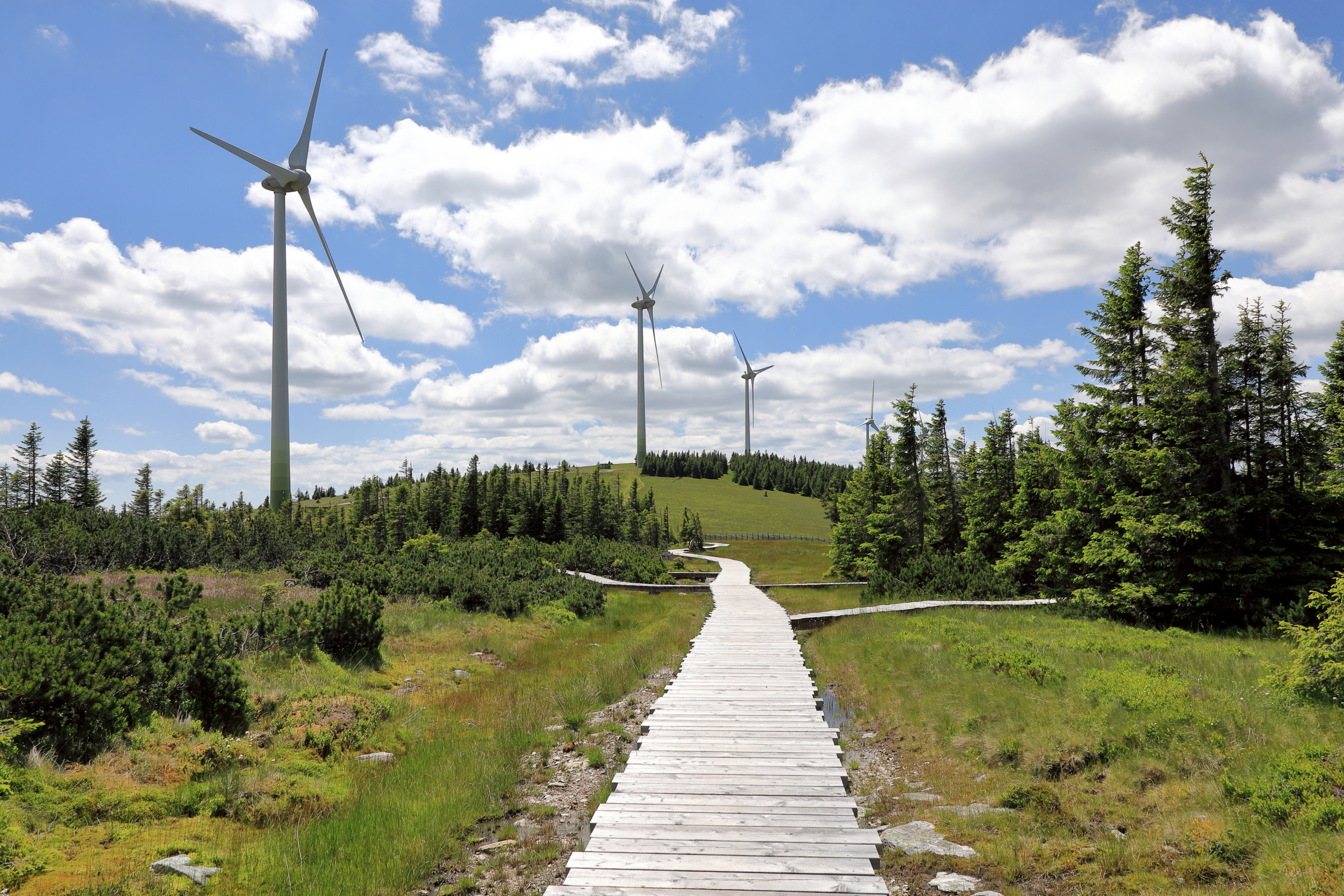
Deutsch: Das Schwarzriegelmoos zwischen dem Stuhleck (genaugenommen Schwarzriegel, 1593m) und der Pretul (genaugenommen Grazer Stuhleck, 1635m) an der Gemeindegrenze von Rettenegg und Mürzzuschlag. Im Zuge der Errichtung des landschaftsverschandelnden „Windparks Pretul“ (14 Windenergieanlagen (Nabenhöhe 78 m und 82 m Rotordurchmesser) mit einer Jahreserzeugung von rund 84 GWh; errichtet von 2015 bis 2017) wurde anschließend renaturiert und touristische Maßnahmen umgesetzt. Unter anderem wurde beim östlichsten Hochmoor der Zentralalpen, dem „Schwarzriegelmoos“, eine Aussichtsplattform, ein Naturlehrpfad und Holzstege über dem Moor errichtet (Projektname „Naturerlebnis Schwarzriegelmoos“, Eröffnung Herbst 2018). English: The Schwarzriegelmoos is the highest raised bog in the Central Alps on 1500 meters above sea level. The wind turbines were installed in the 2000s, after which the bog was renaturalised and a board walk put in place.
|
| Date | |
| Source | Own work |
| Author | C.Stadler/Bwag |
| Permission (Reusing this file) |
Deutsch: Hallo, du darfst mein Foto kostenlos nutzen, aber nenne mich bitte als Fotograf, beispielsweise „Foto: C.Stadler/Bwag“ oder © C.Stadler/Bwag; CC-BY-SA-4.0. Auf mehr Angaben bestehe ich nicht - im Gegensatz zu manch anderen, die die Vorgaben der unten angeführten Lizenzierung auf Punkt und Beistrich einfordern. English: Feel free to use my photos, but please mention me as the author like © C.Stadler/Bwag or © C.Stadler/Bwag; CC-BY-SA-4.0 (that's good enough) and if you want send me a message: bwag@gmx.net. |

| Object location | | View this and other nearby images on: OpenStreetMap |
|---|
| Camera location | | View this and other nearby images on: OpenStreetMap |
|---|
Licensing
[edit]
I, the copyright holder of this work, hereby publish it under the following license:
This file is licensed under the Creative Commons Attribution-Share Alike 4.0 International license.
- You are free:
- to share – to copy, distribute and transmit the work
- to remix – to adapt the work
- Under the following conditions:
- attribution – You must give appropriate credit, provide a link to the license, and indicate if changes were made. You may do so in any reasonable manner, but not in any way that suggests the licensor endorses you or your use.
- share alike – If you remix, transform, or build upon the material, you must distribute your contributions under the same or compatible license as the original.
This image was uploaded as part of Wiki Loves Earth 2020.
|
 |

|
Diese Datei wurde im Rahmen von WikiDaheim 2020 in Österreich erstellt und hochgeladen. Sie wurde dem Themenbereich Naturschutz zugeordnet. |
File history
Click on a date/time to view the file as it appeared at that time.
| Date/Time | Thumbnail | Dimensions | User | Comment | |
|---|---|---|---|---|---|
| current | 19:50, 7 July 2020 | | 4,190 × 2,794 (9.7 MB) | Bwag (talk | contribs) | {{Information |Description= {{de|1= Das Schwarzriegelmoor zwischen dem Stuhleck (Schwarzriegel, 1593m) und der Pretul (Grazer Stuhleck, 1635m) an der Gemeindegrenze von Rettenegg und Mürzzuschlag.<br/>Im Zuge der Errichtung des landschaftsverschandelnden „Windparks Pretul“ (2015-2017) wurden anschließend renaturiert und touristische Maßnahmen umgesetzt. Unter anderem wurde beim östlichsten Hochmoor der Zentralalpen, dem „Schwarzriegelmoos“, eine Aussichtsplattform, ein Naturlehrpfad und Holz... |
You cannot overwrite this file.
File usage on Commons
The following 2 pages use this file:
File usage on other wikis
The following other wikis use this file:
- Usage on de.wikipedia.org
- Usage on de.wikiversity.org
- Usage on www.wikidata.org
- Usage on zh.wikipedia.org