File:St Ives - Trewidden Road - geograph.org.uk - 2499669.jpg
From Wikimedia Commons, the free media repository
Jump to navigation
Jump to search
Size of this preview: 800 × 494 pixels. Other resolutions: 320 × 197 pixels | 640 × 395 pixels | 1,024 × 632 pixels | 1,280 × 790 pixels | 2,560 × 1,579 pixels | 4,098 × 2,528 pixels.
Original file (4,098 × 2,528 pixels, file size: 3.85 MB, MIME type: image/jpeg)
File information
Structured data
Captions
Summary
[edit]DescriptionSt Ives - Trewidden Road - geograph.org.uk - 2499669.jpg |
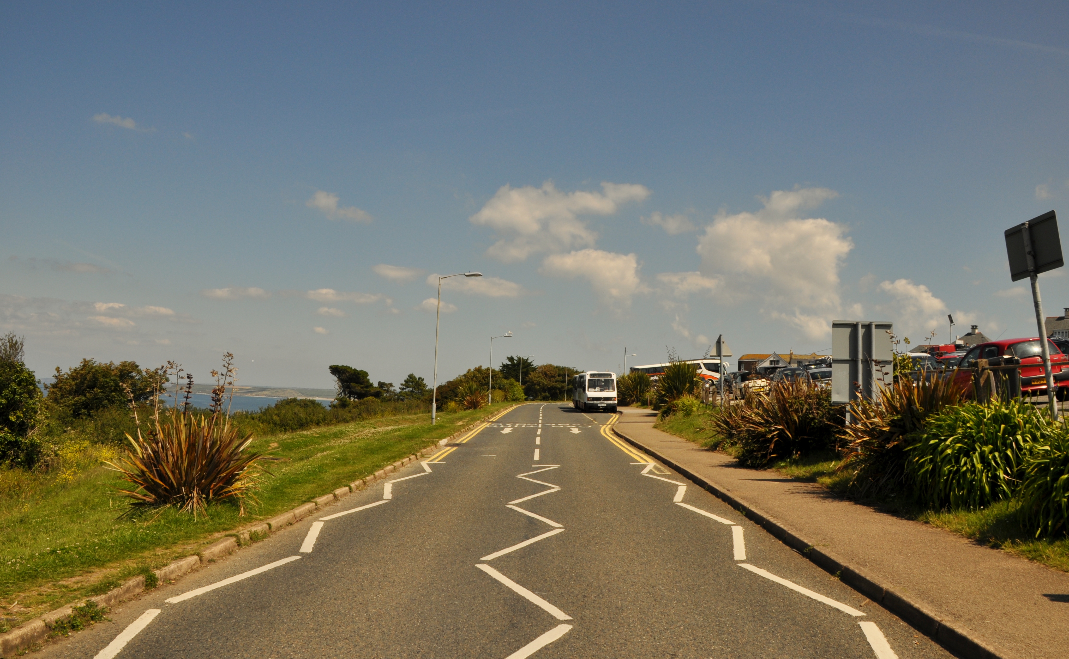
English: A view east along Trewidden Road in St Ives, Cornwall. On the right is Trenwith Car Park used by tourists visiting the town, both in private cars and in coach parties. They alight here, and catch the white minibus into the town. |
|||
Date | ||||
Source | From geograph.org.uk | |||
Author | Lewis Clarke | |||
Permission (Reusing this file) |
Creative Commons Attribution Share-alike license 2.0 | |||
Other versions |
|
|||
Attribution (required by the license) InfoField | Lewis Clarke / St Ives : Trewidden Road / | |||
InfoField | Lewis Clarke / St Ives : Trewidden Road |
Camera location | 50° 12′ 33.78″ N, 5° 29′ 06.41″ W | View this and other nearby images on: OpenStreetMap | 50.209384; -5.485115 |
---|
Licensing
[edit]This image was taken from the Geograph project collection. See this photograph's page on the Geograph website for the photographer's contact details. The copyright on this image is owned by Lewis Clarke and is licensed for reuse under the Creative Commons Attribution-ShareAlike 2.0 license.
|
This file is licensed under the Creative Commons Attribution-Share Alike 2.0 Generic license.
Attribution: Lewis Clarke
- You are free:
- to share – to copy, distribute and transmit the work
- to remix – to adapt the work
- Under the following conditions:
- attribution – You must give appropriate credit, provide a link to the license, and indicate if changes were made. You may do so in any reasonable manner, but not in any way that suggests the licensor endorses you or your use.
- share alike – If you remix, transform, or build upon the material, you must distribute your contributions under the same or compatible license as the original.
File history
Click on a date/time to view the file as it appeared at that time.
Date/Time | Thumbnail | Dimensions | User | Comment | |
---|---|---|---|---|---|
current | 15:01, 21 July 2011 | 4,098 × 2,528 (3.85 MB) | Ultra7 (talk | contribs) | == {{int:filedesc}} == {{Information |Description={{en|1=St Ives : Trewidden Road}} |Source=From [http://www.geograph.org.uk/photo/2499669 geograph.org.uk] |Date=2011-07-02 |Author=[http://www.geograph.org.uk/profile/11775 Lewis Clarke] |Permission=Creati |
You cannot overwrite this file.
File usage on Commons
The following page uses this file:
Metadata
This file contains additional information such as Exif metadata which may have been added by the digital camera, scanner, or software program used to create or digitize it. If the file has been modified from its original state, some details such as the timestamp may not fully reflect those of the original file. The timestamp is only as accurate as the clock in the camera, and it may be completely wrong.
Camera manufacturer | NIKON CORPORATION |
---|---|
Camera model | NIKON D5000 |
Exposure time | 1/400 sec (0.0025) |
F-number | f/10 |
ISO speed rating | 200 |
Date and time of data generation | 14:52, 2 July 2011 |
Lens focal length | 18 mm |
Altitude | 70 meters above sea level |
Orientation | Normal |
Horizontal resolution | 300 dpi |
Vertical resolution | 300 dpi |
Software used | Ver.1.00 |
File change date and time | 18:16, 4 July 2011 |
Y and C positioning | Co-sited |
Exposure Program | Not defined |
Exif version | 2.21 |
Date and time of digitizing | 14:52, 2 July 2011 |
Image compression mode | 4 |
APEX exposure bias | 0 |
Maximum land aperture | 3.6 APEX (f/3.48) |
Metering mode | Pattern |
Light source | Unknown |
Flash | Flash did not fire, auto mode |
DateTime subseconds | 50 |
DateTimeOriginal subseconds | 50 |
DateTimeDigitized subseconds | 50 |
Color space | sRGB |
Sensing method | One-chip color area sensor |
Custom image processing | Normal process |
Exposure mode | Auto exposure |
White balance | Auto white balance |
Digital zoom ratio | 1 |
Focal length in 35 mm film | 27 mm |
Scene capture type | Standard |
Contrast | Normal |
Saturation | Normal |
Sharpness | Normal |
Subject distance range | Unknown |
Unique image ID | F0C73A73589C4012A48BDBA993160A33 |
North or south latitude | North latitude |
East or west longitude | West longitude |
Satellites used for measurement | 0 |
Speed unit | Kilometers per hour |
Speed of GPS receiver | 3.3336 |
Geodetic survey data used | WGS-84 |
GPS date | 2 July 2011 |
Structured data
Items portrayed in this file
depicts
some value
50°12'33.782"N, 5°29'6.414"W
2 July 2011
0.0025 second
10
18 millimetre
200
image/jpeg
Hidden categories:
- Images with extracted images
- Information field template with formatting
- Files with coordinates missing SDC location of creation
- CC-BY-SA-2.0
- Images from Geograph Britain and Ireland
- Images from Geograph Britain and Ireland missing SDC depicts
- Images from Geograph Britain and Ireland missing SDC coordinates of depicted place
- Images from Geograph Britain and Ireland missing SDC location of creation
- Images from Geograph Britain and Ireland missing SDC geograph.org.uk image ID
- Cropped UK bus images
- Files uploaded by Ultra7
- United Kingdom photographs taken on 2011-07-02
- Photographs by Lewis Clarke