File:StateLibQld 1 159663 Woody Point shoreline, ca. 1876.jpg
Jump to navigation
Jump to search
Size of this preview: 800 × 600 pixels. Other resolutions: 320 × 240 pixels | 640 × 480 pixels | 1,000 × 750 pixels.
Original file (1,000 × 750 pixels, file size: 123 KB, MIME type: image/jpeg)
Captions
Captions
Add a one-line explanation of what this file represents
Summary
[edit]
| Description |
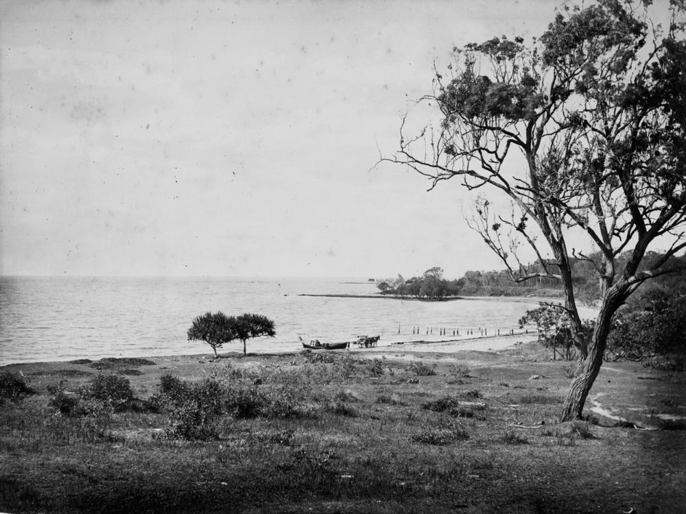
English: Woody Point shoreline, ca. 1876
Woody Point is on the southern tip of Redcliffe Peninsula, on the shores of Bramble Bay. In 1799, Matthew Flinders landed on the peninsula and named the location Red Cliff Point after the colours in the cliffs. In 1823 the peninsula was selected as the site of Queensland’s first penal colony but by 1825 the prisoners were moved further up the Brisbane River to escape the mosquitoes and reportedly to escape the Gubbi Gubbi (Kabi Kabi) and the Ningy Ningy people (Ningi Ningi, Ninghi Ninghi), part of the Undambi people, who were indigenous to the land. Redcliffe was once a small seaside retreat 40 km north of Brisbane. When the Hornibrook and Houghton Highways linked Brighton, an outer Brisbane suburb, to the Redcliffe peninsula, Redcliffe then became much more accessible and grew as part of Brisbane's suburban sprawl. |
| Date | circa 1876 |
| Source | Item is held by John Oxley Library, State Library of Queensland. |
| Author |
Licensing
[edit]
This image or other work is of Australian origin and is now in the public domain because its term of copyright has expired. According to the Australian Copyright Council (ACC), ACC Information Sheet G023v19 (Duration of copyright) (January 2019).1
When using this template, please provide information of where the image was first published and who created it. |
 | |||||||||||||||||||

|
This image has been digitised by the State Library of Queensland, and provided to the Wikimedia Commons as part of a cooperative project. The original photograph is in the public domain. The metadata has been released by State Library of Queensland under the Creative Commons Attribution-Share Alike 2.5 license.
|
File history
Click on a date/time to view the file as it appeared at that time.
| Date/Time | Thumbnail | Dimensions | User | Comment | |
|---|---|---|---|---|---|
| current | 09:51, 12 January 2011 | | 1,000 × 750 (123 KB) | SLQbot (talk | contribs) | =={{int:filedesc}}== {{Information |description={{en|1=Woody Point shoreline, ca. 1876 Woody Point is on the southern tip of Redcliffe Peninsula, on the shores of Bramble Bay. In 1799, Matthew Flinders landed on the peninsula and named the location Red Cl |
You cannot overwrite this file.
File usage on Commons
There are no pages that use this file.
File usage on other wikis
The following other wikis use this file:
- Usage on en.wikipedia.org