File:The Hind House (geograph 6108664).jpg
Jump to navigation
Jump to search
Size of this preview: 800 × 600 pixels. Other resolutions: 320 × 240 pixels | 640 × 480 pixels | 1,024 × 768 pixels.
Original file (1,024 × 768 pixels, file size: 210 KB, MIME type: image/jpeg)
Captions
Captions
Add a one-line explanation of what this file represents
Summary
[edit].jpg&action=edit§ion=1)
| Description | |
| Date | |
| Source | From geograph.org.uk |
| Author | David Brown |
| Permission (Reusing this file) |
Creative Commons Attribution Share-alike license 2.0 |
| Attribution (required by the license) | David Brown / The Hind House / |
| Camera location | | View this and other nearby images on: OpenStreetMap |
|---|
.jpg¶ms=053.953161_N_-000.483263_E_globe:Earth_type:camera_source:geograph-osgb36(SE99635185)_heading:270.00&language=en)
| Object location | | View this and other nearby images on: OpenStreetMap |
|---|
.jpg¶ms=053.953380_N_-000.486610_E_globe:Earth_class:object_type:object_source:geograph-osgb36(SE99415187)_heading:270.00&language=en)
Licensing
[edit].jpg&action=edit§ion=2)

|
This image was taken from the Geograph project collection. See this photograph's page on the Geograph website for the photographer's contact details. The copyright on this image is owned by David Brown and is licensed for reuse under the Creative Commons Attribution-ShareAlike 2.0 license.
|
This file is licensed under the Creative Commons Attribution-Share Alike 2.0 Generic license.
Attribution: David Brown
- You are free:
- to share – to copy, distribute and transmit the work
- to remix – to adapt the work
- Under the following conditions:
- attribution – You must give appropriate credit, provide a link to the license, and indicate if changes were made. You may do so in any reasonable manner, but not in any way that suggests the licensor endorses you or your use.
- share alike – If you remix, transform, or build upon the material, you must distribute your contributions under the same or compatible license as the original.
File history
Click on a date/time to view the file as it appeared at that time.
| Date/Time | Thumbnail | Dimensions | User | Comment | |
|---|---|---|---|---|---|
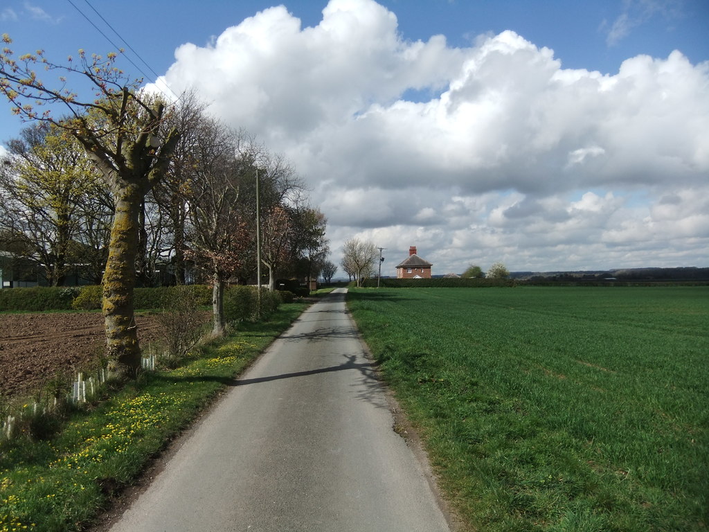
| current | 19:10, 14 March 2023 | | 1,024 × 768 (210 KB) | Keith D (talk | contribs) | == {{int:filedesc}} == {{Information |Description={{en|1=The Hind House, Hutton Cranswick, East Riding of Yorkshire, England.}} |Source=From [https://www.geograph.org.uk/photo/6108664 geograph.org.uk] |Date=2019-04-03 |Author=[https://www.geograph.org.uk/profile/9573 David Brown] |Permission=Creative Commons Attribution Share-alike license 2.0 |Other fields={{Credit line |Author=David Brown |License=[https://creativecommons.org/licen... |
You cannot overwrite this file.
File usage on Commons
There are no pages that use this file.
.jpg&oldid=741619044)
Categories:
- Hutton Cranswick
- Watton, East Riding of Yorkshire
- Roads in the East Riding of Yorkshire
- National Cycle Network route 1
- Way of the Roses
- Houses in the East Riding of Yorkshire
- Fields in the East Riding of Yorkshire
- Hedges in Hutton Cranswick
- Trees in Hutton Cranswick
- Hedges in Watton, East Riding of Yorkshire
- Trees in Watton, East Riding of Yorkshire
- Utility poles in the East Riding of Yorkshire
- April 2019 in the East Riding of Yorkshire