File:Thraciae-veteris-typvs.jpg
跳至導覽
跳至搜尋
預覽大小:780 × 600 像素。 其他解析度:312 × 240 像素 | 624 × 480 像素 | 999 × 768 像素 | 1,280 × 984 像素 | 2,560 × 1,969 像素 | 4,452 × 3,424 像素。
原始檔案 (4,452 × 3,424 像素,檔案大小:3.59 MB,MIME 類型:image/jpeg)
說明
說明
添加單行說明來描述出檔案所代表的內容
摘要
[編輯]| 描述 |
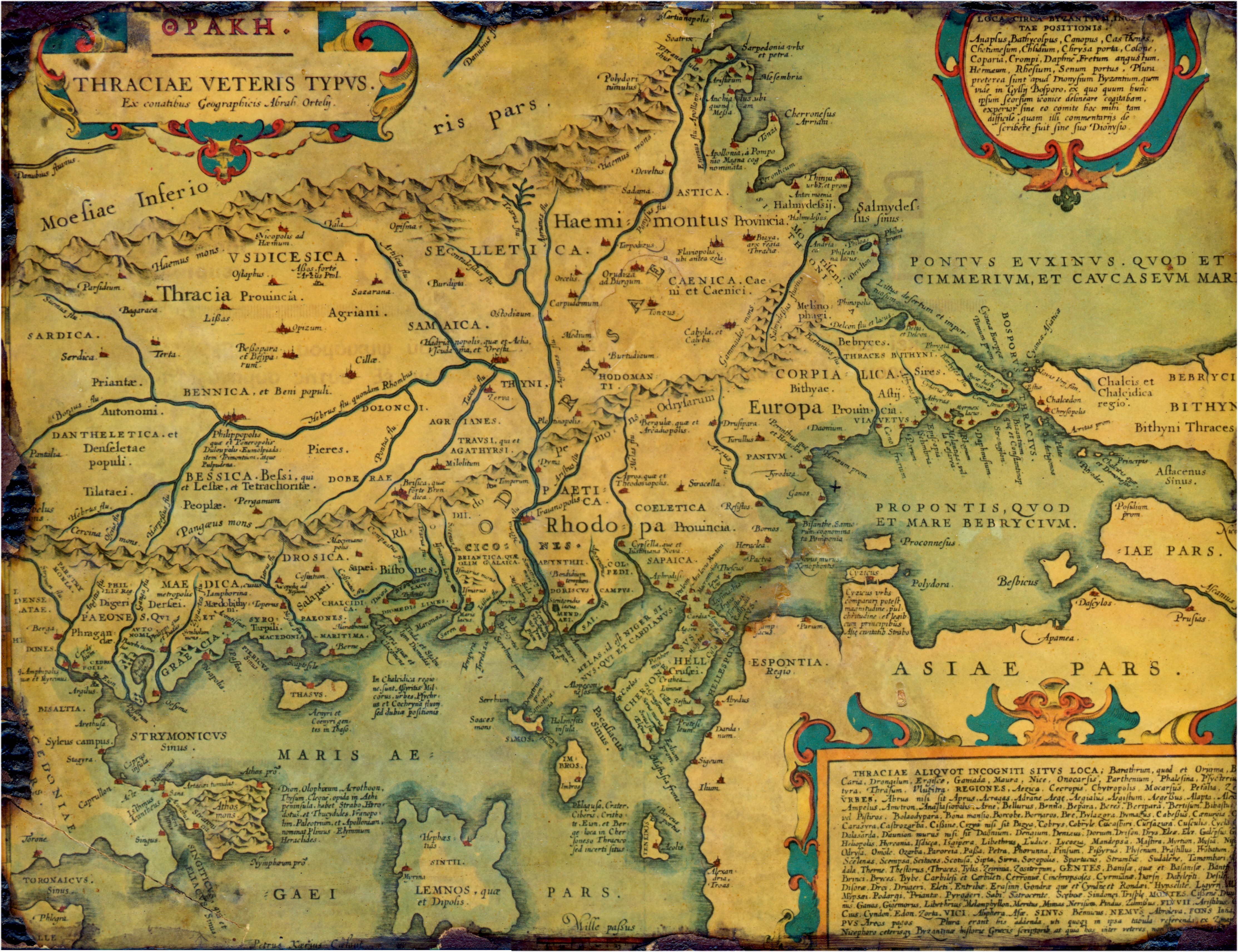
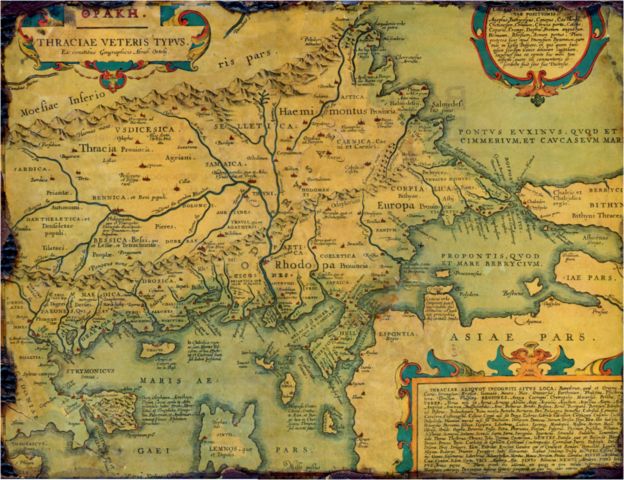
English: Old, historical map of ancient Thrace, mostly in Latin and very few Greek, made in 1585. The map also shows part of Asia minor, Moesia inferior, & ancient Greece along with some Aegan islands. There is some anachronism on the map, such as Moesia inferior and other features.
Français : Vieille carte historique de la Thrace antique, principalement en latin avec un petit peu de grec, faite en 1585. La carte montre également une partie de l'Asie mineure, la Mésie inférieure, et la Grèce antique avec quelques îles égéennes. Il y a des anachronismes sur la carte, tels que la Mésie inférieure et d'autres caractéristiques. |
| 日期 | |
| 來源 | Thraciae veteris typvs . . . 1585 |
| 作者 | |
| 授權許可 (重用此檔案) |
PD-Art |

授權條款
[編輯]
|
此為如實地拍攝平面藝術品的相片複製本。原作位於公有領域,是因下列原因:
維基媒體基金會的官方立場認為:「針對平面公有領域的藝術作品進行忠實重製,其重製後的照片也屬於公有領域。」
因此,可認定本重製照片屬於公有領域。在其他司法管轄區,再利用此照片可能會被限制;參見再利用PD-Art照片以獲得進一步資訊。 | ||||
|
|
檔案歷史
點選日期/時間以檢視該時間的檔案版本。
| 日期/時間 | 縮圖 | 尺寸 | 用戶 | 備註 | |
|---|---|---|---|---|---|
| 目前 | 2006年7月12日 (三) 21:58 | | 4,452 × 3,424(3.59 MB) | Adamantios(對話 | 貢獻) | {{Information |Description=Old, historical map of Thrace. |Source=copy of framed gravure |Date=copied on July of 2006 |Author=unknown |Permission=PD-old |other_versions= }} Category:Old maps of the Balkans Category:History of the Balkans |
無法覆蓋此檔案。
檔案用途
下列13個頁面有用到此檔案:
- Ancient Thrace and ancient Thracians
- Atlas of Bulgaria
- Atlas of European history
- Atlas of Greece
- Atlas of Turkey
- Atlas of the antiquity
- User:Adamantios
- User:Adamantios/Third party media
- User talk:Adamantios
- Commons:Featured picture candidates/Image:Thraciae-veteris-typvs.jpg
- Commons:Featured picture candidates/Log/May 2008
- Commons:Quality images/Subject/Objects/Other/Archive
- Commons:Quality images candidates/Archives July 2007
全域檔案使用狀況
以下其他 wiki 使用了這個檔案:
- af.wikipedia.org 的使用狀況
- ast.wikipedia.org 的使用狀況
- bg.wikipedia.org 的使用狀況
- br.wikipedia.org 的使用狀況
- ca.wikipedia.org 的使用狀況
- cs.wikipedia.org 的使用狀況
- da.wikipedia.org 的使用狀況
- de.wikipedia.org 的使用狀況
- el.wikipedia.org 的使用狀況
- en.wikipedia.org 的使用狀況
- Aegospotami
- Thrace
- Perinthus
- Plovdiv
- Thynia
- Ismarus (Thrace)
- Dionysupolis
- Agora (Thrace)
- Zerynthus
- Delkos
- Heraclea Sintica
- Apollonia (Kavala)
- Bisanthe
- Bergule
- Galepsus (Thrace)
- List of ancient cities in Thrace and Dacia
- List of kings of Thrace and Dacia
- Pistyrus
- Crenides (Macedonia)
- Myrcinus
- Neapolis (Thrace)
- Oesyme
- Sirra
- Bergepolis
- Larissa (Homeric city)
- Sale (Thrace)
- Stryme
- Drys (Thrace)
- Dicaea (Thrace)
- Cypsela (Thrace)
- Orthagoria
- Zone (colony)
- Araplus
- Alopeconnesus
- Deris (Thrace)
- Pactya
檢視此檔案的更多全域使用狀況。
詮釋資料
分類:
- Maps by Abraham Ortelius
- Maps of the history of the ancient Balkans
- 16th-century maps of the Sea of Marmara
- 16th-century maps of the Aegean Sea
- 16th-century maps of the Black Sea
- 1580s maps of Greece
- Maps of the history of Bulgaria in ancient times
- Maps of ancient Thrace
- Old maps of Thrace
- Moesia Inferior
- 16th-century maps showing history