File:Trusey Hill (geograph 7207042).jpg
Jump to navigation
Jump to search

Size of this preview: 800 × 549 pixels. Other resolutions: 320 × 219 pixels | 640 × 439 pixels | 1,024 × 702 pixels | 1,280 × 878 pixels | 2,560 × 1,756 pixels | 4,856 × 3,330 pixels.
Original file (4,856 × 3,330 pixels, file size: 3.72 MB, MIME type: image/jpeg)
Captions
Captions
Add a one-line explanation of what this file represents
Summary
[edit].jpg&action=edit§ion=1)
| Description |
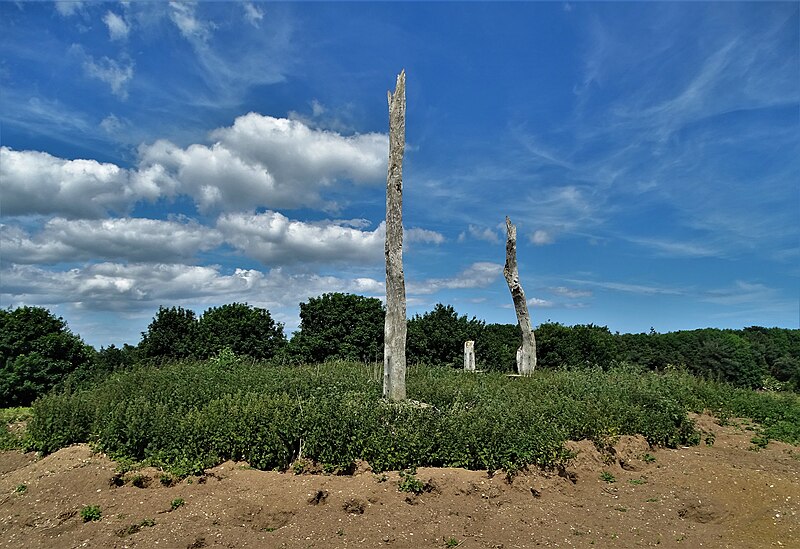
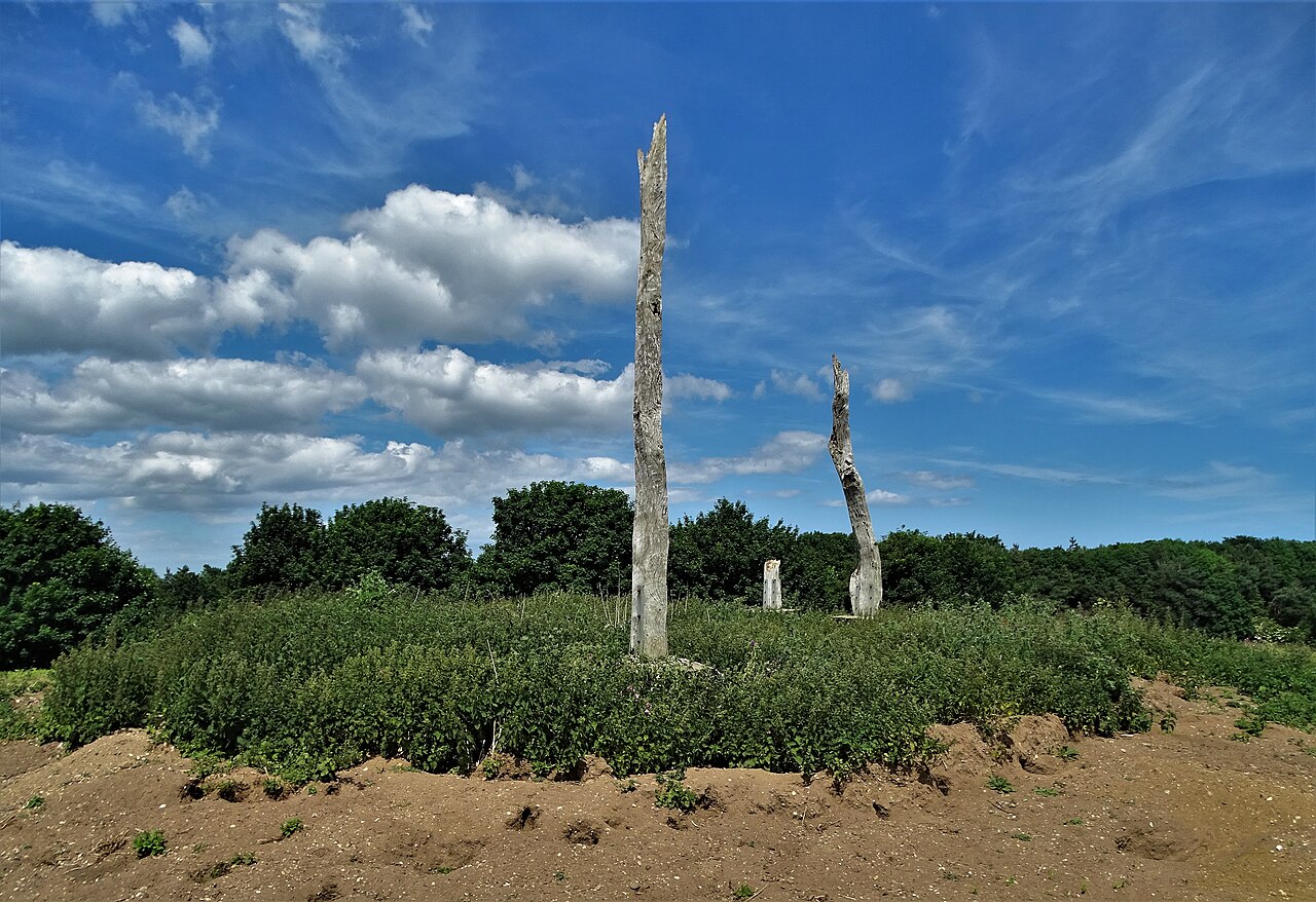
English: Trusey Hill, Barmston, East Riding of Yorkshire, England. It is rumoured that this mound was once a place of Viking burials. In more recent times a farmer erected a ring of Dutch elm trunks here - presumably to mourn the deaths of such trees from Dutch elm disease. |
| Date | |
| Source | From geograph.org.uk |
| Author | Neil Theasby |
| Permission (Reusing this file) |
Creative Commons Attribution Share-alike license 2.0 |
| Attribution (required by the license) | Neil Theasby / Trusey Hill / |
| Camera location | | View this and other nearby images on: OpenStreetMap |
|---|
.jpg¶ms=054.011266_N_-000.226593_E_globe:Earth_type:camera_source:geograph-osgb36(TA1631058705)_heading:315.00&language=en)
| Object location | | View this and other nearby images on: OpenStreetMap |
|---|
.jpg¶ms=054.011410_N_-000.226890_E_globe:Earth_class:object_type:object_source:geograph-osgb36(TA16295872)_heading:315.00&language=en)
Licensing
[edit].jpg&action=edit§ion=2)

|
This image was taken from the Geograph project collection. See this photograph's page on the Geograph website for the photographer's contact details. The copyright on this image is owned by Neil Theasby and is licensed for reuse under the Creative Commons Attribution-ShareAlike 2.0 license.
|
This file is licensed under the Creative Commons Attribution-Share Alike 2.0 Generic license.
Attribution: Neil Theasby
- You are free:
- to share – to copy, distribute and transmit the work
- to remix – to adapt the work
- Under the following conditions:
- attribution – You must give appropriate credit, provide a link to the license, and indicate if changes were made. You may do so in any reasonable manner, but not in any way that suggests the licensor endorses you or your use.
- share alike – If you remix, transform, or build upon the material, you must distribute your contributions under the same or compatible license as the original.
File history
Click on a date/time to view the file as it appeared at that time.
| Date/Time | Thumbnail | Dimensions | User | Comment | |
|---|---|---|---|---|---|
| current | 09:38, 15 April 2024 | | 4,856 × 3,330 (3.72 MB) | Keith D (talk | contribs) | == {{int:filedesc}} == {{Information |Description={{en|1=Trusey Hill, Barmston, East Riding of Yorkshire, England.<br />It is rumoured that this mound was once a place of Viking burials. In more recent times a farmer erected a ring of Dutch elm trunks here - presumably to mourn the deaths of such trees from Dutch elm disease.}} |Source=From [https://www.geograph.org.uk/photo/7207042 geograph.org.uk] |Date=2022-06-21 |... |
You cannot overwrite this file.
File usage on Commons
There are no pages that use this file.
.jpg&oldid=868611234)