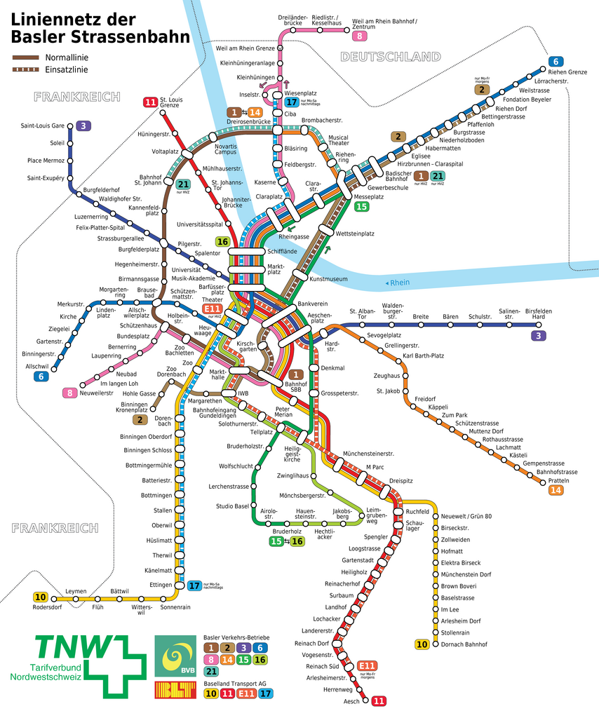
File:Basel - Straßenbahnnetzplan.png

File originale (2 973 × 3 564 pixel, dimensione del file: 1,2 MB, tipo MIME: image/png)
Didascalie
Didascalie
|
| Descrizione |
|
||
| Data | (UTC) | ||
| Fonte | Basel_-_Straßenbahn_-_Netzplan.png | ||
| Autore |
Original work: Maximilian Dörrbecker (Chumwa)
|
||
| Licenza (Riusare questo file) |
Io, detentore del copyright su quest'opera, dichiaro di pubblicarla con la seguente licenza: Questo file è disponibile in base alla licenza Creative Commons Attribuzione-Condividi allo stesso modo 2.5 Generico
Sie dürfen das Bild zu den folgenden Bedingungen nutzen:
|
||
| Altre versioni |
|


|
Questa immagine (categorizzazione automatica: transport map) o tutte le immagini in questa categoria o galleria dovrebbero essere ricreate usando grafica vettoriale come file SVG. Questo offre diversi vantaggi: vedi Commons:Media for cleanup per maggiori informazioni. Se è disponibile una versione in formato SVG di questa immagine, per favore caricala. Dopo aver caricato un file SVG, sostituisci questo avviso con il template {{Vector version available|nome_immagine.svg}}.
|
Registro originale del caricamento
[modifica]
This image is a derivative work of the following images:
- File:Basel_-_Straßenbahn_-_Netzplan.png licensed with Cc-by-sa-2.5
- 2008-02-14T05:17:36Z Chumwa 2973x3494 (1114634 Bytes) Überschrift auf Wunsch von [[:de:User:Wladyslaw_Sojka|Wladyslaw]] abgeändert.
- 2008-02-12T19:27:02Z Chumwa 2973x3494 (1113455 Bytes) Korrekturanmerkungen von [[:de:User:Wladyslaw_Sojka|Wladyslaw]] eingearbeitet: Rhein mit Fließrichtung ausgestattet, Linienende Riehen und Haltestellennamen Neuewelt/ Grün 80 korrigiert, Haltestellensignet Messeplatz etwas
- 2008-02-12T07:06:11Z Chumwa 2973x3494 (1113678 Bytes) Darstellung der Verkehrsträger der einzelnen Linien mit aufgenommen
- 2008-02-11T23:00:13Z Chumwa 2973x3494 (1092068 Bytes) verbesserte Darstellung der Einsatzlinien
- 2008-02-11T22:30:39Z Chumwa 2973x3494 (1092466 Bytes) Einsatzlinien differenziert dargestellt
- 2008-02-11T21:51:28Z Chumwa 2973x3494 (1065040 Bytes) some enhencements
- 2008-02-11T19:13:39Z Chumwa 2973x3494 (1061914 Bytes) {{Information |Description= *{{ de }} Karte: Schema-Netzplan der Straßenbahn Basel *{{ en }} Map: Basel streetcar network *{{ fr }} Plan: Réseau des tramways de Bâle |Source=Self made, based on a transport map from the CTS
Uploaded with derivativeFX
Cronologia del file
Fare clic su un gruppo data/ora per vedere il file come si presentava nel momento indicato.
| Data/Ora | Miniatura | Dimensioni | Utente | Commento | |
|---|---|---|---|---|---|
| attuale | 11:11, 6 gen 2018 | | 2 973 × 3 564 (1,2 MB) | Chumwa (discussione | contributi) | Aktualisierung |
| 04:59, 8 ago 2017 |  | 2 973 × 3 564 (1,2 MB) | Chumwa (discussione | contributi) | kleinere Ausrichtungen | |
| 17:24, 7 ago 2017 |  | 2 973 × 3 564 (1,2 MB) | Chumwa (discussione | contributi) | Aktualisierung: Saint-Louis Gare | |
| 06:56, 28 mar 2015 |  | 2 973 × 3 564 (1,17 MB) | Chumwa (discussione | contributi) | Aktualisierung: Verlängerung Weil am Rhein | |
| 05:58, 10 lug 2013 |  | 2 973 × 3 494 (1,15 MB) | Chumwa (discussione | contributi) | corr: Haltestelle Musik-Akademie hat gefehlt | |
| 21:07, 8 feb 2011 |  | 2 973 × 3 494 (1,08 MB) | Chumwa (discussione | contributi) | Aktualisierung | |
| 14:16, 12 ott 2010 |  | 2 973 × 3 494 (1 006 KB) | Marton (discussione | contributi) | Reverted to version as of 13:02, 19 February 2010 REASON: 19. Feb. 2010 13:05 und 25. Aug. 2009 04:57 haben nicht alle Liniennummern drin. | |
| 13:05, 19 feb 2010 |  | 2 973 × 3 494 (1,06 MB) | ODLG (discussione | contributi) | Reverted to version as of 04:57, 25 August 2009 | |
| 13:02, 19 feb 2010 |  | 2 973 × 3 494 (1 006 KB) | ODLG (discussione | contributi) | DE : Linie 2 in Einsatzlinie bis Riehen Dorf + Linie E11 in Theater FR : Ligne 2 aux heures de pointe jusqu'à Riehen Dorf + Ligne E11 à Theater | |
| 04:57, 25 ago 2009 |  | 2 973 × 3 494 (1,06 MB) | Chumwa (discussione | contributi) | Heuwaage mit Theater vertauscht |
Impossibile sovrascrivere questo file.
Utilizzo del file
Le seguenti 14 pagine usano questo file:
- Top 200 transport map images that should use vector graphics
- User:Chumwa/Gallery
- User:Chumwa/OgreBot/Potential transport maps/2017 August 1-10
- User:Chumwa/OgreBot/Public transport information/2015 March 21-31
- User:Chumwa/OgreBot/Public transport information/2017 August 1-10
- User:Chumwa/OgreBot/Transport Maps/2015 March 21-31
- User:Chumwa/OgreBot/Transport Maps/2017 August 1-10
- User:Chumwa/OgreBot/Travel and communication maps/2017 August 1-10
- File:Basel - Straßenbahn - Netzplan-2.svg
- File:Basel - Straßenbahn - Netzplan.png
- File:Basel - Straßenbahn - Netzplan.svg
- File:Basel - Straßenbahn - Netzplan 2009.png (reindirizzamento file)
- File:Basel - Straßenbahnnetzplan.png
- Category:Tram transport in Basel
Utilizzo globale del file
Anche i seguenti wiki usano questo file:
- Usato nelle seguenti pagine di als.wikipedia.org:
- Usato nelle seguenti pagine di de.wikipedia.org:
- Basel
- Portal:Schweiz/Galerie
- Portal:Basel/Artikelgalerie
- Basler Verkehrs-Betriebe
- Wikipedia:Exzellente Bilder/Karten und Satellitenbilder
- Basler Tramlinien
- Benutzer:NatiSythen/Karten
- Portal:Schweiz/Galerie/Bilder
- Wikipedia:Kartenwerkstatt/Archiv/2009-02
- Datei:Basel - Straßenbahn - Netzplan 2009.png
- Wikipedia:Kartenwerkstatt/Archiv/2009-04
- Wikipedia:Kartenwerkstatt/Archiv/2011-02
- Wikipedia:Kartenwerkstatt/Schaufenster
- Strassenbahn Basel
- Wikipedia:Kartenwerkstatt/Archiv/2013-07
- Benutzer Diskussion:Chumwa/Archiv/2015/1. Quartal
- Usato nelle seguenti pagine di en.wikipedia.org:
- Usato nelle seguenti pagine di eo.wikipedia.org:
- Usato nelle seguenti pagine di es.wikipedia.org:
- Usato nelle seguenti pagine di fa.wikipedia.org:
- Usato nelle seguenti pagine di fr.wikipedia.org:
- Usato nelle seguenti pagine di he.wikivoyage.org:
- Usato nelle seguenti pagine di hu.wikipedia.org:
- Usato nelle seguenti pagine di it.wikipedia.org:
- Usato nelle seguenti pagine di ja.wikipedia.org:
- Usato nelle seguenti pagine di lmo.wikipedia.org:
- Usato nelle seguenti pagine di nl.wikipedia.org:
- Usato nelle seguenti pagine di no.wikipedia.org:
- Usato nelle seguenti pagine di pl.wikipedia.org:
- Usato nelle seguenti pagine di ru.wikipedia.org:
- Usato nelle seguenti pagine di sv.wikipedia.org:
- Usato nelle seguenti pagine di tr.wikipedia.org:
- Usato nelle seguenti pagine di uk.wikipedia.org:
- Usato nelle seguenti pagine di www.wikidata.org:
- Usato nelle seguenti pagine di zh.wikipedia.org: