File:CallingCodesWorld.svg
Jump to navigation
Jump to search

Size of this PNG preview of this SVG file: 800 × 411 pixels. Other resolutions: 320 × 164 pixels | 640 × 329 pixels | 1,024 × 526 pixels | 1,280 × 657 pixels | 2,560 × 1,314 pixels.
Original file (SVG file, nominally 2,560 × 1,314 pixels, file size: 1.06 MB)
Captions
Captions
Add a one-line explanation of what this file represents
Summary[edit]
| Description |
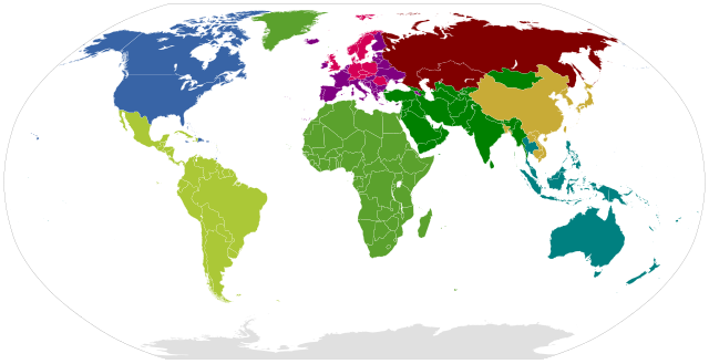
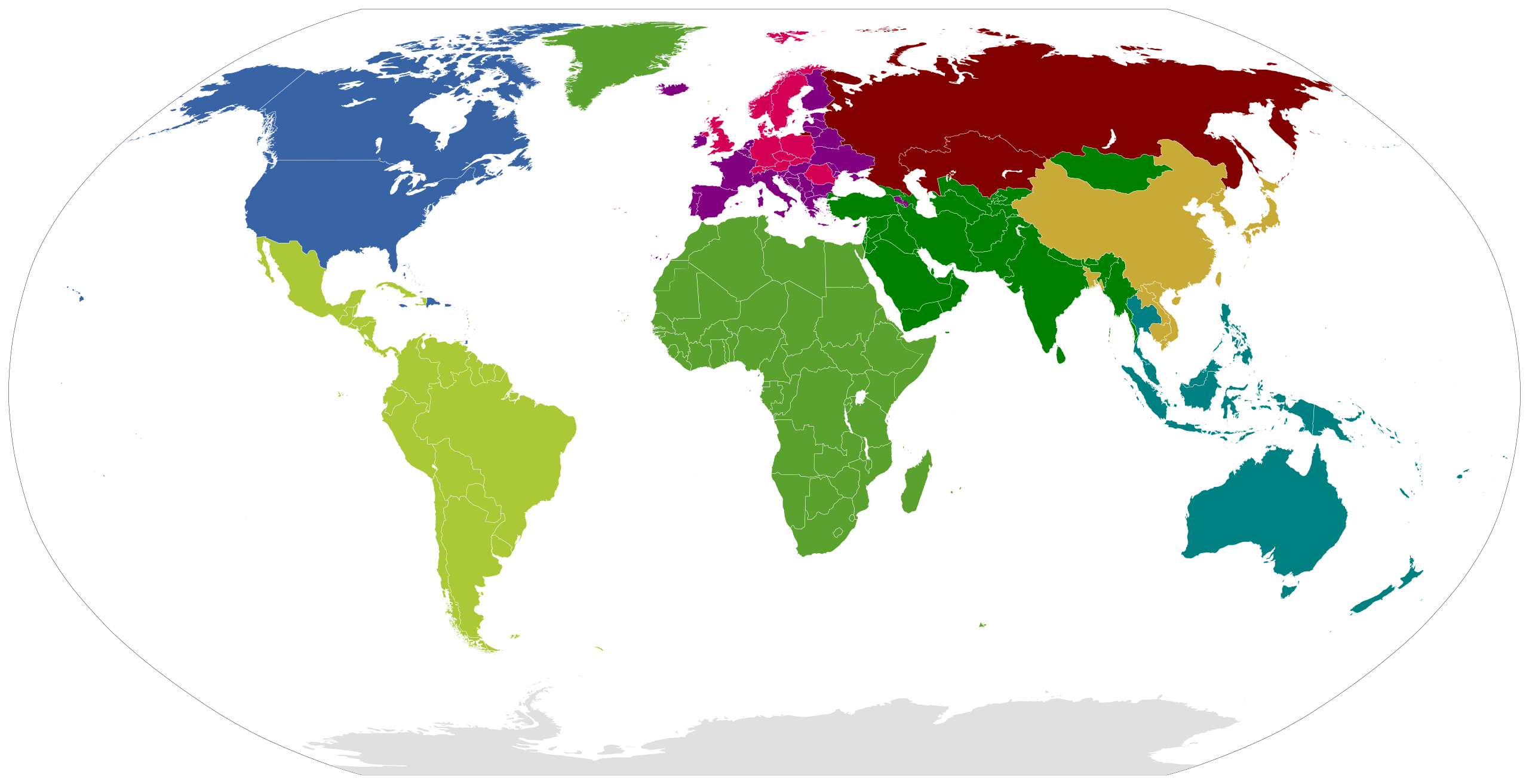
English: This world map shows the areas of the first digit of the country calling codes
Deutsch: Die Weltkarte stellt die Zonen der Ländervorwahlen dar |
||
| Date | |||
| Source | self made, based on image mentioned below | ||
| Author | WikiNight2 | ||
| Other versions |
|

Based on Image:World_Map_Blank.svg
Licensing[edit]
| I, the copyright holder of this work, release this work into the public domain. This applies worldwide. In some countries this may not be legally possible; if so: I grant anyone the right to use this work for any purpose, without any conditions, unless such conditions are required by law. |
File history
Click on a date/time to view the file as it appeared at that time.
| Date/Time | Thumbnail | Dimensions | User | Comment | |
|---|---|---|---|---|---|
| current | 20:53, 16 January 2019 | | 2,560 × 1,314 (1.06 MB) | Fibonacci (talk | contribs) | Remade based on en:List of country calling codes and File:BlankMap-World6.svg |
| 18:35, 22 August 2011 |  | 940 × 477 (1.35 MB) | Derfel73 (talk | contribs) | Added South Sudan | |
| 07:21, 19 August 2010 |  | 940 × 477 (1.35 MB) | Begoon (talk | contribs) | fix scale/crop | |
| 07:14, 19 August 2010 |  | 940 × 477 (1.68 MB) | Begoon (talk | contribs) | Reverted to version as of 19:24, 18 August 2010 | |
| 07:07, 19 August 2010 |  | 940 × 477 (1.35 MB) | Begoon (talk | contribs) | size/crop | |
| 19:24, 18 August 2010 |  | 940 × 477 (1.68 MB) | Techman224 (talk | contribs) | Removed border | |
| 15:28, 26 December 2009 |  | 940 × 477 (1.68 MB) | SeNeKa~commonswiki (talk | contribs) | Reunion corrected | |
| 15:25, 26 December 2009 |  | 940 × 477 (1.68 MB) | SeNeKa~commonswiki (talk | contribs) | microstates added | |
| 08:56, 23 November 2009 |  | 940 × 477 (1.63 MB) | Voland77 (talk | contribs) | update (Abkhazia changed to +7) | |
| 07:49, 14 November 2009 |  | 940 × 477 (1.63 MB) | SeNeKa~commonswiki (talk | contribs) | updated |
You cannot overwrite this file.
File usage on Commons
The following 3 pages use this file:
File usage on other wikis
The following other wikis use this file:
- Usage on en.wikipedia.org
- Usage on yi.wikipedia.org