File:England and Wales within the UK and Europe.svg
Từ Wikimedia Commons, kho lưu trữ phương tiện nội dung mở
Bước tới điều hướng
Bước tới tìm kiếm
Kích thước bản xem trước PNG này của tập tin SVG: 680×520 điểm ảnh. Độ phân giải khác: 314×240 điểm ảnh | 628×480 điểm ảnh | 1.004×768 điểm ảnh | 1.280×979 điểm ảnh | 2.560×1.958 điểm ảnh.
Tập tin gốc (tập tin SVG, 680×520 điểm ảnh trên danh nghĩa, kích thước: 2,57 MB)
Thông tin tập tin
Dữ liệu có cấu trúc
Chú thích
Miêu tả[sửa]
Miêu tảEngland and Wales within the UK and Europe.svg |
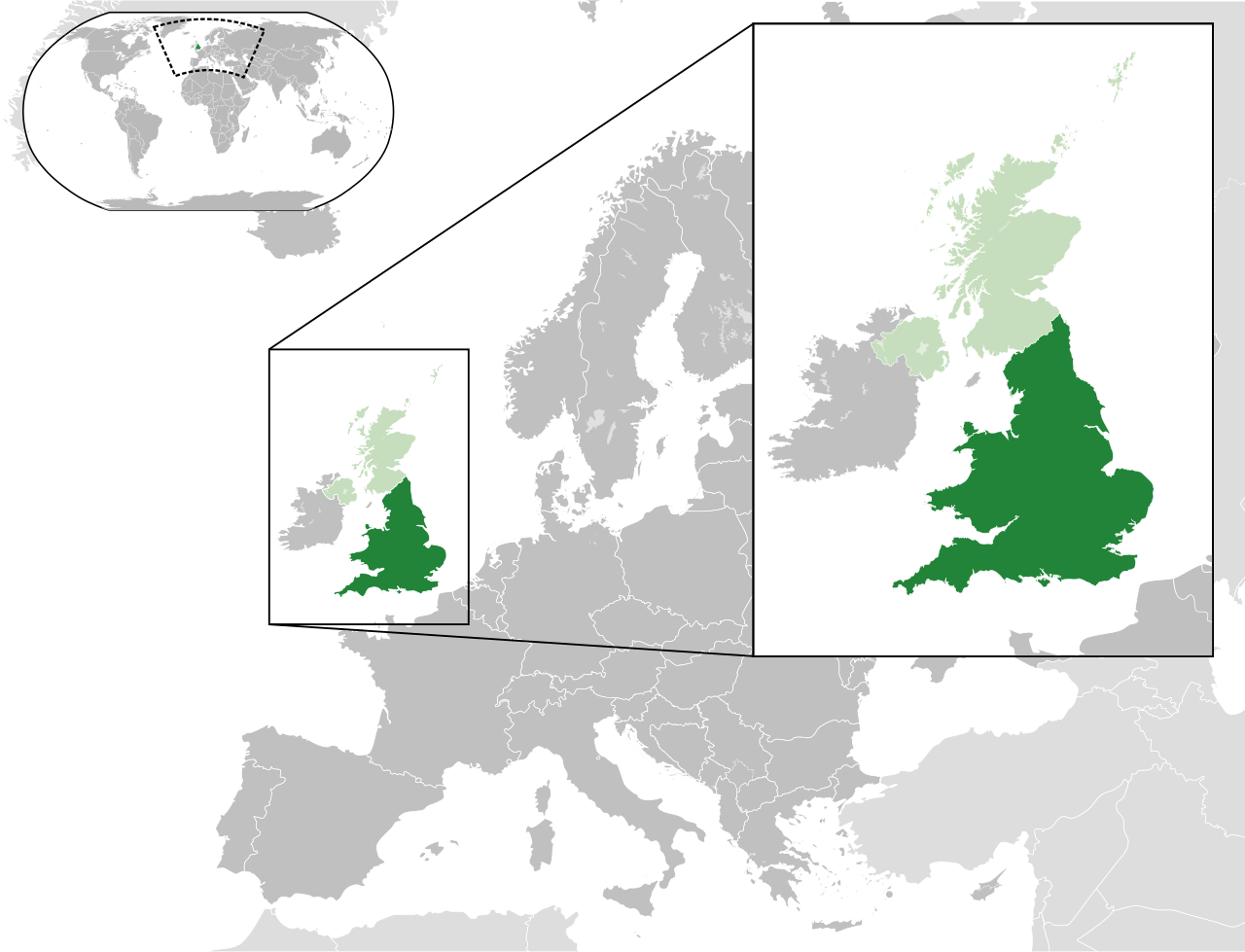
English: England and Wales – dark green
United Kingdom – green Europe – green and dark grey |
Ngày | |
Nguồn gốc |
Derived from: |
Tác giả |
Source: Derivative work: |
Giấy phép[sửa]
Tôi, người giữ bản quyền tác phẩm này, từ đây phát hành nó theo giấy phép sau:
Tập tin này được phát hành theo Giấy phép Creative Commons Ghi công - Chia sẻ tương tự 3.0 Chưa chuyển đồi
- Bạn được phép:
- chia sẻ – sao chép, phân phối và chuyển giao tác phẩm
- pha trộn – để chuyển thể tác phẩm
- Theo các điều kiện sau:
- ghi công – Bạn phải ghi lại tác giả và nguồn, liên kết đến giấy phép, và các thay đổi đã được thực hiện, nếu có. Bạn có thể làm các điều trên bằng bất kỳ cách hợp lý nào, miễn sao không ám chỉ rằng người cho giấy phép ủng hộ bạn hay việc sử dụng của bạn.
- chia sẻ tương tự – Nếu bạn biến tấu, biến đổi, hoặc làm tác phẩm khác dựa trên tác phẩm này, bạn chỉ được phép phân phối tác phẩm mới theo giấy phép y hệt hoặc tương thích với tác phẩm gốc.
Lịch sử tập tin
Nhấn vào ngày/giờ để xem nội dung tập tin tại thời điểm đó.
Ngày/Giờ | Hình xem trước | Kích cỡ | Thành viên | Miêu tả | |
---|---|---|---|---|---|
hiện tại | 15:43, ngày 21 tháng 2 năm 2014 | 680×520 (2,57 MB) | Rob984 (thảo luận | đóng góp) | User created page with UploadWizard |
Bạn không được phép ghi đè tập tin này.
Trang sử dụng tập tin
Trang sau sử dụng tập tin này:
Sử dụng tập tin toàn cục
Những wiki sau đang sử dụng tập tin này:
- Trang sử dụng tại ar.wikipedia.org
- Trang sử dụng tại cy.wikipedia.org
- Trang sử dụng tại de.wikipedia.org
- Trang sử dụng tại en.wikipedia.org
- Trang sử dụng tại es.wikipedia.org
- Trang sử dụng tại id.wikipedia.org
- Trang sử dụng tại it.wikipedia.org
- Trang sử dụng tại nl.wikipedia.org
- Trang sử dụng tại pt.wikipedia.org
- Trang sử dụng tại si.wikipedia.org
- Trang sử dụng tại tr.wikipedia.org
- Trang sử dụng tại uk.wikipedia.org
- Trang sử dụng tại ur.wikipedia.org
- Trang sử dụng tại vi.wikipedia.org
- Trang sử dụng tại www.wikidata.org
- Trang sử dụng tại zh.wikipedia.org
Đặc tính hình
Tập tin này chứa thông tin bổ sung, có thể được thêm từ máy ảnh kỹ thuật số hoặc máy quét được sử dụng để tạo hoặc số hóa tệp.
Nếu tập tin đã được sửa đổi so với trạng thái ban đầu, một số chi tiết có thể không phản ánh đầy đủ tập tin đã sửa đổi.
Tên ngắn | England within the UK and Europe |
---|---|
Tiêu đề của hình | Map of England within the United Kingdom of Great Britain and Northern Ireland, and within Europe.
Released under Creative Commons Attribution-Share Alike 3.0 Unported (http://creativecommons.org/licenses/by-sa/3.0/). Based upon http://commons.wikimedia.org/wiki/File:Blank_map_of_Europe.svg; licence and details below: A blank Map of Europe. Every country has an id which is its ISO-3166-1-ALPHA2 code in lower case. Members of the EU have a class="eu", countries in europe (which I found turkey to be but russia not) have a class="europe". Certain countries are further subdivided the United Kingdom has gb-gbn for Great Britain and gb-nir for Northern Ireland. Russia is divided into ru-kgd for the Kaliningrad Oblast and ru-main for the Main body of Russia. There is the additional grouping #xb for the "British Islands" (the UK with its Crown Dependencies - Jersey, Guernsey and the Isle of Man) Contributors. Original Image: (http://commons.wikimedia.org/wiki/Image:Europe_countries.svg) Júlio Reis (http://commons.wikimedia.org/wiki/User:Tintazul). Recolouring and tagging with country codes: Marian "maix" Sigler (http://commons.wikimedia.org/wiki/User:Maix) Improved geographical features: http://commons.wikimedia.org/wiki/User:W!B: Updated to reflect dissolution of Serbia & Montenegro: http://commons.wikimedia.org/wiki/User:Zirland Updated to include British Crown Dependencies as seperate entities and regroup them as "British Islands", with some simplifications to the XML and CSS: James Hardy (http://commons.wikimedia.org/wiki/User:MrWeeble) Validated (http://commons.wikimedia.org/wiki/User:CarolSpears) Changed the country code of Serbia to RS per http://en.wikipedia.org/wiki/Serbian_country_codes and the file http://www.iso.org/iso/iso3166_en_code_lists.txt (http://commons.wikimedia.org/wiki/User:TimothyBourke) Uploaded on behalf of User:Checkit, direct complaints to him plox: 'Moved countries out of the "outlines" group, removed "outlines" style class, remove separate style information for Russia' (http://commons.wikimedia.org/wiki/User:Collard) Updated various coastlines and boarders and added various islands not previously shown (details follow). Added Kosovo and Northern Cyprus as disputed territories. Moved major lakes to their own object and added more. List of updated boarders/coastlines: British Isles (+ added Isle of Wight, Skye, various smaller islands), the Netherlands, Germany, Czech Republic, Denmark, Sweden, Finland, Poland, Kaliningrad Oblast of the Russian Federation (and minor tweaks to Lithuania), Ukraine, Moldova (minor), Romania, Bulgaria, Turkey, Greece, F.Y.R. Macedonia, Serbia, Bosnia and Herzegovina, Montenegro, Albania, Croatia, Italy (mainland and Sicily), Malta (http://commons.wikimedia.org/wiki/User:Alphathon). Added Bornholm (http://commons.wikimedia.org/wiki/User:Heb)
|
Chiều ngang | 680 |
Chiều cao | 520 |