File:Germany location map.svg

לקובץ המקורי (קובץ SVG, הגודל המקורי: 1,073 × 1,272 פיקסלים, גודל הקובץ: 452 ק"ב)
כיתובים
כיתובים
תקציר
| תיאור |
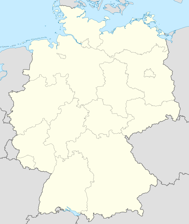
Quadratische Plattkarte, N-S-Streckung 150 %. Geographische Begrenzung der Karte:
Equirectangular projection, N/S stretching 150 %. Geographic limits of the map:
Français : Carte de l'Allemagne |
||
| תאריך יצירה | |||
| מקור | נוצר על־ידי מעלה היצירה, using United States National Imagery and Mapping Agency data | ||
| יוצר | NordNordWest | ||
| גרסאות אחרות |
Derivative works of this file:
Bundesrepublik Deutschland (vor 1990 nur West-Deutschland):
Deutsche Demokratische Republik (mit BRD im Ausschnitt):
Ostdeutschland (vor 1990 Deutsche Demokratische Republik):
Deutschland zwischen Mai 1945 und Oktober 1949:
Thematisch:
Deutsches Reich (1918–1945) (best used with this template (de)):
|
||
| SVGהתפתחות | Adobe Illustrator עם נוצרה ה W3C-לא תקין גרפיקה וקטורית
|


_23_May_1949_-_6_Oct_1949.svg)


_location_map.svg)
_location_map_2013.svg)


_location_map.svg)
רישיון

|
מוענקת בכך הרשות להעתיק, להפיץ או לשנות את המסמך הזה, לפי תנאי הרישיון לשימוש חופשי במסמכים של גנו, גרסה 1.2 או כל גרסה מאוחרת יותר שתפורסם על־ידי המוסד לתוכנה חופשית; ללא פרקים קבועים, ללא טקסט עטיפה קדמית וללא טקסט עטיפה אחורית. עותק של הרישיון כלול בפרק שכותרתו הרישיון לשימוש חופשי במסמכים של גנו. |
- הנכם רשאים:
- לשתף – להעתיק, להפיץ ולהעביר את העבודה
- לערבב בין עבודות – להתאים את העבודה
- תחת התנאים הבאים:
- ייחוס – יש לתת ייחוס הולם, לתת קישור לרישיון, ולציין אם נעשו שינויים. אפשר לעשות את זה בכל צורה סבירה, אבל לא בשום צורה שמשתמע ממנה שמעניק הרישיון תומך בך או בשימוש שלך.
- שיתוף זהה – אם תיצרו רמיקס, תשנו, או תבנו על החומר, חובה עליכם להפיץ את התרומות שלך לפי תנאי רישיון זהה או תואם למקור.
היסטוריית הקובץ
ניתן ללחוץ על תאריך/שעה כדי לראות את הקובץ כפי שנראה באותו זמן.
| תאריך/שעה | תמונה ממוזערת | ממדים | משתמש | הערה | |
|---|---|---|---|---|---|
| נוכחית | 12:51, 16 בספטמבר 2013 | | 1,272 × 1,073 (452 ק"ב) | SokoWiki (שיחה | תרומות) | Clearer borders. |
| 08:34, 16 בספטמבר 2013 |  | 1,272 × 1,073 (452 ק"ב) | NordNordWest (שיחה | תרומות) | Reverted to version as of 12:32, 2 October 2012; didn't make anything better | |
| 08:34, 16 בספטמבר 2013 |  | 1,272 × 1,073 (452 ק"ב) | NordNordWest (שיחה | תרומות) | Reverted to version as of 12:32, 2 October 2012; didn't make anything better | |
| 20:08, 15 בספטמבר 2013 |  | 1,272 × 1,073 (451 ק"ב) | SokoWiki (שיחה | תרומות) | * | |
| 12:32, 2 באוקטובר 2012 |  | 1,272 × 1,073 (452 ק"ב) | Palosirkka (שיחה | תרומות) | Reverted to version as of 20:14, 5 August 2012 Location maps must remain very accurate | |
| 05:40, 2 באוקטובר 2012 |  | 1,272 × 1,073 (396 ק"ב) | Palosirkka (שיחה | תרומות) | Scrubbed with http://codedread.com/scour/ | |
| 20:14, 5 באוגוסט 2012 |  | 1,272 × 1,073 (452 ק"ב) | NordNordWest (שיחה | תרומות) | upd | |
| 10:03, 19 בינואר 2010 |  | 1,272 × 1,073 (490 ק"ב) | NordNordWest (שיחה | תרומות) | update | |
| 08:33, 22 ביולי 2009 |  | 1,273 × 1,075 (608 ק"ב) | NordNordWest (שיחה | תרומות) | c | |
| 14:36, 13 באוקטובר 2008 |  | 1,273 × 1,075 (606 ק"ב) | NordNordWest (שיחה | תרומות) |
אין באפשרותך לדרוס את הקובץ הזה.
שימוש בקובץ
יותר מ־100 דפים משתמשים בקובץ זה. הרשימה הבאה מראה רק את 100 הדפים הראשונים שמשתמשים בקובץ. ניתן לצפות ברשימה המלאה.
- Bad Hersfeld
- Bad Honnef
- Billigheim
- Bornheim (Rheinland)
- Deutschland
- Eitorf
- Helmstedt
- Hennef (Sieg)
- Info:Kusterdingen
- Info:Mössingen
- Kusterdingen
- Mosbach
- Nentershausen
- Oberpleis
- Ruppichteroth
- Wilhelmsstift Tübingen
- User:Daniel Mietchen/Category:Images used by media organizations but violating license terms
- User:NordNordWest/Gallery/Location maps
- User:PMMKALYAN
- User:Sekamor
- User talk:Mmh
- User talk:NordNordWest/Archive
- User talk:Sting/Archive 01
- Commons:Overwriting existing files
- Commons:Overwriting existing files/cs
- Commons:Overwriting existing files/de
- Commons:Overwriting existing files/en
- Commons:Overwriting existing files/fr
- Commons:Overwriting existing files/ja
- Commons:Overwriting existing files/pl
- Commons:Overwriting existing files/ru
- Commons talk:Project Mapmaking Wiki Standards
- File:Ambulante Kinderhospizdienste in Deutschland.PNG
- File:Auerbach (Karlsbad) location map.svg
- File:Bahnhoefe Wuerzburg.png
- File:Dat-das-Linie.png
- File:Deutschland.svg
- File:Deutschland Autobahnen.svg
- File:Deutschland Lage von Baden.svg
- File:Deutschland Lage von Württemberg-Baden.svg
- File:Deutschland Lage von Württemberg-Hohenzollern.svg
- File:East-West-Germany-October 1949-July 1952.svg
- File:East Germany location map.svg
- File:Germany, Federal Republic of location map 23 May 1949 - 6 Oct 1949.svg
- File:Germany, Federal Republic of location map April 1952 - August 1955.svg
- File:Germany, Federal Republic of location map December 1950 - April 1952.svg
- File:Germany, Federal Republic of location map January 1957 - October 1990.svg
- File:Germany, Federal Republic of location map October 1949 - November 1950.svg
- File:Germany, Federal Republic of location map September 1955 - December 1956.svg
- File:Germany, German Democratic Republic location map January 1957 - October 1990.svg
- File:Germany, German Democratic Republic location map July 1952 - January 1957.svg
- File:Germany, German Democratic Republic location map October 1949 - July 1952.svg
- File:Germany, German Democratic Republic location map w·o FRG July 1952 - October 1990.svg
- File:Germany, German Democratic Republic location map w·o FRG October 1949 - June 1952.svg
- File:Germany, location map (SBZ perspective) 23 May 1949 - 6 Oct 1949.svg
- File:Germany2 location map.svg
- File:Germany (+districts +municipalities) location map.png
- File:Germany (+districts +municipalities) location map current.svg
- File:Germany Eishockey Oberliga 2008-09.svg
- File:Germany location map-bundesliga1.png
- File:Germany location map.svg
- File:Germany location map 23 April 1949 - 22 May 1949.svg
- File:Germany location map 8 Jun 1947 - 22 Apr 1949.svg
- File:Germany location map April 1992 - July 1992.svg
- File:Germany location map August 1992 - June 1993.svg
- File:Germany location map July 1993 - December 2009.svg
- File:Germany location map October 1990 - March 1992.svg
- File:Germany location map labeled 8 Jun 1947 - 22 Apr 1949.svg
- File:Germany location map neustadt waldnaab.svg
- File:Glacis Minden.svg
- File:Glacis Minden cropped.jpg
- File:Glacis Minden cropped neu.jpg
- File:Häfen Minden.svg
- File:JWP-Karte-Deutschland.svg
- File:KRB location map.png
- File:Karte Deutschland.png
- File:Karte Deutschland.svg
- File:Karte konstanz in deutschland.png
- File:Lage Freiberg in Deutschland.png
- File:Locator map Corvey.svg
- File:Position der Analytischen Task Forces des Bundes.svg
- File:Relief Map of Germany.png
- File:Relief Map of Germany.svg
- File:Salt mining in germany.png
- File:Senne-Bahn.png
- Template:Germany location map/other versions
- Template:Infobox settlement
- Template:Positionskarte
- Category:Ammerbuch
- Category:Bad Niedernau
- Category:Baisingen
- Category:Bodelshausen
- Category:Dußlingen
- Category:Gomaringen
- Category:Gütersloh
- Category:Hirrlingen
- Category:Königslutter am Elm
- Category:Neustetten
- Category:Ofterdingen
- Category:Rottenburg am Neckar
_location_map.png)
_location_map_current.svg)
ישנם דפים נוספים שמשתמשים בקובץ זה.
שימוש גלובלי בקובץ
אתרי הוויקי השונים הבאים משתמשים בקובץ זה:
- שימוש באתר af.wikipedia.org
- שימוש באתר als.wikipedia.org
- Weil der Stadt
- Schopfheim
- Rheinfelden (Baden)
- Rümmingen
- Lörrach
- Kehl
- Steinen (Baden)
- Weil am Rhein
- Bad Säckingen
- Freiburg im Breisgau
- Schwörstadt
- Augsburg
- Zell im Wiesental
- Maulburg
- Offenburg
- Ötigheim
- Hamburg
- Renchen
- Konstanz
- Furtwangen im Schwarzwald
- Görwihl
- Ebringen
- Müllheim im Markgräflerland
- Pfaffenweiler
- Calw
- Au (Breisgau)
- Merzhausen
- Sölden (Schwarzwald)
- Schallstadt
- Bollschweil
- Ehrenkirchen
- Wittnau (Breisgau)
- Vörstetten
- Achern
- Wehr (Baden)
- Vogtsburg im Kaiserstuhl
צפייה בשימושים גלובליים נוספים של קובץ זה.